File:Map Eastern New Orleans to Gulfport MS 1982.jpg
Size of this preview: 800 × 439 pixels. Other resolutions: 320 × 176 pixels | 640 × 351 pixels | 1,024 × 562 pixels | 1,280 × 702 pixels | 2,560 × 1,405 pixels | 6,976 × 3,828 pixels.
Original file (6,976 × 3,828 pixels, file size: 4.9 MB, MIME type: image/jpeg)
Captions
Captions
Add a one-line explanation of what this file represents
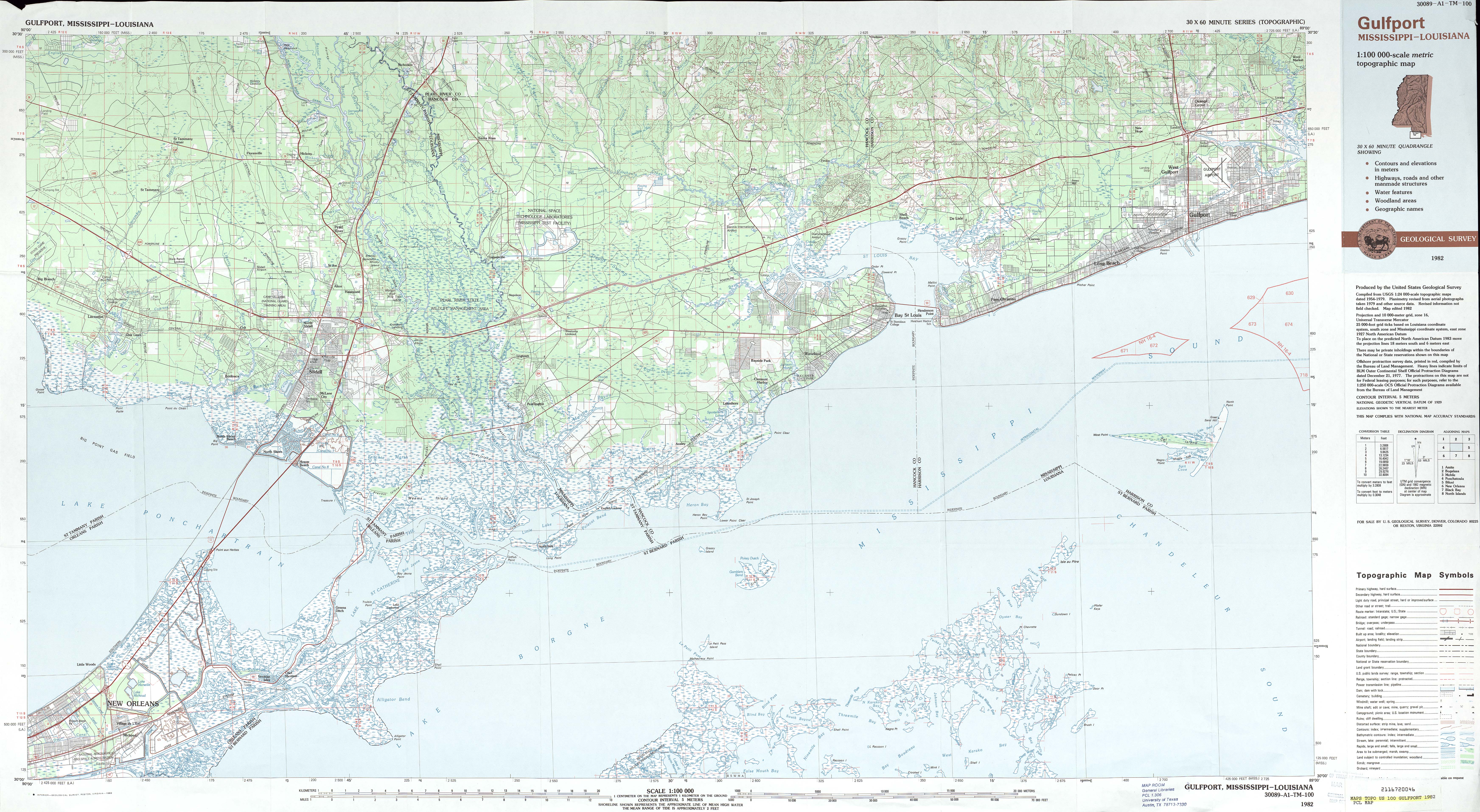
| Description | 1982 map, showing section of Mississippi and Louisiana Gulf Coast area, from Eastern New Orleans to Gulfport Mississippi, including Slidell, Louisiana, Bay St. Louis, Mississippi, and Pass Christian, Mississippi. | ||||||
| Date | |||||||
| Source | New Orleans, Louisiana to Gulfport, Mississippi Gulfport Sheet, Metric Topographic Map 30089-A1-TM-100, U.S. Geological Survey, 1982. Via [1] | ||||||
| Author | U.S. Geological Survey | ||||||
| Permission (Reusing this file) |
|
||||||

File history
Click on a date/time to view the file as it appeared at that time.
| Date/Time | Thumbnail | Dimensions | User | Comment | |
|---|---|---|---|---|---|
| current | 14:59, 19 June 2012 | | 6,976 × 3,828 (4.9 MB) | Infrogmation (talk | contribs) | {{Information |Description=1982 map, showing section of Mississippi and Louisiana Gulf Coast area, from Eastern New Orleans to Gulfport Mississippi, including Slidell, Louisiana, Bay St. Louis, Mississippi, and Pass Christian, Mississippi. |Source= New... |
You cannot overwrite this file.
File usage on Commons
There are no pages that use this file.