File:Map Padre Island towns.gif
No higher resolution available.
Map_Padre_Island_towns.gif (330 × 590 pixels, file size: 35 KB, MIME type: image/gif)
Captions
Captions
Add a one-line explanation of what this file represents
| Description |
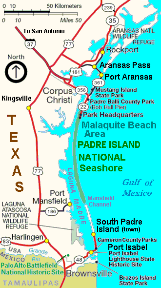
Map of Padre Island — showing the towns and parks on the Gulf Coast Barrier island in Texas.
|
| Date | |
| Source | Cropped/labeled derivative version of file from U.S. National Park Service, URL: http://www.nps.gov/pais/planyourvisit/images/GMP_PAIS_cropped_to_415x600.jpg |
| Author | Wikid77, revising map from U.S. National Park Service. |
| Other versions |
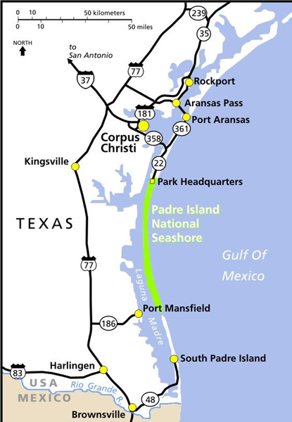
Wider view, in dimmer colors:
|
| This image or media file contains material based on a work of a National Park Service employee, created as part of that person's official duties. As a work of the U.S. federal government, such work is in the public domain in the United States. See the NPS website and NPS copyright policy for more information. |
File history
Click on a date/time to view the file as it appeared at that time.
| Date/Time | Thumbnail | Dimensions | User | Comment | |
|---|---|---|---|---|---|
| current | 03:33, 17 February 2008 | | 330 × 590 (35 KB) | Wikid77 (talk | contribs) | initial upload |
You cannot overwrite this file.
File usage on Commons
The following page uses this file:
File usage on other wikis
The following other wikis use this file:
- Usage on en.wikipedia.org
- Usage on es.wikipedia.org
- Usage on ko.wikipedia.org