File:Map of Alaska highlighting Kusilvak Census Area.svg

Size of this PNG preview of this SVG file: 800 × 423 pixels. Other resolutions: 320 × 169 pixels | 640 × 338 pixels | 1,024 × 541 pixels | 1,280 × 677 pixels | 2,560 × 1,353 pixels | 1,470 × 777 pixels.
Original file (SVG file, nominally 1,470 × 777 pixels, file size: 644 KB)
Captions
Captions
Add a one-line explanation of what this file represents
| Description |
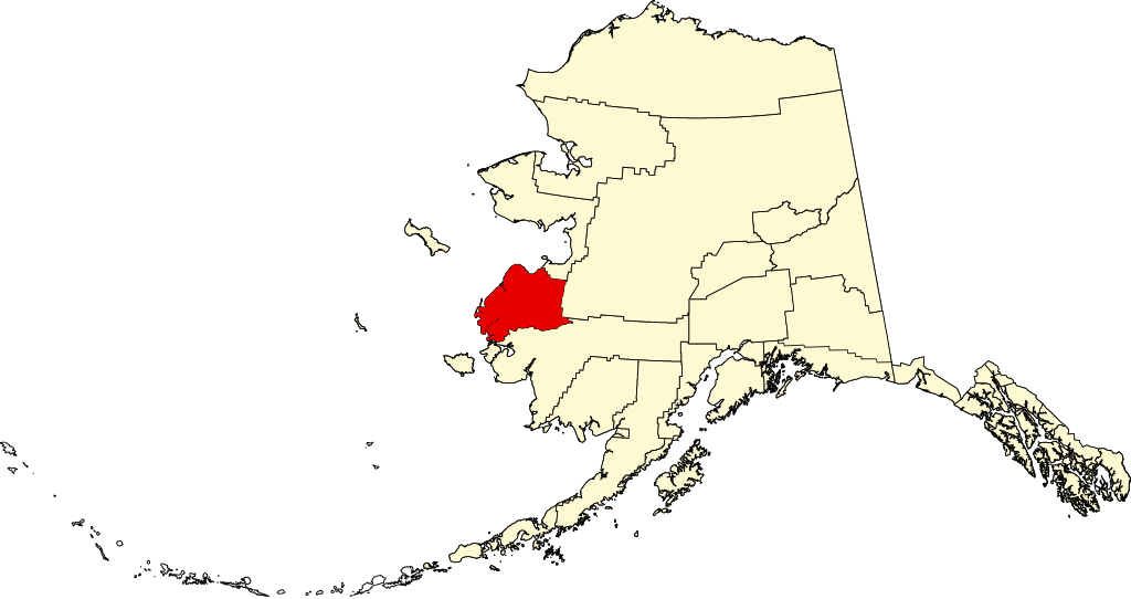
English: This is a locator map showing Wade Hampton Census Area in Alaska. |
| Source | Own work |
| Author | David Benbennick |
| I, the copyright holder of this work, release this work into the public domain. This applies worldwide. In some countries this may not be legally possible; if so: I grant anyone the right to use this work for any purpose, without any conditions, unless such conditions are required by law. |
File history
Click on a date/time to view the file as it appeared at that time.
| Date/Time | Thumbnail | Dimensions | User | Comment | |
|---|---|---|---|---|---|
| current | 20:12, 25 June 2024 | | 1,470 × 777 (644 KB) | Nux (talk | contribs) | uniform colors with good contrast |
| 19:20, 7 September 2007 |  | 1,470 × 777 (338 KB) | Dbenbenn (talk | contribs) | {{subst:User:Dbenbenn/clm|county=Wade Hampton Census Area|state=Alaska|type=borough and census area}} |
You cannot overwrite this file.
File usage on Commons
The following 2 pages use this file:
File usage on other wikis
The following other wikis use this file:
- Usage on bpy.wikipedia.org
- Usage on ca.wikipedia.org
- Usage on ce.wikipedia.org
- Usage on cy.wikipedia.org
- Usage on de.wikipedia.org
- Usage on en.wikipedia.org
- List of boroughs and census areas in Alaska
- Kusilvak Census Area, Alaska
- Alakanuk, Alaska
- Chevak, Alaska
- Emmonak, Alaska
- Hooper Bay, Alaska
- Kotlik, Alaska
- Marshall, Alaska
- Mountain Village, Alaska
- Pilot Station, Alaska
- Pitkas Point, Alaska
- Russian Mission, Alaska
- Scammon Bay, Alaska
- Nunam Iqua, Alaska
- St. Mary's, Alaska
- Norton Sound
- Unorganized Borough, Alaska
- Hazen Bay
- Wikipedia:WikiProject Alaska
- Chevak Airport
- Andreafsky Wilderness
- Hooper Bay Airport
- Ninglikfak River
- Tutakoke River
- KCUK
- Sheldon Point Airport
- Template:Unorganized Borough, Alaska
- Template:Kusilvak Census Area, Alaska
- User:Nyttend/County templates/AK
- Template:KusilvakAK-geo-stub
- Ingakslugwat Hills
- Kusilvak Mountains
- Nunavakanuk Lake
- Russian Mission Airport
- Category:Populated places in Unorganized Borough, Alaska
- Category:Populated places in Kusilvak Census Area, Alaska
- Paimiut, Alaska
- Yupiit Piciryarait Cultural Center
- User:AridCeption/sandbox
- Algaaciq Native Village
- File talk:Map of Alaska highlighting Kusilvak Census Area.svg
- Usage on es.wikipedia.org
- Usage on et.wikipedia.org
- Usage on fi.wikipedia.org
View more global usage of this file.