File:Map of Austria after Anschluss.jpg

Original file (1,467 × 925 pixels, file size: 627 KB, MIME type: image/jpeg)
Captions
Captions
Summary
edit
| Description |
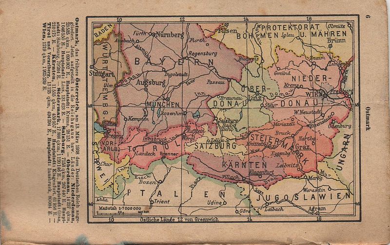
Polski: Mapa anektowanej Austrii (Ostmark) z niemieckiego atlasu kieszonkowego, 1939-1940 English: Map of annexed Austria (Ostmark) from german pocket atlas, 19391
-1940 |
| Date | |
| Source | Private collection |
| Author | Unknown author |
Licensing
edit
|
This work is in the public domain in its country of origin and other countries and areas where the copyright term is the author's life plus 70 years or fewer.
| |
| This file has been identified as being free of known restrictions under copyright law, including all related and neighboring rights. | |
File history
Click on a date/time to view the file as it appeared at that time.
| Date/Time | Thumbnail | Dimensions | User | Comment | |
|---|---|---|---|---|---|
| current | 11:15, 4 January 2015 | | 1,467 × 925 (627 KB) | Hoa binh (talk | contribs) | User created page with UploadWizard |
You cannot overwrite this file.
File usage on Commons
There are no pages that use this file.