File:Map of Connecticut highlighting Hartford County.svg

Size of this PNG preview of this SVG file: 800 × 583 pixels. Other resolutions: 320 × 233 pixels | 640 × 467 pixels | 1,024 × 747 pixels | 1,280 × 933 pixels | 2,560 × 1,866 pixels | 1,624 × 1,184 pixels.
Original file (SVG file, nominally 1,624 × 1,184 pixels, file size: 10 KB)
Captions
Captions
Add a one-line explanation of what this file represents
Summary
edit
| Description |
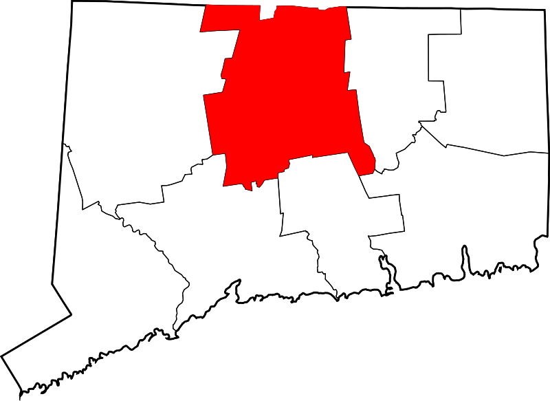
English: This is a locator map showing Hartford County in Connecticut. For more information, see Commons:United States county locator maps. |
| Date | |
| Source |
Own work: English: The maps use data from nationalatlas.gov, specifically countyp020.tar.gz on the Raw Data Download page. The maps also use state outline data from statesp020.tar.gz. The Florida maps use hydrogm020.tar.gz to display Lake Okeechobee. |
| Author | David Benbennick |
Licensing
edit
| I, the copyright holder of this work, release this work into the public domain. This applies worldwide. In some countries this may not be legally possible; if so: I grant anyone the right to use this work for any purpose, without any conditions, unless such conditions are required by law. |
File history
Click on a date/time to view the file as it appeared at that time.
| Date/Time | Thumbnail | Dimensions | User | Comment | |
|---|---|---|---|---|---|
| current | 12:49, 25 June 2024 | | 1,624 × 1,184 (10 KB) | Nux (talk | contribs) | fix rendering (remove clipping) |
| 18:32, 19 June 2024 |  | 1,624 × 1,184 (10 KB) | Nux (talk | contribs) | fix rendering (remove clipping) | |
| 10:31, 12 February 2006 |  | 1,624 × 1,184 (16 KB) | David Benbennick (talk | contribs) | {{subst:User:Dbenbenn/clm|county=Hartford County|state=Connecticut}} |
You cannot overwrite this file.
File usage on Commons
There are no pages that use this file.
File usage on other wikis
The following other wikis use this file:
- Usage on ar.wikipedia.org
- فارمنغتون (كونيتيكت)
- هارتفورد (كونيتيكت)
- إيست هارتفورد
- بريستول (كونيتيكت)
- نيو بريتن
- كانتون فالي (كونيتيكت)
- كولينسفيل (كونيتيكت)
- بورلينغتون (كونيتيكت)
- كانتون (كونيتيكت)
- إيست غرانبي (كونيتيكت)
- أيست ويندسور (كونيتيكت)
- إينفيلد (كونيتيكت)
- غلاستونبوري (كونيتيكت)
- غرانبي (كونيتيكت)
- هارتلاند (كونيتيكت)
- مانشستر (كونيتيكت)
- مارلبورو (كونيتيكت)
- نيوينغون (كونيتيكت)
- قائمة مقاطعات كونيتيكت
- سالمون بروك (كونيتيكت)
- غلاستونبري سنتر (كونيتيكت)
- بلو هيلز (كونيتيكت)
- كينسينغتون (كونيتيكت)
- شيروود مانور (كونيتيكت)
- برود بروك (كونيتيكت)
- قالب:مقاطعة هارتفورد (كونيتيكت)
- نورث غرانبي (كونيتيكت)
- تيراموغوس (كونيتيكت)
- تاريفيل (كونيتيكت)
- ثومبسونفيل (كونيتيكت)
- Usage on bpy.wikipedia.org
- Usage on ca.wikipedia.org
- Hartford (Connecticut)
- Avon (Connecticut)
- Berlin (Connecticut)
- Bloomfield (Connecticut)
- Bristol (Connecticut)
- Burlington (Connecticut)
- Canton (Connecticut)
- Central Manchester
- East Granby
- East Hartford
- East Windsor
- Enfield (Connecticut)
- Farmington (Connecticut)
- New Britain (Connecticut)
- Plainville (Connecticut)
- Simsbury Center
- South Windsor
- Southington (Connecticut)
View more global usage of this file.