File:Map of Framingham annexation of North Sherborn and Sherborn selectmen.jpg
Size of this preview: 715 × 600 pixels. Other resolutions: 286 × 240 pixels | 572 × 480 pixels | 916 × 768 pixels | 1,221 × 1,024 pixels | 2,407 × 2,019 pixels.
Original file (2,407 × 2,019 pixels, file size: 724 KB, MIME type: image/jpeg)
Captions
Captions
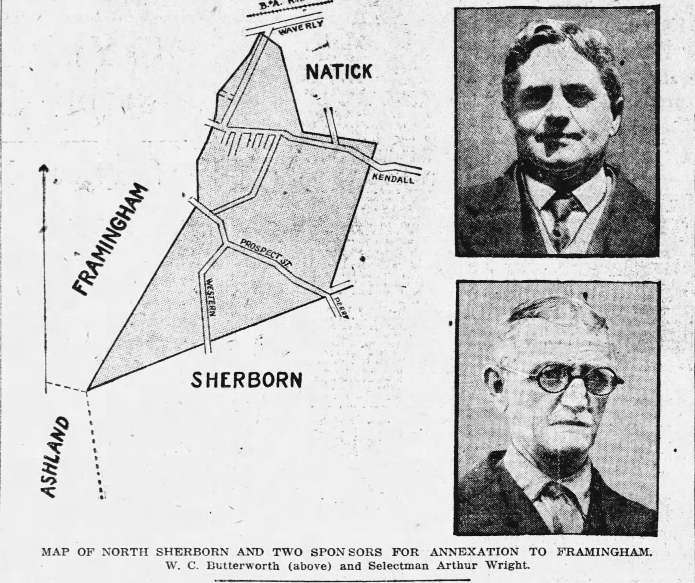
Map of an area of what was part of the Town of Sherborn that was annexed by Framingham in 1925.
Summary
edit
| Description |
English: Map of an area of what was part of the Town of Sherborn in Massachusetts that was annexed by Framingham in 1925. Two sponsors of the annexation from Sherborn are pictured. |
| Date | |
| Source | https://www.newspapers.com/article/the-boston-globe-map-of-framingham-annex/125295276/, The Boston Globe, May 25, 1923, pg. 13 |
| Author | The Boston Globe |
Licensing
edit
This work is in the public domain in the United States because it was published (or registered with the U.S. Copyright Office) before January 1, 1929.
Public domain works must be out of copyright in both the United States and in the source country of the work in order to be hosted on the Commons. If the work is not a U.S. work, the file must have an additional copyright tag indicating the copyright status in the source country.
Note: This tag should not be used for sound recordings. |
File history
Click on a date/time to view the file as it appeared at that time.
| Date/Time | Thumbnail | Dimensions | User | Comment | |
|---|---|---|---|---|---|
| current | 18:46, 25 May 2023 | | 2,407 × 2,019 (724 KB) | Abzeronow (talk | contribs) | Uploaded a work by The Boston Globe from https://www.newspapers.com/article/the-boston-globe-map-of-framingham-annex/125295276/, The Boston Globe, May 25, 1923, pg. 13 with UploadWizard |
You cannot overwrite this file.
File usage on Commons
There are no pages that use this file.