File:Map of Giant Sequoia NM.png
Size of this preview: 462 × 599 pixels. Other resolutions: 185 × 240 pixels | 370 × 480 pixels | 592 × 768 pixels | 790 × 1,024 pixels | 2,020 × 2,619 pixels.
Original file (2,020 × 2,619 pixels, file size: 987 KB, MIME type: image/png)
Captions
Captions
Add a one-line explanation of what this file represents
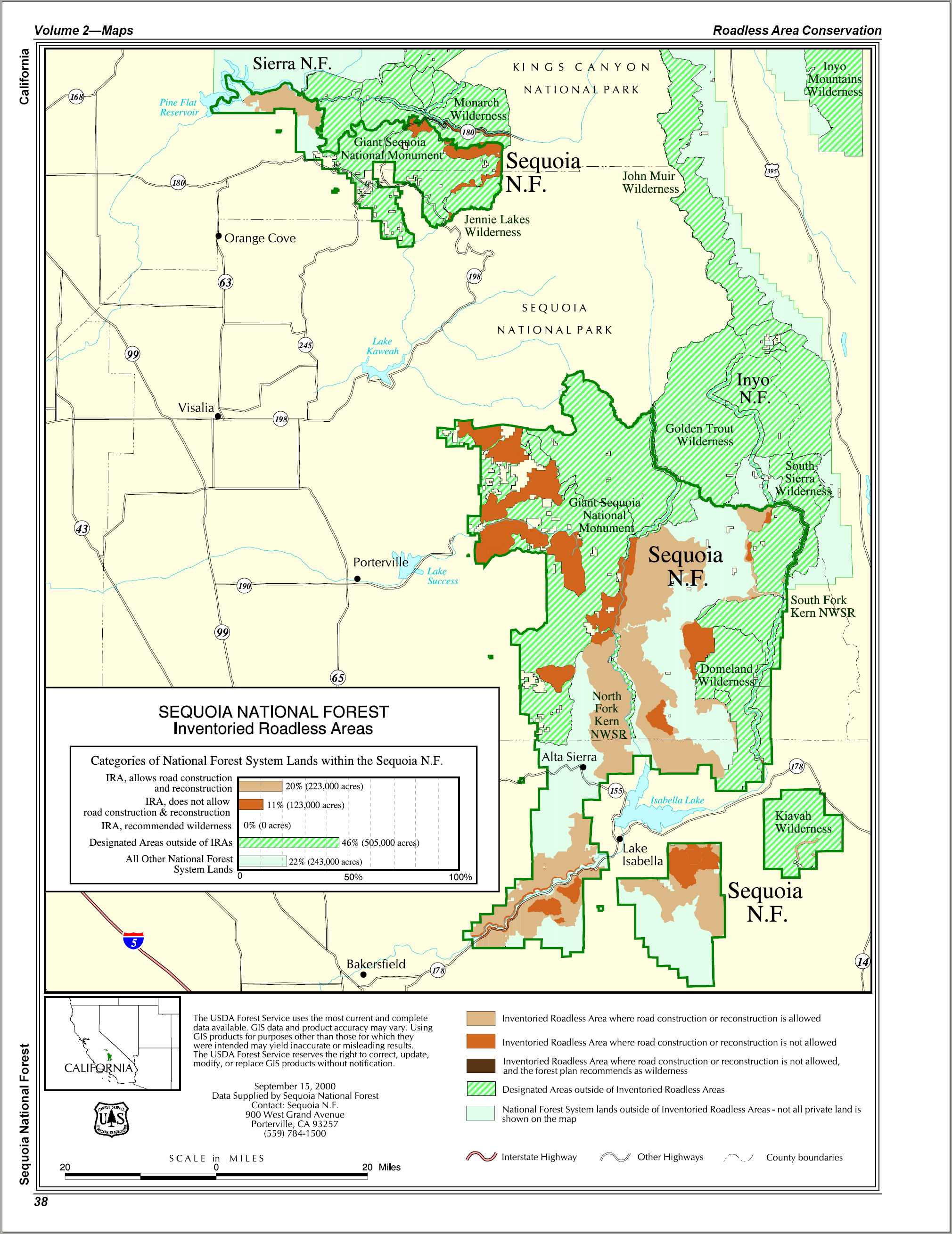
| Description | Map of Giant Sequoia National Monument and nearby Sequoia National Forest, in the Sierra Nevada of California. | |||
| Date | 13 September 2006 (original upload date) | |||
| Source | U.S. Forest Service | |||
| Author | U.S. Forest Service | |||
| Permission (Reusing this file) |
|

File history
Click on a date/time to view the file as it appeared at that time.
| Date/Time | Thumbnail | Dimensions | User | Comment | |
|---|---|---|---|---|---|
| current | 07:50, 13 September 2006 | | 2,020 × 2,619 (987 KB) | Huebi~commonswiki (talk | contribs) | {{Information |Description=Map of Giant Sequoia NM |Source=http://www.fs.fed.us/ |Date= |Author= |Permission= |other_versions= }} {{PD-USGov-USDA}} Category:Giant Sequoia National Monument |
You cannot overwrite this file.
File usage on Commons
There are no pages that use this file.
File usage on other wikis
The following other wikis use this file:
- Usage on de.wikipedia.org