File:Map of Indiana highlighting Delaware County.svg

Size of this PNG preview of this SVG file: 391 × 599 pixels. Other resolutions: 156 × 240 pixels | 313 × 480 pixels | 501 × 768 pixels | 668 × 1,024 pixels | 1,337 × 2,048 pixels | 722 × 1,106 pixels.
Original file (SVG file, nominally 722 × 1,106 pixels, file size: 42 KB)
Captions
Captions
Add a one-line explanation of what this file represents
Summary
edit
| Description |
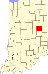
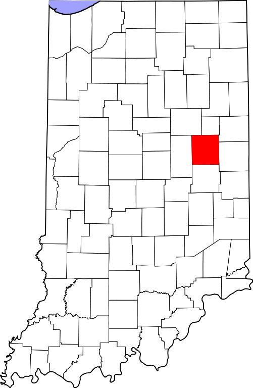
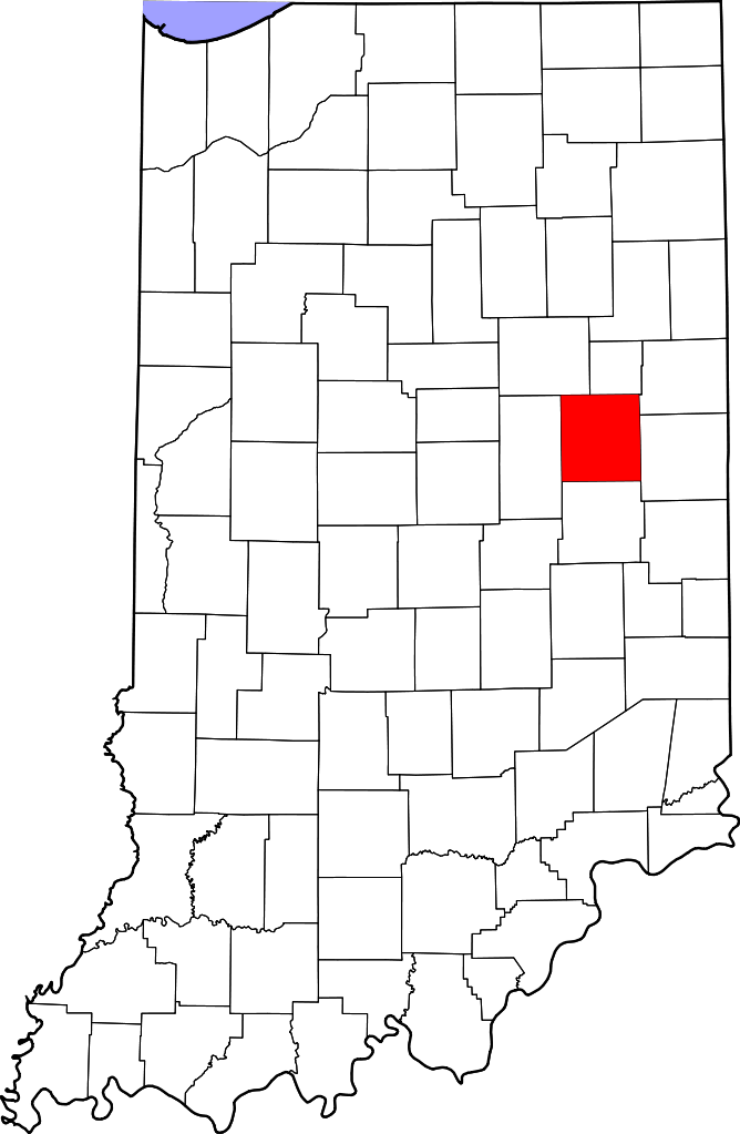
English: This is a locator map showing Delaware County in Indiana. For more information, see Commons:United States county locator maps. |
| Date | |
| Source |
Own work: English: The maps use data from nationalatlas.gov, specifically countyp020.tar.gz on the Raw Data Download page. The maps also use state outline data from statesp020.tar.gz. The Florida maps use hydrogm020.tar.gz to display Lake Okeechobee. |
| Author | David Benbennick |
Licensing
edit
| I, the copyright holder of this work, release this work into the public domain. This applies worldwide. In some countries this may not be legally possible; if so: I grant anyone the right to use this work for any purpose, without any conditions, unless such conditions are required by law. |
File history
Click on a date/time to view the file as it appeared at that time.
| Date/Time | Thumbnail | Dimensions | User | Comment | |
|---|---|---|---|---|---|
| current | 14:35, 25 June 2024 | | 722 × 1,106 (42 KB) | Nux (talk | contribs) | uniform colors with good contrast |
| 20:38, 19 June 2024 |  | 722 × 1,106 (42 KB) | Nux (talk | contribs) | fix rendering (remove clipping) | |
| 12:09, 12 February 2006 |  | 2,887 × 4,423 (56 KB) | David Benbennick (talk | contribs) | {{subst:User:Dbenbenn/clm|county=Delaware County|state=Indiana}} |
You cannot overwrite this file.
File usage on Commons
The following 12 pages use this file:
- Category:Births in Delaware County, Indiana
- Category:Bridges in Delaware County, Indiana
- Category:Deaths in Delaware County, Indiana
- Category:Delaware County, Indiana
- Category:Education in Delaware County, Indiana
- Category:Historic districts in Delaware County, Indiana
- Category:Maps of Delaware County, Indiana
- Category:National Register of Historic Places in Delaware County, Indiana
- Category:People of Delaware County, Indiana
- Category:Populated places in Delaware County, Indiana
- Category:Towns in Delaware County, Indiana
- Category:Visitor attractions in Delaware County, Indiana
File usage on other wikis
The following other wikis use this file:
- Usage on ar.wikipedia.org
- Usage on bg.wikipedia.org
- Usage on bpy.wikipedia.org
- Usage on cdo.wikipedia.org
- Usage on ceb.wikipedia.org
- Usage on ce.wikipedia.org
- Usage on cy.wikipedia.org
- Usage on de.wikipedia.org
- Usage on el.wikipedia.org
- Usage on en.wikipedia.org
- List of counties in Indiana
- Delaware County, Indiana
- Albany, Indiana
- Chesterfield, Indiana
- Daleville, Indiana
- Eaton, Indiana
- Gaston, Indiana
- Muncie, Indiana
- Selma, Indiana
- Yorktown, Indiana
- Wheeler-Thanhauser Orchid Collection and Species Bank
- DeSoto, Indiana
- Cowan, Indiana
- Template:Delaware County, Indiana
- Center Township, Delaware County, Indiana
- Delaware Township, Delaware County, Indiana
- Hamilton Township, Delaware County, Indiana
- Harrison Township, Delaware County, Indiana
- Liberty Township, Delaware County, Indiana
- Monroe Township, Delaware County, Indiana
- Mount Pleasant Township, Delaware County, Indiana
- Niles Township, Delaware County, Indiana
- Perry Township, Delaware County, Indiana
- Salem Township, Delaware County, Indiana
- Union Township, Delaware County, Indiana
- Washington Township, Delaware County, Indiana
- Anthony, Indiana
- Bethel, Delaware County, Indiana
- Template:DelawareCountyIN-geo-stub
- Cammack, Indiana
- Cross Roads, Delaware County, Indiana
View more global usage of this file.