File:Map of Massachusetts highlighting Middlesex County.svg

Size of this PNG preview of this SVG file: 800 × 489 pixels. Other resolutions: 320 × 196 pixels | 640 × 391 pixels | 1,024 × 626 pixels | 1,280 × 783 pixels | 2,560 × 1,566 pixels | 1,488 × 910 pixels.
Original file (SVG file, nominally 1,488 × 910 pixels, file size: 26 KB)
Captions
Captions
Add a one-line explanation of what this file represents
Summary
edit
| Description |
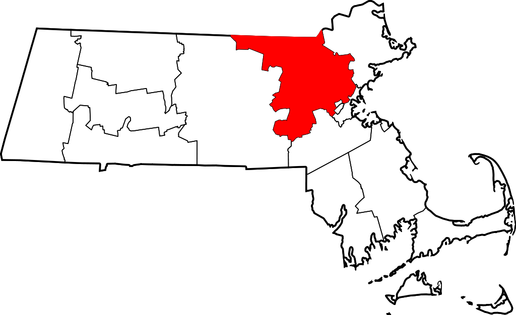
English: This is a locator map showing Middlesex County in Massachusetts. For more information, see Commons:United States county locator maps. |
| Date | |
| Source |
Own work: English: The maps use data from nationalatlas.gov, specifically countyp020.tar.gz on the Raw Data Download page. The maps also use state outline data from statesp020.tar.gz. The Florida maps use hydrogm020.tar.gz to display Lake Okeechobee. |
| Author | David Benbennick |
| SVG development | This W3C-invalid locator map was created with an unknown SVG tool. |
Licensing
edit
| I, the copyright holder of this work, release this work into the public domain. This applies worldwide. In some countries this may not be legally possible; if so: I grant anyone the right to use this work for any purpose, without any conditions, unless such conditions are required by law. |
File history
Click on a date/time to view the file as it appeared at that time.
| Date/Time | Thumbnail | Dimensions | User | Comment | |
|---|---|---|---|---|---|
| current | 21:43, 24 June 2024 | | 1,488 × 910 (26 KB) | Nux (talk | contribs) | fix rendering (remove clipping) |
| 12:50, 12 February 2006 |  | 2,976 × 1,819 (43 KB) | David Benbennick (talk | contribs) | {{subst:User:Dbenbenn/clm|county=Middlesex County|state=Massachusetts|type=county}} |
You cannot overwrite this file.
File usage on Commons
The following 10 pages use this file:
- Category:Births in Middlesex County, Massachusetts
- Category:Deaths in Middlesex County, Massachusetts
- Category:Education in Middlesex County, Massachusetts
- Category:Geography of Middlesex County, Massachusetts
- Category:History of Middlesex County, Massachusetts
- Category:Maps of Middlesex County, Massachusetts
- Category:Middlesex County, Massachusetts
- Category:Parks in Middlesex County, Massachusetts
- Category:People of Middlesex County, Massachusetts
- Category:Populated places in Middlesex County, Massachusetts
File usage on other wikis
The following other wikis use this file:
- Usage on ar.wikipedia.org
- كامبريدج (ماساتشوستس)
- تشيستنت هل
- مقاطعة ميدلسيكس (ماساتشوستس)
- مالدن
- أكتون (ماساتشوستس)
- لوويل
- نيوتن (ماساتشوستس)
- سومرفيل (ماساتشوستس)
- ميدفورد (ماساتشوستس)
- إيفرت
- والثام
- مارلبورو (ماساتشوستس)
- وترتاون
- ووبرن
- ميلروز (ماساتشوستس)
- بينهورست (ماساتشوستس)
- ديفينس (ماساتشوستس)
- بورلينغتون (ماساتشوستس)
- كارليلس (ماساتشوستس)
- تشيلمسفورد (ماساتشوستس)
- كونكورد (ماساتشوستس)
- دراكوت (ماساتشوستس)
- دونستيبل (ماساتشوستس)
- فرامينغهام (ماساتشوستس)
- غروتون (ماساتشوستس)
- هوليستون (ماساتشوستس)
- هوبكينتون (ماساتشوستس)
- هودسون (ماساتشوستس)
- ليكسينغتون (ماساتشوستس)
- لينكولن (ماساتشوستس)
- ليتلتون (ماساتشوستس)
- ماينارد (ماساتشوستس)
- ناتيك (ماساتشوستس)
- نورث ريدينغ (ماساتشوستس)
- بيبريل (ماساتشوستس)
- قائمة مقاطعات ماساتشوستس
- ريدينج (ماساتشوستس)
- تاونسند (ماساتشوستس)
- ستونهام (ماساتشوستس)
- أير (ماساتشوستس)
- بيلمونت (ماساتشوستس)
- هدسون (ماساتشوستس)
- شيرلي (ماساتشوستس)
- ويست كونكورد (ماساتشوستس)
- قالب:مقاطعة ميدلسيكس (ماساشوستس)
- Usage on bg.wikipedia.org
- Usage on bpy.wikipedia.org
- Usage on ca.wikipedia.org
View more global usage of this file.