File:Map of New York highlighting Yates County.svg

Size of this PNG preview of this SVG file: 787 × 600 pixels. Other resolutions: 315 × 240 pixels | 630 × 480 pixels | 1,008 × 768 pixels | 1,280 × 975 pixels | 2,560 × 1,950 pixels | 1,650 × 1,257 pixels.
Original file (SVG file, nominally 1,650 × 1,257 pixels, file size: 66 KB)
Captions
Captions
Add a one-line explanation of what this file represents
Summary
edit
| Description |
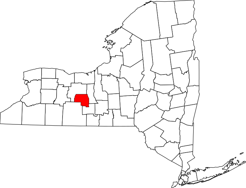
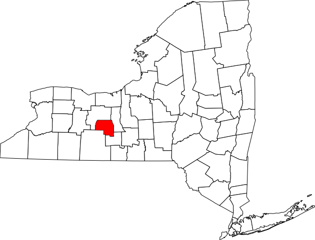
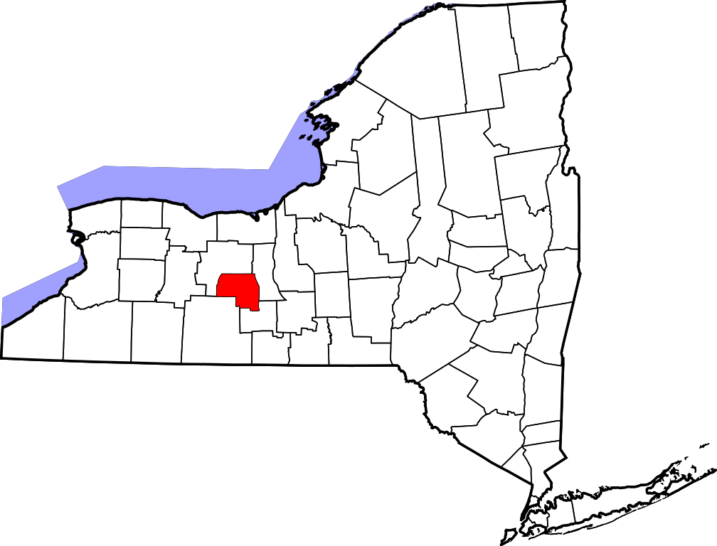
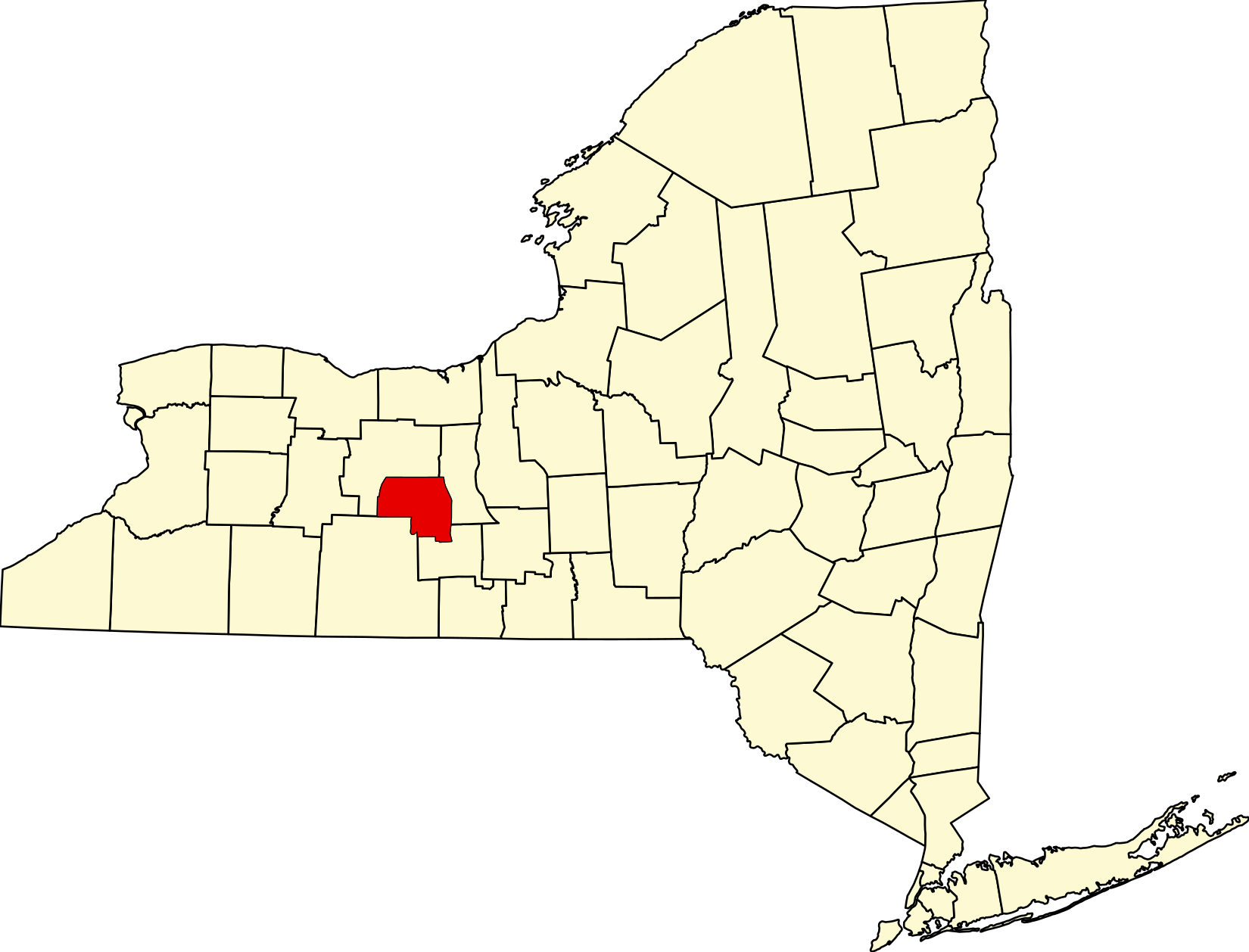
English: This is a locator map showing Yates County in New York. For more information, see Commons:United States county locator maps. |
| Date | |
| Source |
Own work: English: The maps use data from nationalatlas.gov, specifically countyp020.tar.gz on the Raw Data Download page. The maps also use state outline data from statesp020.tar.gz. The Florida maps use hydrogm020.tar.gz to display Lake Okeechobee. |
| Author | David Benbennick |
Licensing
edit
| I, the copyright holder of this work, release this work into the public domain. This applies worldwide. In some countries this may not be legally possible; if so: I grant anyone the right to use this work for any purpose, without any conditions, unless such conditions are required by law. |
File history
Click on a date/time to view the file as it appeared at that time.
| Date/Time | Thumbnail | Dimensions | User | Comment | |
|---|---|---|---|---|---|
| current | 20:55, 15 June 2024 | | 1,650 × 1,257 (66 KB) | Nux (talk | contribs) | fix (remove clip-path) |
| 15:35, 12 February 2006 |  | 6,599 × 5,030 (112 KB) | David Benbennick (talk | contribs) | {{subst:User:Dbenbenn/clm|county=Yates County|state=New York|type=county}} |
You cannot overwrite this file.
File usage on Commons
The following 5 pages use this file:
File usage on other wikis
The following other wikis use this file:
- Usage on ar.wikipedia.org
- Usage on bg.wikipedia.org
- Usage on bpy.wikipedia.org
- Usage on cdo.wikipedia.org
- Usage on ceb.wikipedia.org
- Usage on ce.wikipedia.org
- Usage on cs.wikipedia.org
- Usage on cy.wikipedia.org
- Usage on de.wikipedia.org
- Usage on en.wikipedia.org
- Yates County, New York
- List of counties in New York
- Barrington, New York
- Benton, New York
- Dresden, Yates County, New York
- Dundee, New York
- Italy, New York
- Jerusalem, New York
- Middlesex, New York
- Milo, New York
- Penn Yan, New York
- Potter, New York
- Starkey, New York
- Torrey, New York
- Rushville, New York
- Keuka Park, New York
- Keuka Lake State Park
- National Register of Historic Places listings in Yates County, New York
- Template:Yates County, New York
- Lakemont, New York
- Glenora, New York
- Template:YatesCountyNY-geo-stub
- Branchport, New York
- User:Nyttend/County templates/NY/2
- Category:Populated places in Yates County, New York
- Bellona, New York
- Himrod, New York
- Rock Stream, New York
- User:AridCeption/sandbox
- File talk:Map of New York highlighting Yates County.svg
View more global usage of this file.