File:Map of Ohio highlighting Hamilton County.svg

Size of this PNG preview of this SVG file: 552 × 600 pixels. Other resolutions: 221 × 240 pixels | 442 × 480 pixels | 707 × 768 pixels | 942 × 1,024 pixels | 1,885 × 2,048 pixels | 1,050 × 1,141 pixels.
Original file (SVG file, nominally 1,050 × 1,141 pixels, file size: 37 KB)
Captions
Captions
Add a one-line explanation of what this file represents
Summary
edit
| Description |
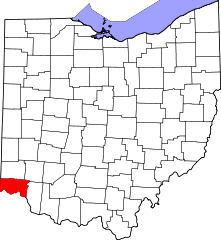
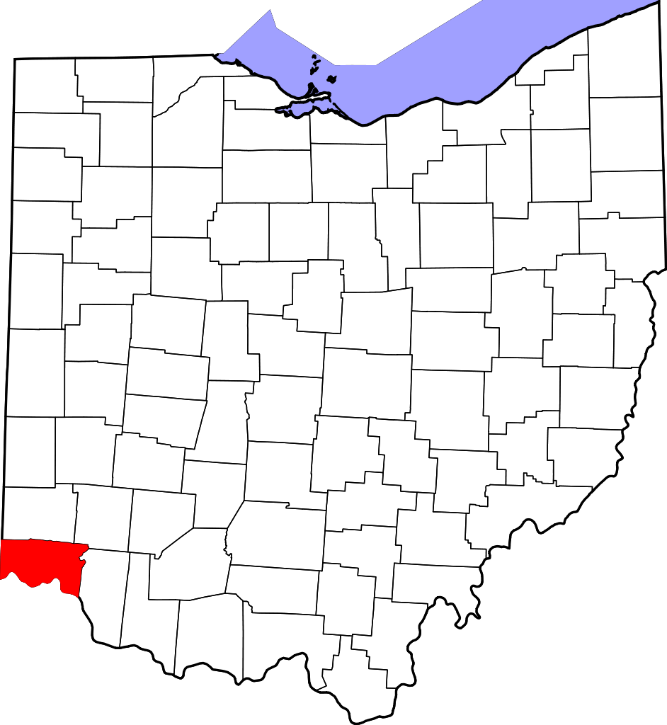
English: This is a locator map showing Hamilton County in Ohio. For more information, see Commons:United States county locator maps. |
| Date | |
| Source |
Own work: English: The maps use data from nationalatlas.gov, specifically countyp020.tar.gz on the Raw Data Download page. The maps also use state outline data from statesp020.tar.gz. The Florida maps use hydrogm020.tar.gz to display Lake Okeechobee. |
| Author | David Benbennick |
Licensing
edit
| I, the copyright holder of this work, release this work into the public domain. This applies worldwide. In some countries this may not be legally possible; if so: I grant anyone the right to use this work for any purpose, without any conditions, unless such conditions are required by law. |
File history
Click on a date/time to view the file as it appeared at that time.
| Date/Time | Thumbnail | Dimensions | User | Comment | |
|---|---|---|---|---|---|
| current | 01:35, 25 June 2024 | | 1,050 × 1,141 (37 KB) | Nux (talk | contribs) | fix rendering (remove clipping) |
| 16:08, 12 February 2006 |  | 3,675 × 3,995 (58 KB) | David Benbennick (talk | contribs) | {{subst:User:Dbenbenn/clm|county=Hamilton County|state=Ohio|type=county}} |
You cannot overwrite this file.
File usage on Commons
The following page uses this file:
File usage on other wikis
The following other wikis use this file:
- Usage on ar.wikipedia.org
- سينسيناتي (أوهايو)
- أمبرلي فيليج
- فيرفيلد (أوهايو)
- فورست بارك (أوهايو)
- غلينديل (أوهايو)
- غرينهيلز (أوهايو)
- لوكلاند (أوهايو)
- لوفلاند (أوهايو)
- ميريمونت (أوهايو)
- ميلفورد (أوهايو)
- مونتغومري (أوهايو)
- سيلفيرتون (أوهايو)
- سبرينغديل (أوهايو)
- تيرايس بارك (أوهايو)
- وويومينغ (أوهايو)
- نوروود
- شارونفيل
- بلو أش
- دير بارك
- شفيوت
- ريدينغ (أوهايو)
- هاريسون (أوهايو)
- ماونت هيلثي
- نورث كوليج هيل
- سانت برنارد
- ماديرا (أوهايو)
- إنديان هيل
- أديستون (أوهايو)
- إيفنديل (أوهايو)
- نيوثن (أوهايو)
- أرلينغتون هايتس (أوهايو)
- كليفس (أوهايو)
- إيلموود (أوهايو)
- فيرفاكس (أوهايو)
- غولف مانور (أوهايو)
- لينكولن هايتس (أوهايو)
- نورث بند (أوهايو)
- وودلوان (أوهايو)
- قالب:مقاطعة هاميلتون (أوهايو)
- بلدة أندرسون (مقاطعة هاملتون)
- شيري غروف (أوهايو)
- وايت أوك (أوهايو)
- فورستفيل (أوهايو)
- توربين هيلز (أوهايو)
- دنت (أوهايو)
- كينوود (أوهايو)
- بليزانت رن (أوهايو)
- قالب:مقاطعة هاملتون (أوهايو)
- Usage on azb.wikipedia.org
View more global usage of this file.