File:Map of Virginia highlighting Halifax County.svg

Size of this PNG preview of this SVG file: 800 × 347 pixels. Other resolutions: 320 × 139 pixels | 640 × 278 pixels | 1,024 × 444 pixels | 1,280 × 555 pixels | 2,560 × 1,110 pixels | 2,495 × 1,082 pixels.
Original file (SVG file, nominally 2,495 × 1,082 pixels, file size: 159 KB)
Captions
Captions
Add a one-line explanation of what this file represents
Summary
edit
| Description |
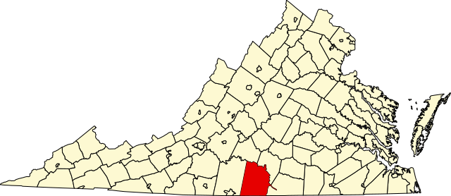
English: This is a locator map showing Halifax County in Virginia. For more information, see Commons:United States county locator maps. |
| Date | |
| Source |
Own work: English: The maps use data from nationalatlas.gov, specifically countyp020.tar.gz on the Raw Data Download page. The maps also use state outline data from statesp020.tar.gz. The Florida maps use hydrogm020.tar.gz to display Lake Okeechobee. |
| Author | David Benbennick |
| SVG development |
Licensing
edit
| I, the copyright holder of this work, release this work into the public domain. This applies worldwide. In some countries this may not be legally possible; if so: I grant anyone the right to use this work for any purpose, without any conditions, unless such conditions are required by law. |
File history
Click on a date/time to view the file as it appeared at that time.
| Date/Time | Thumbnail | Dimensions | User | Comment | |
|---|---|---|---|---|---|
| current | 07:55, 5 July 2024 | | 2,495 × 1,082 (159 KB) | Nux (talk | contribs) | fix rendering (remove clipping), uniform colors |
| 17:46, 12 February 2006 |  | 7,486 × 3,247 (223 KB) | David Benbennick (talk | contribs) | {{subst:User:Dbenbenn/clm|county=Halifax County|state=Virginia|type=county}} |
You cannot overwrite this file.
File usage on Commons
The following 5 pages use this file:
File usage on other wikis
The following other wikis use this file:
- Usage on ar.wikipedia.org
- Usage on bg.wikipedia.org
- Usage on bpy.wikipedia.org
- Usage on cdo.wikipedia.org
- Usage on ceb.wikipedia.org
- Usage on ce.wikipedia.org
- Usage on cy.wikipedia.org
- Usage on de.wikipedia.org
- Usage on en.wikipedia.org
- List of cities and counties in Virginia
- Halifax County, Virginia
- Halifax, Virginia
- Scottsburg, Virginia
- South Boston, Virginia
- Virgilina, Virginia
- Clarksville, Virginia
- Clover, Virginia
- Banister River
- Hyco River
- Cluster Springs, Virginia
- Occoneechee State Park
- Template:Halifax County, Virginia
- Difficult Creek Natural Area Preserve
- National Register of Historic Places listings in Halifax County, Virginia
- Nathalie, Virginia
- Midway (near Scottsburg), Halifax County, Virginia
- Midway (near Buffalo Springs), Halifax County, Virginia
- Template:HalifaxCountyVA-geo-stub
- User:Nyttend/County templates/VA/1
- User:LBourne/Scratch pad
- Category:Populated places in Halifax County, Virginia
- Mountain Road, Virginia
- Riverdale, Halifax County, Virginia
- Alton, Virginia
- Crystal Hill, Virginia
- Vernon Hill, Virginia
- Ingram, Virginia
- User:Nyttend/Virginia NRHP/Halifax
- Paces, Virginia
- Liberty, Halifax County, Virginia
View more global usage of this file.