File:Map of Voivodeship of Serbia and Banat of Temeschwar (1849-1860).png

Size of this preview: 557 × 600 pixels. Other resolutions: 223 × 240 pixels | 446 × 480 pixels | 769 × 828 pixels.
Original file (769 × 828 pixels, file size: 95 KB, MIME type: image/png)
Captions
Captions
Add a one-line explanation of what this file represents
Summary edit
.png&action=edit§ion=1)
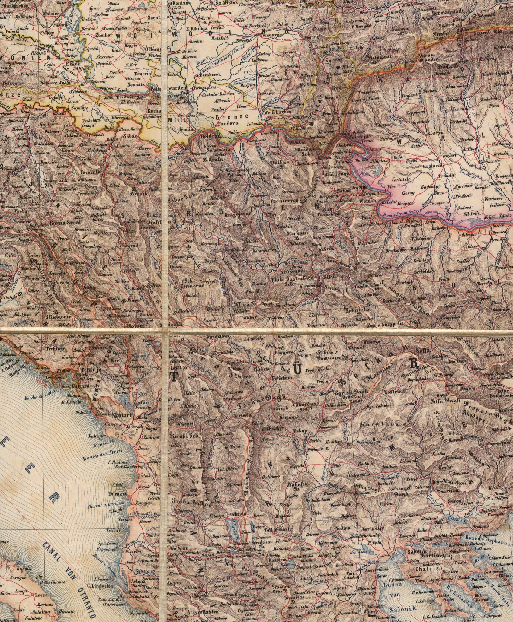
- English: Voivodeship of Serbia and Banat of Temeschwar (1849-1860)
- Serbian: Војводство Србија и Тамишки Банат (1849-1860)
References edit
.png&action=edit§ion=2)
Published references:
- The Times History of Europe, Times Books, 2002.
- Sima M. Ćirković, Srbi među evropskim narodima, Beograd, 2004.
- Dr Tomislav Bogavac, Nestajanje Srba, Niš, 1994.
- Dragomir Jankov, Vojvodina - propadanje jednog regiona, Novi Sad, 2004.
- Istorijski atlas, Zavod za udžbenike i nastavna sredstva - Zavod za kartografiju "Geokarta", Beograd, 1999.
- Školski istorijski atlas, Zavod za izdavanje udžbenika Socijalističke Republike Srbije, Beograd, 1970.
- Peter Rokai - Zoltan Đere - Tibor Pal - Aleksandar Kasaš, Istorija Mađara, Beograd, 2002.
- Lazo M. Kostić, Srpska Vojvodina i njene manjine, Novi Sad, 1999.
- Drago Njegovan, Prisajedinjenje Vojvodine Srbiji, Novi Sad, 2004.
- Čedomir Popov - Jelena Popov, Autonomija Vojvodine - srpsko pitanje, Sremski Karlovci, 2000.
- Dr Dušan J. Popović, Srbi u Vojvodini, knjiga 3, Novi Sad, 1990.
- J. H. Šviker, Politička istorija Srba u Ugarskoj, Novi Sad - Beograd, 1998.
- Sigfrid Kaper, Srpski pokret u južnoj Ugarskoj 1848-1849, Beograd - Valjevo, 1996.
- Dimitrije Boarov, Politička istorija Vojvodine, Novi Sad, 2001.
- Dejan Mikavica, Srpska Vojvodina u Habsburškoj monarhiji 1690-1920, Novi Sad, 2005.
- Dr Milenko Palić, Srbi u Mađarskoj - Ugarskoj do 1918, Novi Sad, 1995.
- Drago Njegovan, Srpska Vojvodina, Enciklopedija Novog Sada, knjiga 26, Novi Sad, 2005.
- Istorija Vojvodine, Enciklopedija Novog Sada, sveska 5, Novi Sad, 1996.
- Vladimir Ćorović, Ilustrovana istorija Srba, knjiga peta, Beograd, 2006.
- Vasilije Krestić, Iz prošlosti Srema, Bačke i Banata, Beograd, 2003.
- Slavko Gavrilović, Srbi u Habsburškoj Monarhiji (1792-1849), Novi Sad, 1994.
- Milan Tutorov, Banatska rapsodija, Novi Sad, 2001.
- Jovan M. Pejin, Iz prošlosti Kikinde, Kikinda, 2000.
- Rodoljub Malenčić, Miletić, Novi Sad, 1996.
- Čedomir Popov - Slavko Gavrilović, Evropska revolucija i srpski pokret 1848-1849, Beograd - Novi Sad, 1997.
Internet references:
- Bahovo doba - Vojvodstvo Srbija i Tamiški Banat archive copy at the Wayback Machine (in Serbian)
- Titles of Habsburg emperors
- Map
- Map
- Map
- Map
- Map
Source and licence edit
.png&action=edit§ion=3)

|
This map has been uploaded by Electionworld from en.wikipedia.org to enable the |
Self-made map by PANONIAN
| This work has been released into the public domain by its author, PANONIAN. This applies worldwide. In some countries this may not be legally possible; if so: |
File history
Click on a date/time to view the file as it appeared at that time.
| Date/Time | Thumbnail | Dimensions | User | Comment | |
|---|---|---|---|---|---|
| current | 15:22, 2 July 2014 | | 769 × 828 (95 KB) | PANONIAN (talk | contribs) | aesthetics |
| 12:36, 10 September 2010 |  | 769 × 828 (101 KB) | PANONIAN (talk | contribs) | aesthetical correction | |
| 13:03, 9 August 2009 |  | 769 × 828 (101 KB) | PANONIAN (talk | contribs) | ||
| 20:26, 19 May 2009 |  | 769 × 828 (101 KB) | PANONIAN (talk | contribs) | ||
| 16:31, 19 May 2009 |  | 769 × 591 (79 KB) | PANONIAN (talk | contribs) | ||
| 21:34, 21 December 2006 |  | 769 × 591 (52 KB) | Electionworld (talk | contribs) | {{ew|en|PANONIAN}} Self-made map by PANONIAN {{PD-user|PANONIAN}} Category:Maps of Serbia |
You cannot overwrite this file.
File usage on Commons
The following 6 pages use this file:
File usage on other wikis
The following other wikis use this file:
- Usage on be.wikipedia.org
- Usage on bg.wikipedia.org
- Usage on ca.wikipedia.org
- Usage on de.wikipedia.org
- Usage on el.wikipedia.org
- Usage on en.wikipedia.org
- Usage on et.wikipedia.org
- Usage on fa.wikipedia.org
- Usage on fr.wikipedia.org
- Usage on gl.wikipedia.org
- Usage on he.wikipedia.org
- Usage on hu.wikipedia.org
- Usage on it.wikipedia.org
- Usage on ja.wikipedia.org
- Usage on lt.wikipedia.org
- Usage on mk.wikipedia.org
- Usage on pnb.wikipedia.org
- Usage on pt.wikipedia.org
- Usage on ro.wikipedia.org
- Usage on ru.wikipedia.org
- Usage on sh.wikipedia.org
- Usage on sv.wikipedia.org
- Usage on uk.wikipedia.org
- Usage on vec.wikipedia.org
- Usage on www.wikidata.org
View more global usage of this file.
.png)
.png&oldid=792539604)