File:Mapa de Chile.svg

Size of this PNG preview of this SVG file: 120 × 600 pixels. Other resolutions: 48 × 240 pixels | 96 × 480 pixels | 153 × 768 pixels | 204 × 1,024 pixels | 409 × 2,048 pixels | 400 × 2,000 pixels.
Original file (SVG file, nominally 400 × 2,000 pixels, file size: 2.84 MB)
Captions
Captions
Add a one-line explanation of what this file represents
| Description |
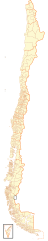
Español: Mapa contemporáneo de Chile, dividido en regiones y comunas. |
| Date | |
| Source | Own work |
| Author | B1mbo |
| Permission (Reusing this file) |
I, the copyright holder of this work, hereby publish it under the following license: This file is licensed under the Creative Commons Attribution-Share Alike 2.5 Generic license.
|
| SVG development |
| Legal disclaimer
The edition and circulation of maps, geographic charts and other documents about the boundaries and frontiers of Chile, don't have any relation with the Republic of Chile, according to the Article 2 g) of DFL Nº83 of 1979 of the Ministery of Foreign Affairs. |
I, the copyright holder of this work, hereby publish it under the following licenses:

|
Permission is granted to copy, distribute and/or modify this document under the terms of the GNU Free Documentation License, Version 1.2 or any later version published by the Free Software Foundation; with no Invariant Sections, no Front-Cover Texts, and no Back-Cover Texts. A copy of the license is included in the section entitled GNU Free Documentation License. |
This file is licensed under the Creative Commons Attribution-Share Alike 4.0 International, 3.0 Unported, 2.5 Generic, 2.0 Generic and 1.0 Generic license.
- You are free:
- to share – to copy, distribute and transmit the work
- to remix – to adapt the work
- Under the following conditions:
- attribution – You must give appropriate credit, provide a link to the license, and indicate if changes were made. You may do so in any reasonable manner, but not in any way that suggests the licensor endorses you or your use.
- share alike – If you remix, transform, or build upon the material, you must distribute your contributions under the same or compatible license as the original.
You may select the license of your choice.
File history
Click on a date/time to view the file as it appeared at that time.
| Date/Time | Thumbnail | Dimensions | User | Comment | |
|---|---|---|---|---|---|
| current | 19:56, 29 January 2021 | 400 × 2,000 (2.84 MB) | James2813 (talk | contribs) | Reverted to version as of 22:52, 5 September 2018 (UTC) El rectángulo corresponde al Acuerdo de 1998. | |
| 20:43, 14 March 2020 | 400 × 2,000 (2.84 MB) | CarlosArturoAcosta (talk | contribs) | Retiro rectángulo con relleno blanco en la parte inferior del mapa | ||
| 22:52, 5 September 2018 | 400 × 2,000 (2.84 MB) | Janitoalevic (talk | contribs) | Ñuble Region | ||
| 12:12, 16 January 2009 | 400 × 2,000 (2.71 MB) | Gvf (talk | contribs) | |||
| 03:13, 3 October 2007 | 400 × 2,000 (2.71 MB) | B1mbo (talk | contribs) | {{Information |Description= {{es|Mapa de Chile, dividido en regiones y comunas.}} |Source=own work |Date=2 de octubre de 2007 |Author=B1mbo |Permission={{self|cc-by-sa-2.5}} |other_versions= }} {{Chilean map|User:B1mbo}} [[Category:SVG |
You cannot overwrite this file.
File usage on Commons
The following 13 pages use this file:
- File:COVID-19 pandemic by commune, density (2020-05-29).svg
- File:División electoral de Chile (1989-2013).svg
- File:División electoral de Chile (2017).svg
- File:Estados de excepción constitucional en Chile (octubre 2019).svg
- File:Mapa de Chile (1928).svg
- File:Mapa de Chile (1928, provincias).svg
- File:Mapa de Chile (1929).svg
- File:Mapa de Chile (1929, provincias).svg
- File:Mapa de Chile (provincias).svg
- File:Mapa de Chile (regiones).svg
- File:Mapa rhinella arunco.svg
- File:Resultados Plebiscito 1988 por comuna.svg
- Template:División política de Chile
.svg)
.svg)
.svg)
.svg)
.svg)
.svg)
.svg)
.svg)
.svg)
.svg)
File usage on other wikis
The following other wikis use this file:
- Usage on es.wikipedia.org
- Organización territorial de Chile
- Comunas de Chile
- Wikiproyecto Discusión:Chile/Archivo/2007/01
- Elección presidencial de Chile de 2009-2010
- Elecciones municipales de Chile de 2008
- Anexo:Elecciones parlamentarias en la Región del Biobío de 2009
- Anexo:Elecciones parlamentarias en la Región de Arica y Parinacota de 2009
- Anexo:Elecciones parlamentarias en la Región de O'Higgins de 2009
- Anexo:Elecciones parlamentarias en la Región de Magallanes de 2009
- Anexo:Elecciones parlamentarias en la Región de Coquimbo de 2009
- Usage on no.wikipedia.org
- Usage on pt.wikipedia.org
- Usage on ro.wikipedia.org
- Usage on sco.wikipedia.org
- Usage on zh.wikipedia.org