File:Matzleinsdorf bei Melk - Kirche.JPG
Size of this preview: 800 × 566 pixels. Other resolutions: 320 × 226 pixels | 640 × 453 pixels | 1,024 × 725 pixels | 1,280 × 906 pixels | 2,560 × 1,812 pixels | 6,000 × 4,246 pixels.
Original file (6,000 × 4,246 pixels, file size: 9.44 MB, MIME type: image/jpeg)
Captions
Captions
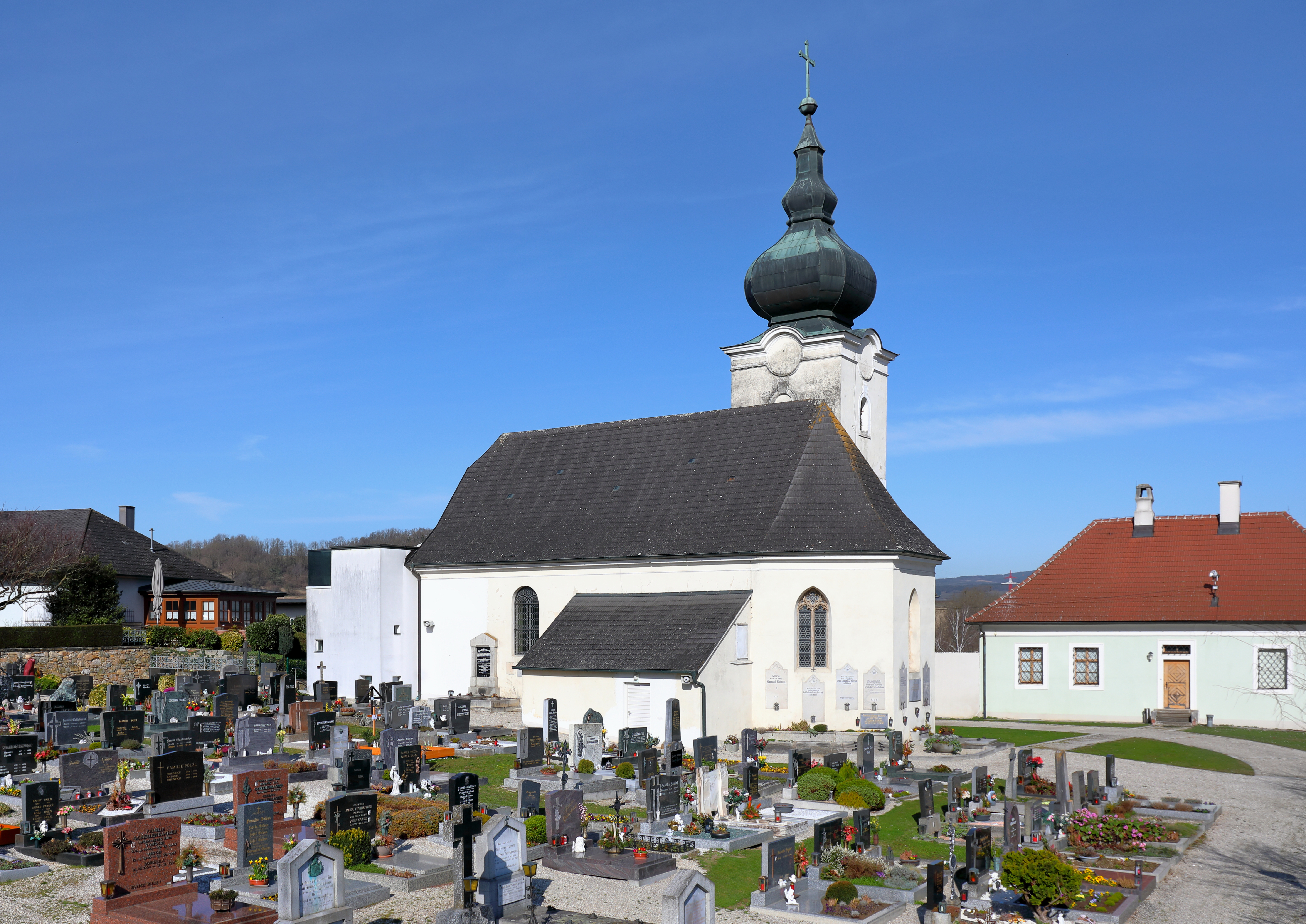
Southeast view of the parish church of Matzleinsdorf in Lower Austria.
Summary
edit
| Description |
Deutsch: Südostansicht der röm.-kath. Pfarrkirche hl. Bartholomäus in Matzleinsdorf, ein Dorf in der niederösterreichischen Gemeinde Zelking-Matzleinsdorf.
Ursprünglich eine gotische Kirche, die nach dem Verfall nach 1735/1736 im Auftrag des Melker Abtes Berthold Dietmayr wieder aufgebaut wurdeː [1]. Ab 1999 (Fertigstellung 2000) wurde nach den Plänen des Architekten Richard Zeitlhuber westseitig ein Zubau errichtet, der Eingangsbauwerk und Erweiterung des Kirchenschiffes in einem realisiertː [2]. English: Southeast view of the parish church of Matzleinsdorf in Lower Austria. |
| Date | |
| Source | Own work |
| Author | C.Stadler/Bwag |
| Permission (Reusing this file) |
Deutsch: Hallo, du darfst mein Foto kostenlos nutzen, aber nenne mich bitte als Fotograf, beispielsweise „Foto: C.Stadler/Bwag“ oder © C.Stadler/Bwag; CC-BY-SA-4.0. Auf mehr Angaben bestehe ich nicht - im Gegensatz zu manch anderen, die die Vorgaben der unten angeführten Lizenzierung auf Punkt und Beistrich einfordern. English: Feel free to use my photos, but please mention me as the author like © C.Stadler/Bwag or © C.Stadler/Bwag; CC-BY-SA-4.0 (that's good enough) and if you want send me a message: bwag@gmx.net. |
| Object location | | View this and other nearby images on: OpenStreetMap |
|---|
| Camera location | | View this and other nearby images on: OpenStreetMap |
|---|
Licensing
edit
I, the copyright holder of this work, hereby publish it under the following license:
This file is licensed under the Creative Commons Attribution-Share Alike 3.0 Unported license.
- You are free:
- to share – to copy, distribute and transmit the work
- to remix – to adapt the work
- Under the following conditions:
- attribution – You must give appropriate credit, provide a link to the license, and indicate if changes were made. You may do so in any reasonable manner, but not in any way that suggests the licensor endorses you or your use.
- share alike – If you remix, transform, or build upon the material, you must distribute your contributions under the same or compatible license as the original.
File history
Click on a date/time to view the file as it appeared at that time.
| Date/Time | Thumbnail | Dimensions | User | Comment | |
|---|---|---|---|---|---|
| current | 21:35, 6 March 2024 | | 6,000 × 4,246 (9.44 MB) | Bwag (talk | contribs) | == {{int:filedesc}} == {{Information |Description= {{de|1= Südostansicht der röm.-kath. Pfarrkirche hl. Bartholomäus in Matzleinsdorf, ein Dorf in der niederösterreichischen Gemeinde Zelking-Matzleinsdorf.<br/>Ursprünglich eine gotische Kirche, die nach dem Verfall nach 1735/1736 im Auftrag des Melker Abtes Berthold Dietmayr wieder aufgebaut wurdeː [https://diglib.tugraz.at/download.php?id=5319b2ac5fcdb&location=browse]. Ab 1999 (Fertigstellung 2000) wurde nach den Plänen des Architekten Ric... |
You cannot overwrite this file.
File usage on Commons
There are no pages that use this file.
File usage on other wikis
The following other wikis use this file:
- Usage on de.wikipedia.org
- Usage on eo.wikipedia.org