File:Mechelen St-Romboutskathedraal interieur.jpg
Original file (3,888 × 5,592 pixels, file size: 5.23 MB, MIME type: image/jpeg)
Captions
Captions
Summary edit
| Description |
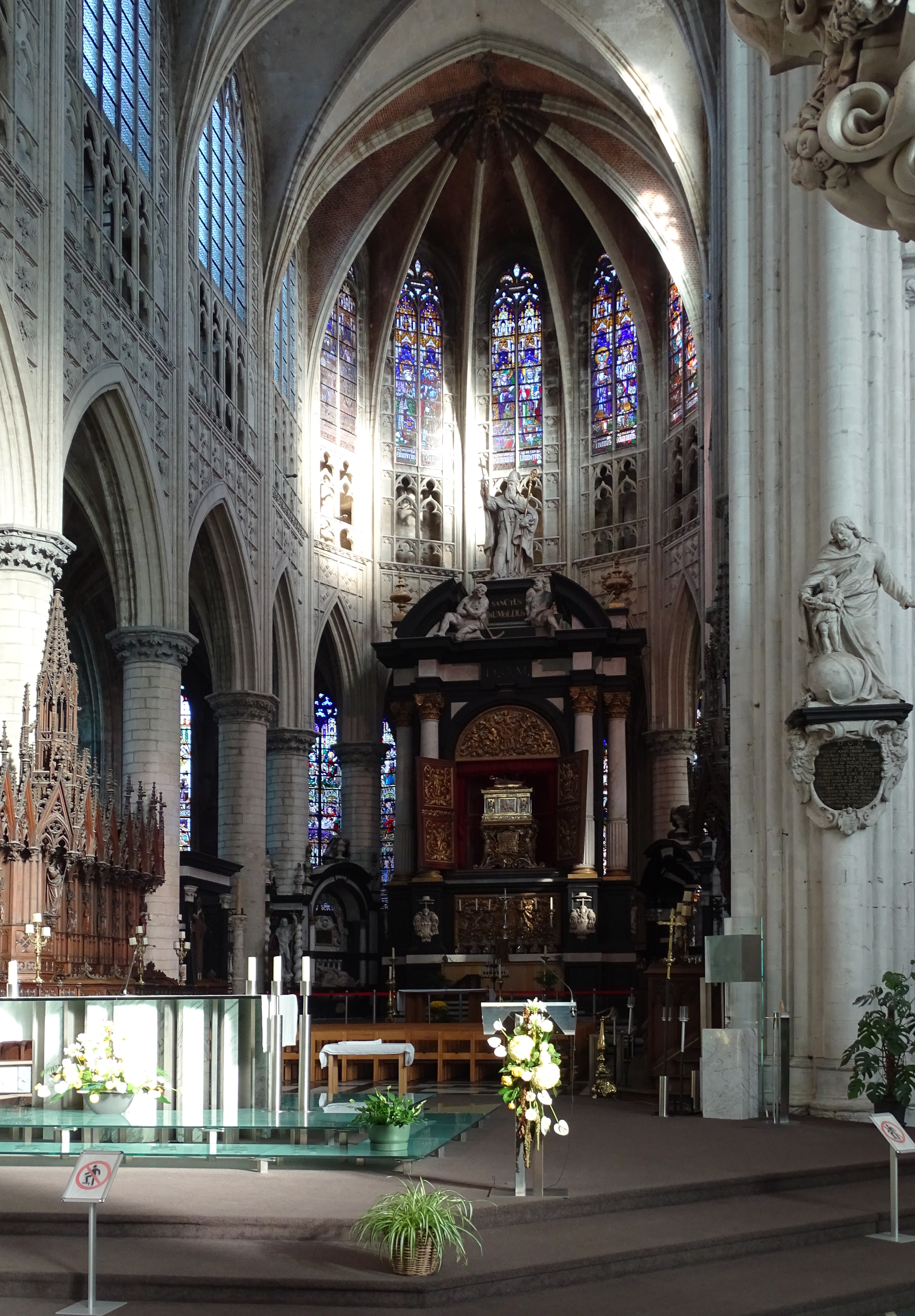
Nederlands: Het hoogkoor van de Sint-Romboutskathedraal te Mechelen. Het hoofdaltaar in het koor werd ontworpen door Willem van Hesius s.j., en uitgevoerd doorLucas Faydherbe, met de hulp van Mattheus van Beveren. Het wordt bekroond door een beeld van Sint-Rombout, met de twee moordenaars aan zijn voeten. Het vergulde, boogveld met de deuren werden door Artus Quellin de Jonge gebeiteld. Bovenaan staat een beeld van Sint-Rombout door Lucas Faydherbe. In het centrum bevindt zich het schrijn met het gebeente van Sint-Rombout zelf.
English: The choir of St-Rumbold's Cathedral in Mechelen (Belgium). The main altar was designed by Willem Hesius s.j. and made by Lucas Faydherbe, with the assistance of Mattheus van Beveren. The statue on top is Saint Rumbold, with his two murderers at his feet, made by Lucas Faydherbe. The gilded arcs and doors were carved by Artus Quellin de Jonge.
The statues along the sides in the aisle are apostles made by Lucas Faydherbe. |
| Date | |
| Source | Own work |
| Author |
Ad Meskens You are free to use this picture for any purpose as long as you credit its author, Ad Meskens. Example: © Ad Meskens / Wikimedia Commons
This file has been released under a license which is incompatible with Facebook's licensing terms. It is not permitted to upload this file to Facebook.
|

| Camera location | | View this and other nearby images on: OpenStreetMap |
|---|
Licensing edit
- You are free:
- to share – to copy, distribute and transmit the work
- to remix – to adapt the work
- Under the following conditions:
- attribution – You must give appropriate credit, provide a link to the license, and indicate if changes were made. You may do so in any reasonable manner, but not in any way that suggests the licensor endorses you or your use.
- share alike – If you remix, transform, or build upon the material, you must distribute your contributions under the same or compatible license as the original.
File history
Click on a date/time to view the file as it appeared at that time.
| Date/Time | Thumbnail | Dimensions | User | Comment | |
|---|---|---|---|---|---|
| current | 14:20, 21 June 2022 | | 3,888 × 5,592 (5.23 MB) | Ad Meskens (talk | contribs) | Uploaded own work with UploadWizard |
You cannot overwrite this file.
File usage on Commons
The following page uses this file: