File:Meiko Central Bridge 20171202C.png
Size of this preview: 800 × 381 pixels. Other resolutions: 320 × 153 pixels | 640 × 305 pixels | 1,024 × 488 pixels | 1,280 × 610 pixels | 2,560 × 1,220 pixels | 5,355 × 2,552 pixels.
Original file (5,355 × 2,552 pixels, file size: 22.19 MB, MIME type: image/png)
Captions
Captions
Add a one-line explanation of what this file represents
Summary
edit
| Description |
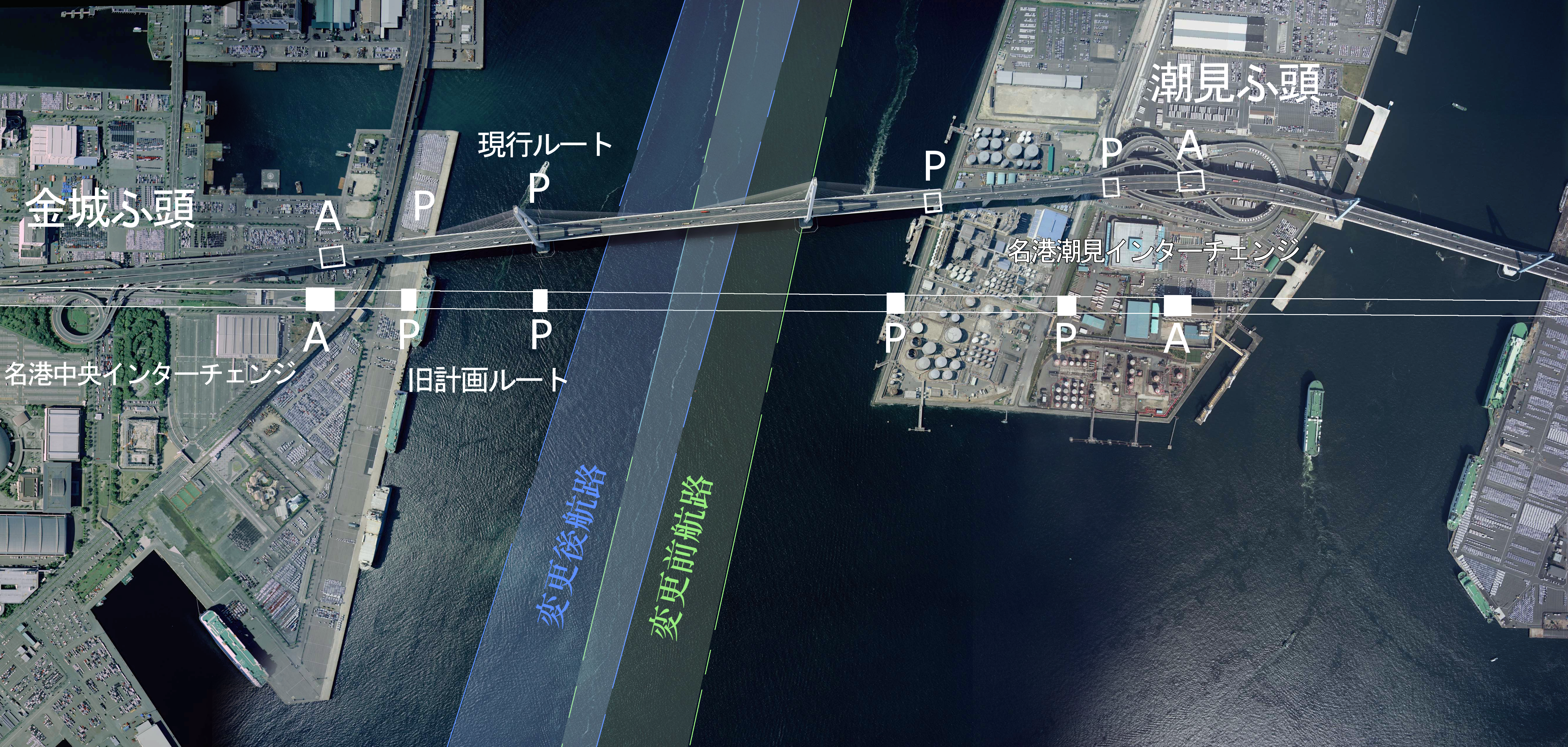
日本語: 名港中央大橋のルートおよび航路の変遷を示した画像。典拠:『三十年のあゆみ』建設省中部地方建設局名四国道工事事務所、1989年10月、385頁。『名古屋港史 建設編』名古屋港史編集委員会、1990年3月1日、246-249頁。『名古屋港図』名古屋港管理組合、1984年7月。『名古屋港要覧2016』名古屋港管理組合、『第26回 技術報告会資料 道路編』建設省中部地方建設局、1977年7月、83頁。 |
| Date | |
| Source | 国土画像情報(カラー空中写真)(CCB20072-C29-75とCCB20072-C10-39、CCB20072-C27-71との合成画像) |
| Author | 国土地理院 |
Licensing
edit

|
The copyright holder of this file, the Ministry of Land, Infrastructure, Transport and Tourism of Japan, allows anyone to use it for any purpose, provided that the copyright holder is properly attributed. Redistribution, derivative work, commercial use, and all other use is permitted. |
Attribution:
Copyright © National Land Image Information (Color Aerial Photographs), Ministry of Land, Infrastructure, Transport and Tourism
|
 |
This image is copyrighted by the Ministry of Land, Infrastructure, Transport and Tourism of Japan. For terms of use, see the stipulation to use of National Land Information (in Japanese) and message from MLIT (in Japanese and English). When you display this image on an article, include the following phrase in the description: "Made based on National Land Image Information (Color Aerial Photographs), Ministry of Land, Infrastructure, Transport and Tourism".
|
File history
Click on a date/time to view the file as it appeared at that time.
| Date/Time | Thumbnail | Dimensions | User | Comment | |
|---|---|---|---|---|---|
| current | 11:46, 2 December 2017 | | 5,355 × 2,552 (22.19 MB) | Oka21000 (talk | contribs) | {{Information |Description ={{ja|1=名港中央大橋のルートおよび航路の変遷を示した画像。典拠:『三十年のあゆみ』建設省中部地方建設局名四国道工事事務所、1989年10月、385頁。『名古屋港史... |
You cannot overwrite this file.
File usage on Commons
The following page uses this file:
File usage on other wikis
The following other wikis use this file:
- Usage on ja.wikipedia.org