File:Mejorada del Campo (Comunidad de Madrid 22-05-2024) desembocadura del río Henares en el río Jarama.png

Size of this preview: 800 × 441 pixels. Other resolutions: 320 × 176 pixels | 640 × 353 pixels | 1,249 × 688 pixels.
Original file (1,249 × 688 pixels, file size: 1.87 MB, MIME type: image/png)
Captions
Captions
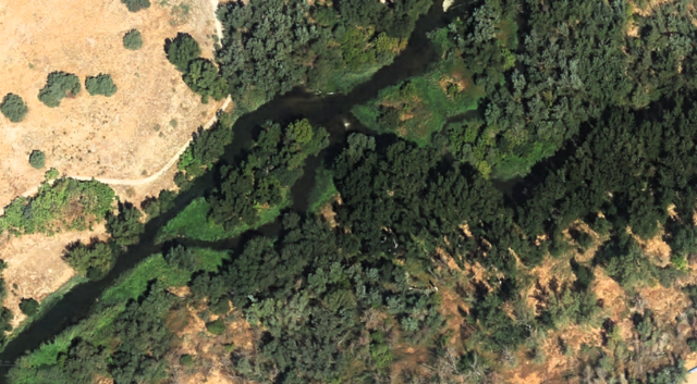
Mouth of the Henares River into the Jarama River
Summary
edit_desembocadura_del_r%C3%ADo_Henares_en_el_r%C3%ADo_Jarama.png&action=edit§ion=1)
| Description |
Español: Vista aérea de la desembocadura del río Henares en el río Jarama, dentro del término municipal de Mejorada del Campo (Comunidad de Madrid - España) a escala 1:1.066. |
| Date | |
| Source | Visor de la Infraestructura de Datos Espaciales de la Comunidad de Madrid. 22/05/2024. |
| Author | Consejería de Medio Ambiente, Ordenación del Territorio y Sostenibilidad de la Comunidad de Madrid (Q50376829) |
| Permission (Reusing this file) |
"Información geográfica de la Comunidad de Madrid. Acceso público y gratuito CC BY 4.0." |
| Camera location | | View this and other nearby images on: OpenStreetMap |
|---|
_desembocadura_del_r%C3%ADo_Henares_en_el_r%C3%ADo_Jarama.png¶ms=040.404391_N_-003.502244_E_globe:Earth_type:camera__&language=en)
Licensing
edit_desembocadura_del_r%C3%ADo_Henares_en_el_r%C3%ADo_Jarama.png&action=edit§ion=2)
This file is licensed under the Creative Commons Attribution 4.0 International license.
- You are free:
- to share – to copy, distribute and transmit the work
- to remix – to adapt the work
- Under the following conditions:
- attribution – You must give appropriate credit, provide a link to the license, and indicate if changes were made. You may do so in any reasonable manner, but not in any way that suggests the licensor endorses you or your use.
File history
Click on a date/time to view the file as it appeared at that time.
| Date/Time | Thumbnail | Dimensions | User | Comment | |
|---|---|---|---|---|---|
| current | 18:58, 22 May 2024 | | 1,249 × 688 (1.87 MB) | Raimundo Pastor (talk | contribs) | Uploaded a work by {{Q|Q50376829}} from https://idem.madrid.org/visor/?v=ambiental&&el=SIGI_MA_VIAS_PECUARIAS&ZONE=457486.49667356367,4472781.993536591,18 with UploadWizard |
You cannot overwrite this file.
File usage on Commons
The following page uses this file:
File usage on other wikis
The following other wikis use this file:
- Usage on ca.wikipedia.org
- Usage on ceb.wikipedia.org
- Usage on de.wikipedia.org
- Usage on en.wikipedia.org
- Usage on eo.wikipedia.org
- Usage on es.wikipedia.org
- Usage on fr.wikipedia.org
- Usage on gl.wikipedia.org
- Usage on hu.wikipedia.org
- Usage on it.wikipedia.org
- Usage on pt.wikipedia.org
- Usage on sv.wikipedia.org
_desembocadura_del_río_Henares_en_el_río_Jarama.png&oldid=891815244)