File:Moscow KH-9 1979.jpg

Size of this preview: 434 × 599 pixels. Other resolutions: 174 × 240 pixels | 348 × 480 pixels | 556 × 768 pixels | 742 × 1,024 pixels | 1,484 × 2,048 pixels | 2,574 × 3,552 pixels.
Original file (2,574 × 3,552 pixels, file size: 5.94 MB, MIME type: image/jpeg)
Captions
Captions
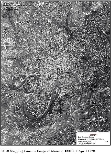
Moscow 1979 from US satellite KH-9
Summary edit
| Description |
English: Moscow 1979 from US satellite KH-9 |
|||||||||
| Date | ||||||||||
| Source | http://www.nro.gov/foia/declass/GAMHEX/GAMBIT%20and%20HEXAGON%20Images/300_dpi/12.jpg | |||||||||
| Creator |
US gov |
|||||||||
| Geotemporal data | ||||||||||
| Bounding box |
|
|||||||||
| Georeferencing | ||||||||||
Licensing edit
| This work originally came from a National Reconnaissance Office (NRO) website or publication and has been specifically released into the public domain in the United States. Unless specifically released, NRO information should be assumed to be classified. The NRO seal is usage-restricted. See the site policy security notice and the site policy copyright notice for more information. Please note that if a copyright is indicated on a photo, graphic, or any other material, permission to copy these materials must be obtained from the original source.[1] |

|
File history
Click on a date/time to view the file as it appeared at that time.
| Date/Time | Thumbnail | Dimensions | User | Comment | |
|---|---|---|---|---|---|
| current | 02:36, 28 January 2012 | | 2,574 × 3,552 (5.94 MB) | Secretlondon (talk | contribs) |
You cannot overwrite this file.
File usage on Commons
The following page uses this file: