File:Municipalities in MYK.svg

Size of this PNG preview of this SVG file: 660 × 560 pixels. Other resolutions: 283 × 240 pixels | 566 × 480 pixels | 905 × 768 pixels | 1,207 × 1,024 pixels | 2,414 × 2,048 pixels.
Original file (SVG file, nominally 660 × 560 pixels, file size: 329 KB)
Captions
Captions
Add a one-line explanation of what this file represents
Summary
edit
| Description |
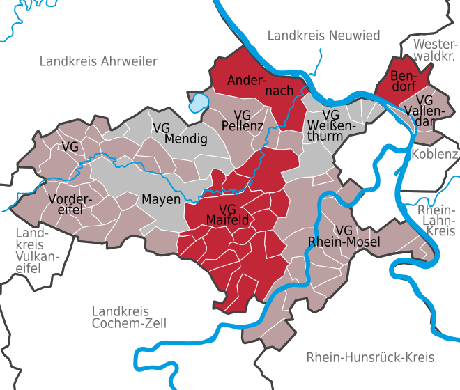
Deutsch: Verbandsgemeinden und verbandsfreie Städte im Landkreis Mayen-Koblenz |
| Date | |
| Source | Own work based on: Municipalities (Ortsgemeinden) in Rhineland-Palatinate.svg by TUBS |
| Author |
Hagar66 based on work of TUBS |
| SVG development |
_in_Rhineland-Palatinate.svg)
Licensing
edit
This file is licensed under the Creative Commons Attribution-Share Alike 3.0 Unported, 2.5 Generic, 2.0 Generic and 1.0 Generic license.
- You are free:
- to share – to copy, distribute and transmit the work
- to remix – to adapt the work
- Under the following conditions:
- attribution – You must give appropriate credit, provide a link to the license, and indicate if changes were made. You may do so in any reasonable manner, but not in any way that suggests the licensor endorses you or your use.
- share alike – If you remix, transform, or build upon the material, you must distribute your contributions under the same or compatible license as the original.

|
I'd greatly appreciate, that you attribute this media file to Wikimedia Commons, if used outside Wikipedia or Commons. For use in publications such as books, newspapers, blogs, websites, please insert here the following line:
|
File history
Click on a date/time to view the file as it appeared at that time.
| Date/Time | Thumbnail | Dimensions | User | Comment | |
|---|---|---|---|---|---|
| current | 21:09, 11 April 2015 | | 660 × 560 (329 KB) | NordNordWest (talk | contribs) | corr |
| 17:54, 1 July 2014 |  | 660 × 560 (644 KB) | NordNordWest (talk | contribs) | corr | |
| 17:53, 1 July 2014 |  | 14,400 × 14,400 (658 KB) | NordNordWest (talk | contribs) | upd | |
| 08:00, 29 September 2010 |  | 660 × 560 (660 KB) | Hagar66 (talk | contribs) | == {{int:filedesc}} == {{Information |Description= {{DeLocMaps |mun= |munlink= |lk=Landkreis Mayen-Koblenz |enlk=District of Mayen-Koblenz |enlklink=Mayen-Koblenz |frlk=L'arrondissement de Mayen-Coblence |frlklink=Arrondissement de Mayen-Coblence |land=Rh | |
| 07:56, 29 September 2010 |  | 660 × 560 (660 KB) | Hagar66 (talk | contribs) | == {{int:filedesc}} == {{Information |Description= {{DeLocMaps |mun= |munlink= |lk=Landkreis Mayen-Koblenz |enlk=District of Mayen-Koblenz |enlklink=Mayen-Koblenz |frlk=L'arrondissement de Mayen-Coblence |frlklink=Arrondissement de Mayen-Coblence |land=Rh |
You cannot overwrite this file.
File usage on Commons
There are no pages that use this file.
File usage on other wikis
The following other wikis use this file:
- Usage on de.wikipedia.org
- Usage on es.wikipedia.org
- Usage on ja.wikipedia.org
- Usage on sv.wikipedia.org
- Usage on uk.wikipedia.org