File:N62 (Philippines).svg

Size of this PNG preview of this SVG file: 294 × 330 pixels. Other resolutions: 214 × 240 pixels | 428 × 480 pixels | 684 × 768 pixels | 912 × 1,024 pixels | 1,825 × 2,048 pixels.
Original file (SVG file, nominally 294 × 330 pixels, file size: 5 KB)
Captions
Captions
Add a one-line explanation of what this file represents
Summary
edit.svg&action=edit§ion=1)
| Description |
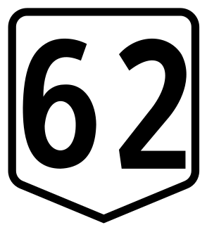
English: Route marker for National Route 62 (N62) the route designation for Quirino Avenue, Diego Cera Avenue, Aguinaldo Highway (Las Piñas to Bacoor segment), Tirona Highway and Manila–Cavite Road. |
||
| Date | |||
| Source | Sign dimensions from Highway Safety Design Standards: Part 2 : Road Signs and Pavement Markings, page A78 | ||
| Author | Department of Public Works and Highways, Hushskyliner and HueMan1 | ||
| Permission (Reusing this file) |
This diagram was created with Inkscape . |
Licensing
edit.svg&action=edit§ion=2)
| This work is in the public domain in the Philippines and possibly other jurisdictions because it is a work created by an officer or employee of the Government of the Philippines or any of its subdivisions and instrumentalities, including government-owned and/or controlled corporations, as part of their regularly prescribed official duties; consequently, any work is ineligible for copyright under the terms of Part IV, Chapter I, Section 171.11 and Part IV, Chapter IV, Section 176 of Republic Act No. 8293 and Republic Act No. 10372, as amended, unless otherwise noted. However, in some instances, the use of this work in the Philippines or elsewhere may be regulated by this law or other laws.
|

|
File history
Click on a date/time to view the file as it appeared at that time.
| Date/Time | Thumbnail | Dimensions | User | Comment | |
|---|---|---|---|---|---|
| current | 07:16, 11 August 2018 | | 294 × 330 (5 KB) | HueMan1 (talk | contribs) | Minor tweaks |
| 09:49, 4 April 2017 |  | 276 × 309 (9 KB) | Hushskyliner (talk | contribs) | User created page with UploadWizard |
You cannot overwrite this file.
File usage on Commons
The following 3 pages use this file:
_sign.svg&redirect=no)
File usage on other wikis
The following other wikis use this file:
- Usage on en.wikipedia.org
- List of roads in Metro Manila
- List of highways numbered 62
- Manila–Cavite Expressway
- Circumferential Road 5
- Radial Road 2
- Aguinaldo Highway
- Antero Soriano Highway
- Alabang–Zapote Road
- NAIA Road
- Ninoy Aquino Avenue
- Elpidio Quirino Avenue
- Diego Cera Avenue
- Philippine highway network
- User:TagaSanPedroAko/Philippines highways and expressways/Philippines highway RJL compliance
- User:TagaSanPedroAko/sandbox/List of secondary and tertiary national roads in Metro Manila
- E3 expressway (Philippines)
- N64 highway
- N622 highway
- N62 highway
- Tirona Highway
- N401 highway
- Usage on en.wikivoyage.org
- Usage on ko.wikipedia.org
- Usage on tl.wikipedia.org
- Padron:Infobox road
- Abenida Elpidio Quirino
- Abenida Diego Cera
- Daang Palibot Blg. 5
- Daang Alabang–Zapote
- Manila–Cavite Expressway
- Lansangang-bayang Aguinaldo
- Daang NAIA
- Abenida Harrison
- Sistema ng lansangang bayan sa Pilipinas
- Padron:Infobox road/doc
- Padron:Infobox road/sandbox
- Lansangang-bayang Tirona
- Lansangang-bayang N62
- Daang Panlihis ng Noveleta–Rosario
- Kalye Marseilla
- Padron:Infobox road/testcases
- Cavite–Laguna Expressway
.svg&oldid=702859610)