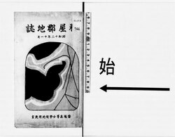
File:NDL1112808 糟屋郡地誌.pdf

Original file (5,512 × 4,308 pixels, file size: 44.16 MB, MIME type: application/pdf, 94 pages)
Captions
Captions
Summary
edit| 糟屋郡地誌
( |
|||||||||||||||||||||||||||
|---|---|---|---|---|---|---|---|---|---|---|---|---|---|---|---|---|---|---|---|---|---|---|---|---|---|---|---|
| Author |
香椎高等女学校 (福岡県) |
||||||||||||||||||||||||||
| Title |
糟屋郡地誌 |
||||||||||||||||||||||||||
| Publisher |
香椎高等女学校 |
||||||||||||||||||||||||||
| Description |
謄写版 |
||||||||||||||||||||||||||
| Language | jpn | ||||||||||||||||||||||||||
| Publication date |
1937 昭和12 |
||||||||||||||||||||||||||
| Place of publication | JP | ||||||||||||||||||||||||||
| Source |
institution QS:P195,Q477675 |
||||||||||||||||||||||||||
| Creator InfoField | 香椎高等女学校地理教室 編 | ||||||||||||||||||||||||||
| Publication Place InfoField | [香椎町 (福岡県) ] | ||||||||||||||||||||||||||
| Subject: NDC InfoField | 291.91 | ||||||||||||||||||||||||||
| Extent InfoField | 173p ; 22cm | ||||||||||||||||||||||||||
| Material Type InfoField | Book | ||||||||||||||||||||||||||
| Source Identifier: JPNO InfoField | 44064664 | ||||||||||||||||||||||||||
| Date Digitized: W3CDTF InfoField | 2010-03-31 | ||||||||||||||||||||||||||
| Audience InfoField | 一般 | ||||||||||||||||||||||||||
| Title Transcription InfoField | カスヤグン チシ | ||||||||||||||||||||||||||
| Publisher Transcription InfoField | カシイ コウトウ ジョガッコウ | ||||||||||||||||||||||||||
| Source Identifier: NDLBibID InfoField | 000000658744 | ||||||||||||||||||||||||||
| Call Number InfoField | 特274-746 | ||||||||||||||||||||||||||
| Creator: NDLNAId InfoField | 00374185 | ||||||||||||||||||||||||||
| Contents InfoField | 標題
名島の風物(帆柱石、名島城址、更生した名島、妙見島、東邦名島發電所)/141 箱崎浦の漁業/172 |
||||||||||||||||||||||||||
Licensing
editThis image is in the public domain because it is a mere mechanical scan or photocopy of a public domain original, or – from the available evidence – is so similar to such a scan or photocopy that no copyright protection can be expected to arise. The original itself is in the public domain for the following reason:
This tag is designed for use where there may be a need to assert that any enhancements (eg brightness, contrast, colour-matching, sharpening) are in themselves insufficiently creative to generate a new copyright. It can be used where it is unknown whether any enhancements have been made, as well as when the enhancements are clear but insufficient. For known raw unenhanced scans you can use an appropriate {{PD-old}} tag instead. For usage, see Commons:When to use the PD-scan tag. |
File history
Click on a date/time to view the file as it appeared at that time.
| Date/Time | Thumbnail | Dimensions | User | Comment | |
|---|---|---|---|---|---|
| current | 14:56, 17 November 2023 |  | 5,512 × 4,308, 94 pages (44.16 MB) | Wmr-bot (talk | contribs) | 上載《1112808.pdf》 |
You cannot overwrite this file.
File usage on Commons
The following page uses this file:
Metadata
This file contains additional information such as Exif metadata which may have been added by the digital camera, scanner, or software program used to create or digitize it. If the file has been modified from its original state, some details such as the timestamp may not fully reflect those of the original file. The timestamp is only as accurate as the clock in the camera, and it may be completely wrong.
| Short title | |
|---|---|
| Author | |
| Keywords | https://commons.wikimedia.org/wiki/Commons:Library_back_up_project |
| Conversion program | PyPDF2 |
| Encrypted | yes (print:yes copy:no change:no addNotes:no algorithm:AES-256) |
| Page size | 2646.75 x 2068.5 pts |
| Version of PDF format | 1.7 |


