File:NE corner of the Magazine.jpg
Size of this preview: 442 × 599 pixels. Other resolutions: 177 × 240 pixels | 354 × 480 pixels | 566 × 768 pixels | 755 × 1,024 pixels | 1,510 × 2,048 pixels | 3,391 × 4,598 pixels.
Original file (3,391 × 4,598 pixels, file size: 17.7 MB, MIME type: image/jpeg)
Captions
Captions
Add a one-line explanation of what this file represents
Summary
edit
| Description |
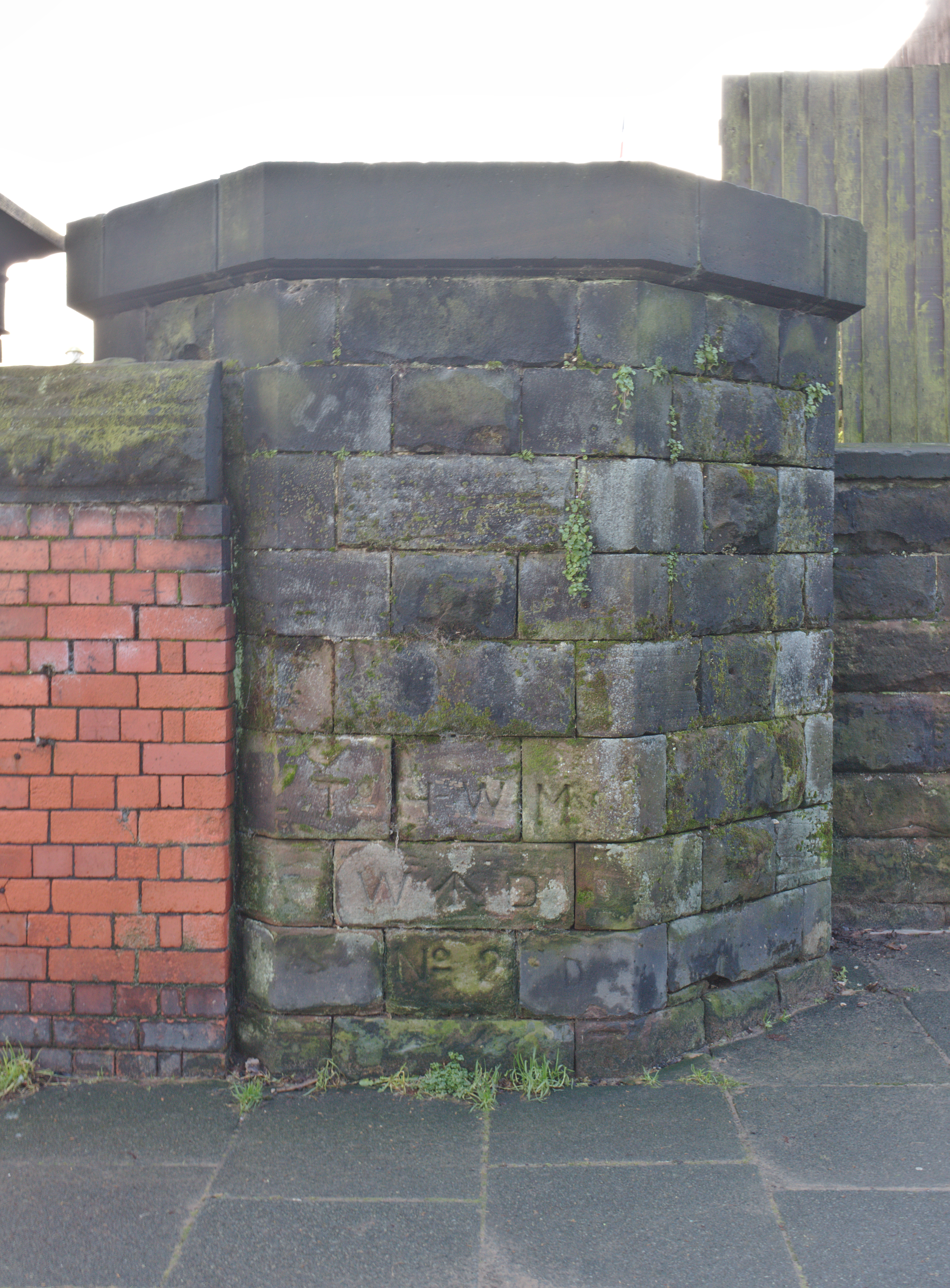
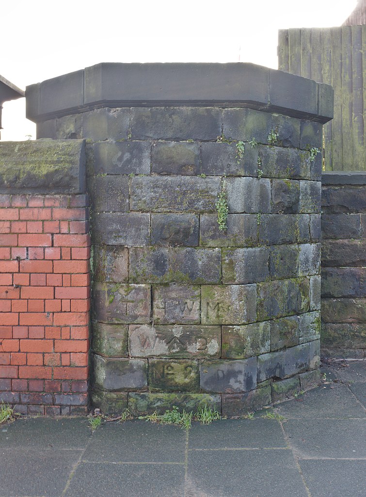
English: This structor marks the northeast corner fo the former Magazines Fort, and is inscribed with several War Department and tidal marks. It also carried an Ordnance Survey cut benchmark. |
| Date | Taken on 29 December 2020 14:01:10 |
| Source | Own work |
| Author | Rodhullandemu |
| Object location | | View this and other nearby images on: OpenStreetMap |
|---|
Licensing
edit

|
The copyright holder of this file, User:Rodhullandemu, allows anyone to use it for any purpose, provided that the copyright holder is properly attributed. Redistribution, derivative work, commercial use, and all other use is permitted. |
Attribution:
By Phil Nash from Wikimedia Commons CC BY-SA 4.0 & GFDL Views
|
File history
Click on a date/time to view the file as it appeared at that time.
| Date/Time | Thumbnail | Dimensions | User | Comment | |
|---|---|---|---|---|---|
| current | 13:21, 22 January 2021 | | 3,391 × 4,598 (17.7 MB) | Rodhullandemu (talk | contribs) | Uploaded own work with UploadWizard |
You cannot overwrite this file.
File usage on Commons
There are no pages that use this file.