File:Nagqu map.svg

Size of this PNG preview of this SVG file: 800 × 557 pixels. Other resolutions: 320 × 223 pixels | 640 × 446 pixels | 1,024 × 713 pixels | 1,280 × 892 pixels | 2,560 × 1,784 pixels | 1,520 × 1,059 pixels.
Original file (SVG file, nominally 1,520 × 1,059 pixels, file size: 223 KB)
Captions
Captions
Add a one-line explanation of what this file represents
Summary edit
| Description |
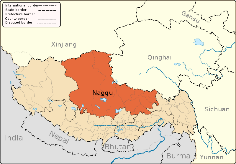
English: A map of the administrative boundaries of The Tibet Autonomous Region with Nagqu Prefecture highlighted. |
| Date | |
| Source | Own work |
| Author | Keithonearth |
| Other versions |
|
| SVG development |


Licensing edit
I, the copyright holder of this work, hereby publish it under the following licenses:
This file is licensed under the Creative Commons Attribution-Share Alike 3.0 Unported license.
- You are free:
- to share – to copy, distribute and transmit the work
- to remix – to adapt the work
- Under the following conditions:
- attribution – You must give appropriate credit, provide a link to the license, and indicate if changes were made. You may do so in any reasonable manner, but not in any way that suggests the licensor endorses you or your use.
- share alike – If you remix, transform, or build upon the material, you must distribute your contributions under the same or compatible license as the original.

|
Permission is granted to copy, distribute and/or modify this document under the terms of the GNU Free Documentation License, Version 1.2 or any later version published by the Free Software Foundation; with no Invariant Sections, no Front-Cover Texts, and no Back-Cover Texts. A copy of the license is included in the section entitled GNU Free Documentation License. |
You may select the license of your choice.
File history
Click on a date/time to view the file as it appeared at that time.
| Date/Time | Thumbnail | Dimensions | User | Comment | |
|---|---|---|---|---|---|
| current | 06:09, 3 March 2021 | | 1,520 × 1,059 (223 KB) | GnolizX (talk | contribs) | File uploaded using svgtranslate tool (https://svgtranslate.toolforge.org/). Added translation for zh. |
| 20:36, 7 May 2013 |  | 1,520 × 1,059 (219 KB) | Keithonearth (talk | contribs) | fixing Ngari/Shigatse prefecture boundary as pointed out by user:Fhah4, as per comment here: http://en.wikipedia.org/w/index.php?title=Wikipedia:Graphics_Lab/Map_workshop&diff=541288793&oldid=541266575 | |
| 05:03, 31 December 2008 |  | 1,520 × 1,059 (220 KB) | Keithonearth (talk | contribs) | Changing colour scheme to make more sense, progression from non-highlighted to most highlighted. Category:Tibet | |
| 02:15, 30 December 2008 |  | 1,520 × 1,059 (219 KB) | Keithonearth (talk | contribs) | {{Information |Description={{en|1=A map of the administrative boundaries of The Tibetan Autonomous Region with Nagqu Prefecture highlighted.}} |Source=Own work by uploader |Author=Keithonearth |Date=2008-12-29 |Permission=see below | |
You cannot overwrite this file.
File usage on Commons
The following 9 pages use this file:
File usage on other wikis
The following other wikis use this file:
- Usage on bn.wikipedia.org
- Usage on cdo.wikipedia.org
- Usage on cs.wikipedia.org
- Usage on da.wikipedia.org
- Usage on en.wikipedia.org
- Nagqu
- Nagqu Town
- Arza
- Seni, Nagqu
- Lhari County
- Biru County
- Nyainrong County
- Amdo County
- Xainza County
- Sog County
- Baingoin County
- Baqên County
- Nyima County
- Shuanghu County
- Baqên Town
- Template:Nagqu
- Bilung
- Biru Town
- Chacang
- Siling Lake
- Domar (Shuanghu)
- Ganda, Tibet
- Gangnyi
- Sewu, Tibet
- Sog, Tibet
- Jiangda, Nagqu
- Jiaqiong Town
- Lhari Town
- Lingti
- Xarma
- Zala, Tibet
- Zharen
- Nyainrong
- Xainza
- Cona Lake
- Codoi Township, Lhari County
- Dongqiao, Tibet
- Cuoma Township
- Pana, Tibet
- Qiangma
- Yanshiping
- Zigetangcuo Lake
- Nyima Township, Baingoin
- Usage on es.wikipedia.org
- Usage on fa.wikipedia.org
- Usage on fi.wikipedia.org
View more global usage of this file.