File:National highway network map.png
Original file (1,000 × 1,138 pixels, file size: 146 KB, MIME type: image/png)
Captions
Captions
Summary edit
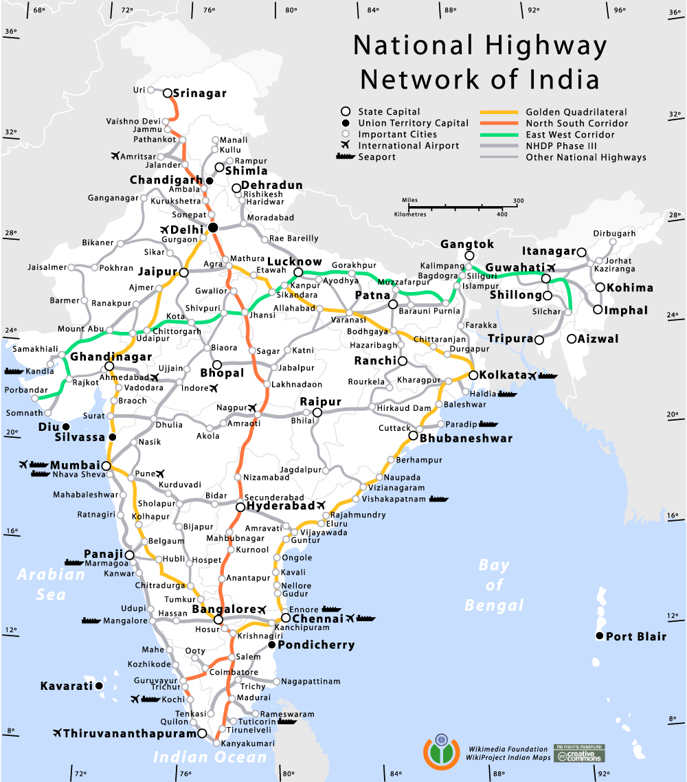
| Description | National Highway Network map of India |
| Date | 10 January 2006 (original upload date) |
| Source | No machine-readable source provided. Own work assumed (based on copyright claims). |
| Author | No machine-readable author provided. Planemad assumed (based on copyright claims). |
Author edit
Comments and Suggestions edit
Please leave your suggestions or errors noted in the map here.
Errors edit
1. City between Delhi and Lucknow is Bareilly and not Rae Bareilly.
2. City's name is Agartala and not Tripura, which is the name of that state.
3. Gandhinagar (in the west) has been mis-spelled.
4. Kalimpong (eastern city near Gangtok) has been mis-spelled.
5. Islampur, Bagdogra, Siliguri and Kalimpong are four cities but share only three dots.
6. Solapur has been mis-spelled.
7. Kavaratti has been mis-spelled.
8. Aizawl has been mis-spelled.
Licensing edit
- You are free:
- to share – to copy, distribute and transmit the work
- to remix – to adapt the work
- Under the following conditions:
- attribution – You must give appropriate credit, provide a link to the license, and indicate if changes were made. You may do so in any reasonable manner, but not in any way that suggests the licensor endorses you or your use.
- share alike – If you remix, transform, or build upon the material, you must distribute your contributions under the same or compatible license as the original.
File history
Click on a date/time to view the file as it appeared at that time.
| Date/Time | Thumbnail | Dimensions | User | Comment | |
|---|---|---|---|---|---|
| current | 09:59, 13 January 2006 | | 1,000 × 1,138 (146 KB) | Planemad (talk | contribs) | made corrections |
| 15:51, 10 January 2006 |  | 1,000 × 1,138 (142 KB) | Planemad (talk | contribs) | added cc and wikimedia india logo | |
| 11:06, 10 January 2006 |  | 1,000 × 1,140 (134 KB) | Planemad (talk | contribs) | National Highway Network map of India ==Author== w:user:planemad ==Revision== Original category:Maps of India |
You cannot overwrite this file.
File usage on Commons
There are no pages that use this file.
File usage on other wikis
The following other wikis use this file:
- Usage on fr.wikipedia.org
- Usage on hi.wikipedia.org
- Usage on ml.wikipedia.org