File:NewBasinCanalAirView1948.jpg
No higher resolution available.
NewBasinCanalAirView1948.jpg (512 × 428 pixels, file size: 36 KB, MIME type: image/jpeg)
Captions
Captions
Add a one-line explanation of what this file represents
| Description |
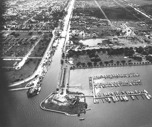
New Orleans: Air view of the New Basin Canal where it meets Lake Pontchartrain, 1947 or 1948. Looking roughly South. The Southern Yacht Club is on the peninsula to the right of the Canal; the New Basin Canal Lighthouse on the smaller peninsula to the left. West End Park is seen inland from the Yacht Club and harbor. |
||||||
| Date | or 1948, more likely the latter according to source site. | ||||||
| Source | US Army Corps of Engineers photograph via [1] | ||||||
| Author | Uncredited US Army Corps of Engineers photographer | ||||||
| Permission (Reusing this file) |
|
||||||

File history
Click on a date/time to view the file as it appeared at that time.
| Date/Time | Thumbnail | Dimensions | User | Comment | |
|---|---|---|---|---|---|
| current | 21:14, 22 December 2007 | | 512 × 428 (36 KB) | Infrogmation (talk | contribs) | {{Information |Description= New Orleans: Air view of the New Basin Canal where it meets Lake Pontchartrain, 1947 or 1948. Looking roughly South. <p> The Southern Yacht Club is on the peninsula to the right of the Canal; the New Basin Canal Lighthouse |
You cannot overwrite this file.
File usage on Commons
There are no pages that use this file.
File usage on other wikis
The following other wikis use this file:
- Usage on en.wikipedia.org