File:New Orleans 1913 Drainage System Map.jpg
Size of this preview: 657 × 600 pixels. Other resolutions: 263 × 240 pixels | 526 × 480 pixels | 665 × 607 pixels.
Original file (665 × 607 pixels, file size: 84 KB, MIME type: image/jpeg)
Captions
Captions
Add a one-line explanation of what this file represents
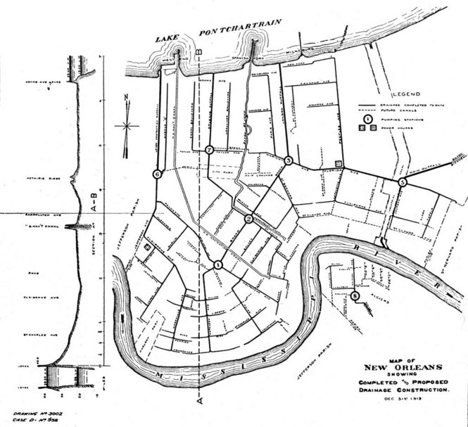
| Description | New Orleans, 1913 map, showing system of drainage culverts, canals, and pumping stations. | ||||||
| Date | |||||||
| Source | Times-Picayune archives [1] | ||||||
| Author | not credited | ||||||
| Permission (Reusing this file) |
|


File history
Click on a date/time to view the file as it appeared at that time.
| Date/Time | Thumbnail | Dimensions | User | Comment | |
|---|---|---|---|---|---|
| current | 12:22, 18 October 2011 | | 665 × 607 (84 KB) | Infrogmation (talk | contribs) | {{Information |Description= New Orleans, 1913 map, showing system of drainage culverts, canals, and pumping stations. |Source= Times-Picayune archives [http://photos.nola.com/tpphotos/2011/10/175pump_9.html] |Date= 1913 |Author= not credited |Permission= |
You cannot overwrite this file.
File usage on Commons
There are no pages that use this file.