File:Nicolas G. Hayek Center 1.jpg
Size of this preview: 400 × 600 pixels. Other resolutions: 160 × 240 pixels | 500 × 750 pixels.
Original file (500 × 750 pixels, file size: 78 KB, MIME type: image/jpeg)
Captions
Captions
Add a one-line explanation of what this file represents
Summary
edit
| Description |
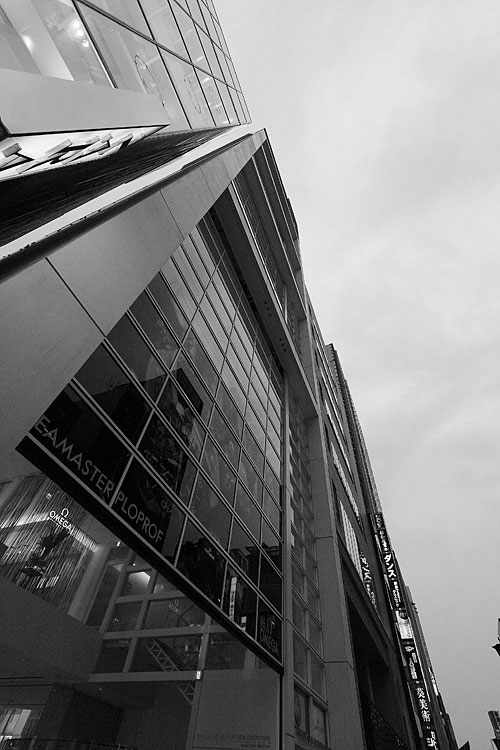
English: Nicolas G. Hayek Center
Designer:Shigeru Ban Place:JP-Tokyo 104-8188, Chuo-ku,Tokyo-to,Japan See: description by swatchgroup 日本語: ■ニコラス・G・ハイエックセンター
設計:坂茂 建設地:東京都中央区銀座7-9-18 竣工:2007年Camera:CANON EOS Kiss Digital X |
||||
| Date | |||||
| Source | originally posted to Flickr as Nicolas G. Hayek Center | ||||
| Author | ..colb.. | ||||
| Permission (Reusing this file) |
This file is licensed under the Creative Commons Attribution 2.0 Generic license.
|
| Object location | | View this and other nearby images on: OpenStreetMap |
|---|
| Camera location | | View this and other nearby images on: OpenStreetMap |
|---|
File history
Click on a date/time to view the file as it appeared at that time.
| Date/Time | Thumbnail | Dimensions | User | Comment | |
|---|---|---|---|---|---|
| current | 23:17, 28 June 2010 | | 500 × 750 (78 KB) | Flickr upload bot (talk | contribs) | Uploaded from http://flickr.com/photo/33826730@N00/4114355625 using Flickr upload bot |
You cannot overwrite this file.
File usage on Commons
There are no pages that use this file.
File usage on other wikis
The following other wikis use this file:
- Usage on de.wikipedia.org
- Usage on ja.wikipedia.org