File:OAB Sulz Karte.png
Size of this preview: 539 × 599 pixels. Other resolutions: 216 × 240 pixels | 432 × 480 pixels | 691 × 768 pixels | 921 × 1,024 pixels | 1,842 × 2,048 pixels | 4,176 × 4,644 pixels.
Original file (4,176 × 4,644 pixels, file size: 7.79 MB, MIME type: image/png)
Captions
Captions
Add a one-line explanation of what this file represents
Summary
edit
| Description |
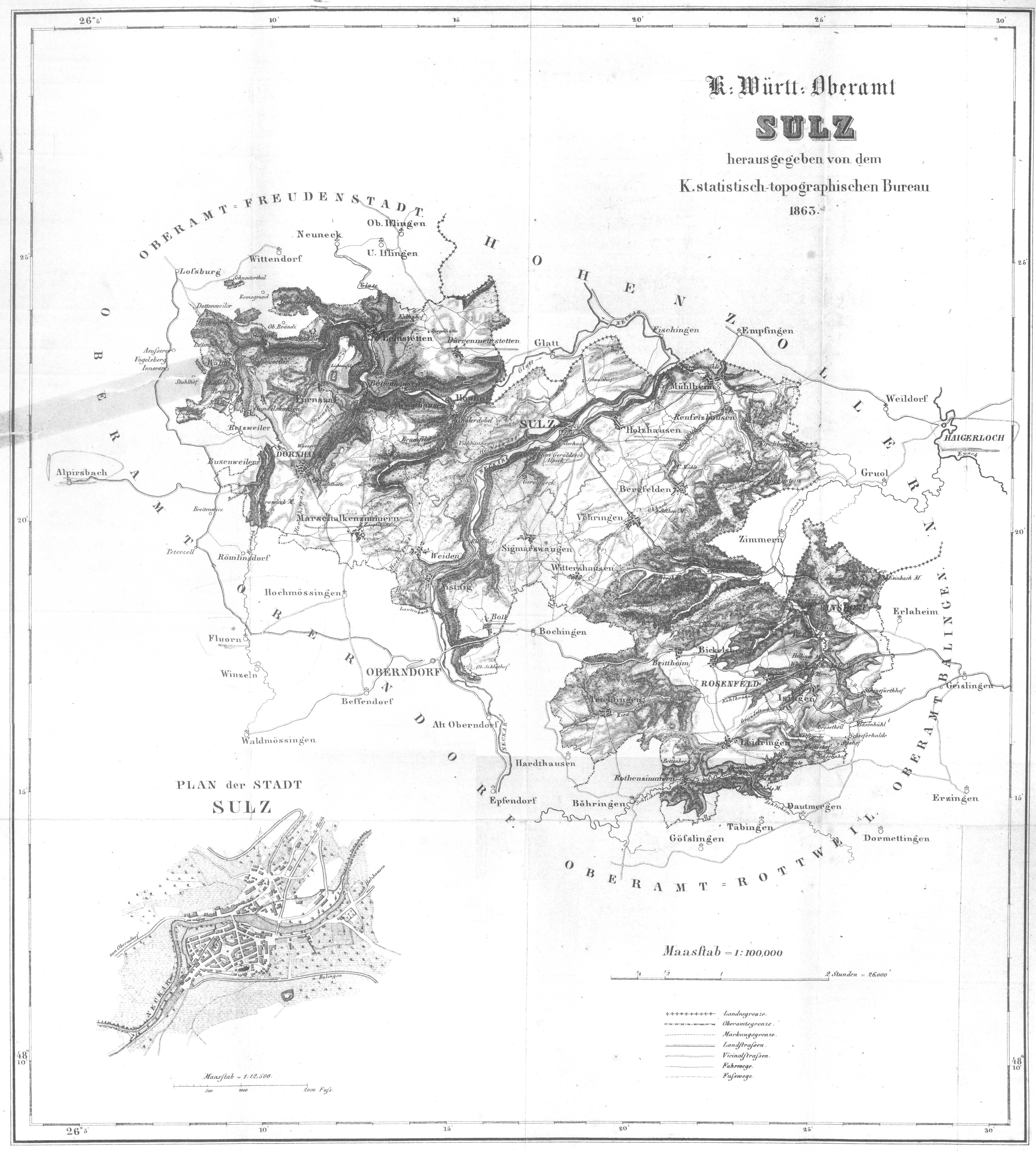
Beschreibung des Oberamts Sulz, ed. Statistisch-topographisches Bureau des Königreichs Württemberg. Verlag Karl Aue, Stuttgart, 1863. |
| Date | |
| Source | book, scanned by uploader |
| Author | Königlich statistisch-topographisches Bureau |
Licensing
edit
|
This work is in the public domain in its country of origin and other countries and areas where the copyright term is the author's life plus 70 years or fewer. | |
| This file has been identified as being free of known restrictions under copyright law, including all related and neighboring rights. | |
File history
Click on a date/time to view the file as it appeared at that time.
| Date/Time | Thumbnail | Dimensions | User | Comment | |
|---|---|---|---|---|---|
| current | 16:04, 6 May 2011 | | 4,176 × 4,644 (7.79 MB) | Ostermaus (talk | contribs) | {{Information |Description = '''Beschreibung des Oberamts Sulz''', ed. Statistisch-topographisches Bureau des Königreichs Württemberg. Verlag Karl Aue, Stuttgart, 1863.<br /> Supplement: Map of the district (O |
You cannot overwrite this file.
File usage on Commons
There are no pages that use this file.