File:OSTEM US Regions.png

Size of this preview: 800 × 582 pixels. Other resolutions: 320 × 233 pixels | 640 × 465 pixels | 1,024 × 744 pixels | 1,280 × 931 pixels | 2,560 × 1,861 pixels | 5,175 × 3,762 pixels.
Original file (5,175 × 3,762 pixels, file size: 576 KB, MIME type: image/png)
Captions
Captions
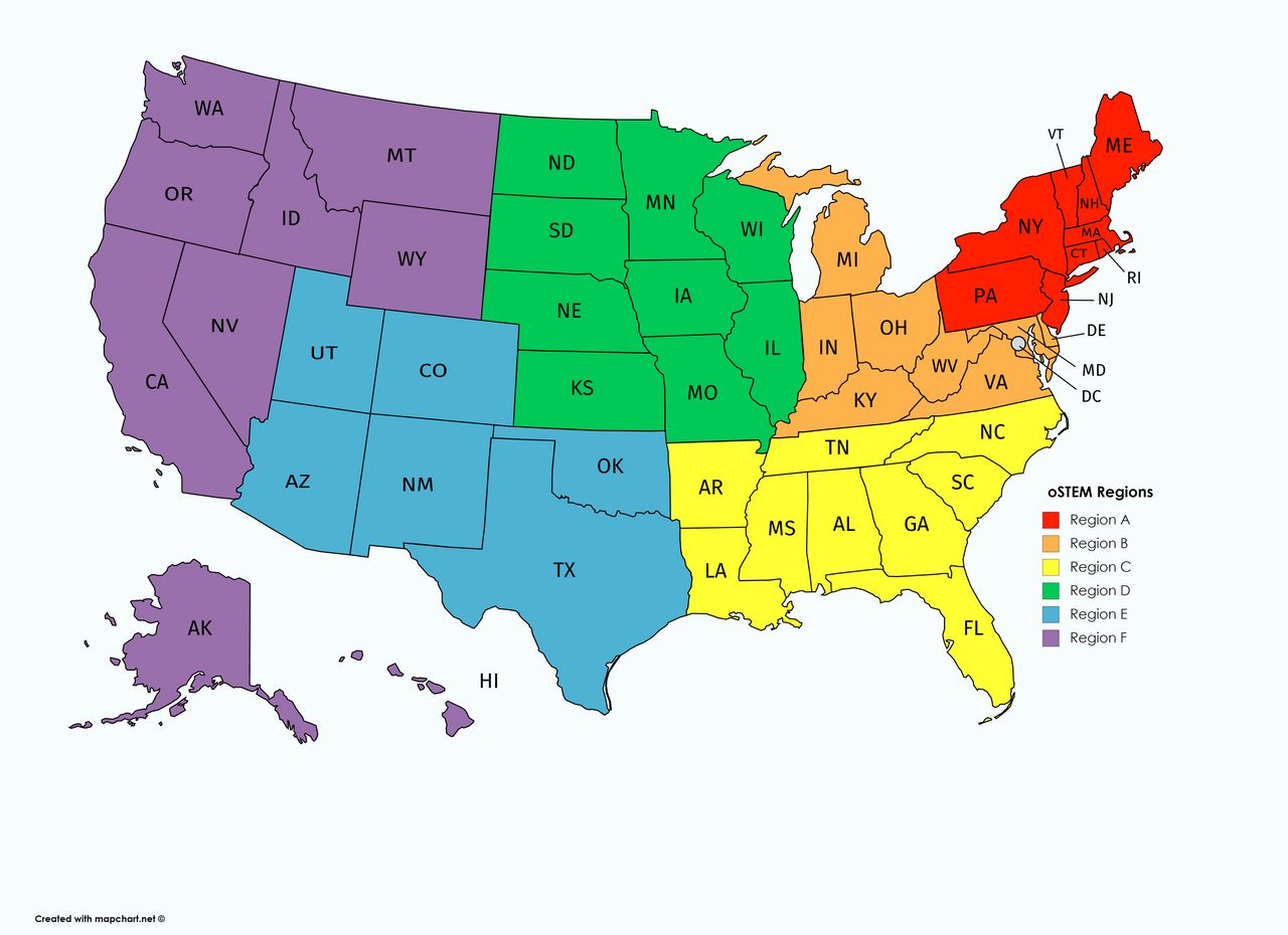
Map of the oSTEM (Out in Science, Technology, Engineering, and Mathematics) Regions in the United States.
Summary
edit
| Description |
English: Map of the oSTEM (Out in Science, Technology, Engineering, and Mathematics) Regions in the United States. |
| Date | |
| Source | https://mapchart.net/ |
| Author | Aaron Kratzer |
Licensing
edit
This file is licensed under the Creative Commons Attribution-Share Alike 4.0 International license.
- You are free:
- to share – to copy, distribute and transmit the work
- to remix – to adapt the work
- Under the following conditions:
- attribution – You must give appropriate credit, provide a link to the license, and indicate if changes were made. You may do so in any reasonable manner, but not in any way that suggests the licensor endorses you or your use.
- share alike – If you remix, transform, or build upon the material, you must distribute your contributions under the same or compatible license as the original.
File history
Click on a date/time to view the file as it appeared at that time.
| Date/Time | Thumbnail | Dimensions | User | Comment | |
|---|---|---|---|---|---|
| current | 01:34, 12 July 2023 | | 5,175 × 3,762 (576 KB) | Obscure2020 (talk | contribs) | Optimized with OxiPNG and ZopfliPNG. |
| 01:58, 9 June 2019 |  | 5,175 × 3,762 (1.22 MB) | Wikikratzer (talk | contribs) | User created page with UploadWizard |
You cannot overwrite this file.
File usage on Commons
There are no pages that use this file.
File usage on other wikis
The following other wikis use this file:
- Usage on en.wikipedia.org