File:Oregon Badlands Wilderness (13664348185).jpg

Original file (1,024 × 683 pixels, file size: 202 KB, MIME type: image/jpeg)
Captions
Captions
Summary
edit.jpg&action=edit§ion=1)
| Description |
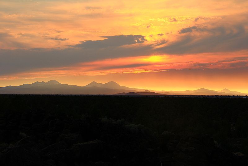
The United States Congress designated the Oregon Badlands Wilderness in 2009 and it now has a total of 29,261 acres. All of this wilderness is located in Oregon and is managed by the Bureau of Land Management. The Oregon Badlands Wilderness holds a number of remarkable and exciting landforms and geologic features. Most of the area includes the rugged Badlands volcano, which has features of inflated lava. Windblown volcanic ash and eroded lava make up the sandy, light-colored soil that covers the low and flat places in these fields of lava. Dry River, active during each of several ice ages, marks the southeast boundary between two volcanic areas – Badlands volcano and the Horse Ridge volcanoes. Earth movements along the Brothers Fault Zone have faulted and sliced up the old Horse Ridge volcanoes, but not Badlands volcano. The Badlands formed in an unusual way. The flow that supplied lava to the Badlands apparently developed a hole in the roof of its main lava tube. This hole became the source of lava that built a shield volcano that we call the Badlands (technically, a rootless shield volcano). An irregularly-shaped pit crater at the top of the shield marks the site where lava flowed in all directions to create the Badlands. It is located about 1500 feet northeast of milepost 15 on Highway 20. Highway 20 traverses the shield along a straight, five-mile stretch between the intersections with an old section of Highway 20 (between mileposts 12.6 and 17.5). Soils in the Badlands were largely formed from ash associated with Mt. Mazama, now known as Crater Lake. A variety of wildlife species inhabit the area including yellow-bellied marmots, bobcat, mule deer, elk, and antelope. The southern portion of the Badlands Wilderness includes crucial winter range for mule deer. Avian species include prairie falcons and golden eagles. Additional information about the Oregon Badlands Wilderness, and all the other BLM Wilderness areas in Oregon/Washington, is available online at: www.blm.gov/or/resources/recreation/wilderness2.php Photo: BLM Oregon/Flickr www.flickr.com/photos/blmoregon/ |
| Date | |
| Source | Oregon Badlands Wilderness |
| Author | Bureau of Land Management |
Licensing
edit.jpg&action=edit§ion=2)
- You are free:
- to share – to copy, distribute and transmit the work
- to remix – to adapt the work
- Under the following conditions:
- attribution – You must give appropriate credit, provide a link to the license, and indicate if changes were made. You may do so in any reasonable manner, but not in any way that suggests the licensor endorses you or your use.
| This image was originally posted to Flickr by mypubliclands at https://flickr.com/photos/91981596@N06/13664348185. It was reviewed on 5 August 2015 by FlickreviewR and was confirmed to be licensed under the terms of the cc-by-2.0. |
| This image is a work of a Bureau of Land Management* employee, taken or made as part of that person's official duties. As a work of the U.S. federal government, the image is in the public domain in the United States. *or predecessor organization |
File history
Click on a date/time to view the file as it appeared at that time.
| Date/Time | Thumbnail | Dimensions | User | Comment | |
|---|---|---|---|---|---|
| current | 19:52, 4 August 2015 | | 1,024 × 683 (202 KB) | Wilfredor (talk | contribs) | Transferred from Flickr via Flickr2Commons |
You cannot overwrite this file.
File usage on Commons
There are no pages that use this file.
.jpg&oldid=692478413)