File:Ostfriesische-Inseln 2plus.jpg
Size of this preview: 800 × 258 pixels. Other resolutions: 320 × 103 pixels | 1,193 × 385 pixels.
Original file (1,193 × 385 pixels, file size: 153 KB, MIME type: image/jpeg)
Captions
Captions
Add a one-line explanation of what this file represents
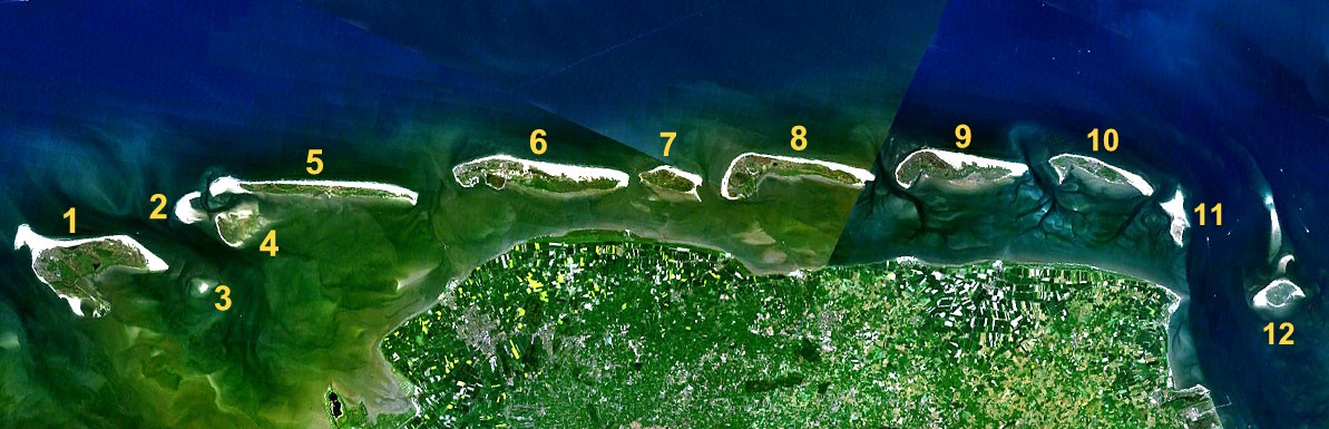
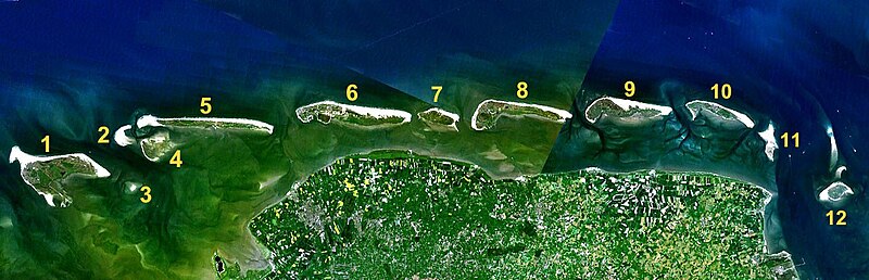
Deutsch: Satellitenaufnahme von den Ostfriesischen Inseln
Română: Fotografie prin satelit a insulelor frizone orientale
- from Nasa World Wind - Free Satellite Image
- Edited version of Image:Ostfriesische-Inseln_2.jpg
| This image is in the public domain because it is a screenshot from NASA’s globe software World Wind using a public domain layer, such as Blue Marble, MODIS, Landsat, SRTM, USGS or GLOBE.
|
 |
File history
Click on a date/time to view the file as it appeared at that time.
| Date/Time | Thumbnail | Dimensions | User | Comment | |
|---|---|---|---|---|---|
| current | 09:21, 27 September 2007 | 1,193 × 385 (153 KB) | Fice (talk | contribs) | * Satellitenaufnahme von den Ostfriesischen Inseln * from Nasa World Wind - Free Satellite Image * Edited version of Ostfriesische-Inseln_2.jpg {{PD-USGov}} Category:Satellite images of islands Category:Islands of Lower Saxony |
You cannot overwrite this file.
File usage on Commons
There are no pages that use this file.
File usage on other wikis
The following other wikis use this file:
- Usage on da.wikipedia.org
- Usage on la.wikipedia.org
- Usage on ro.wikipedia.org
- Usage on sv.wikipedia.org