File:Plan Strasbourg 1720 (cropped).png

Size of this preview: 800 × 581 pixels. Other resolutions: 320 × 232 pixels | 640 × 465 pixels | 1,024 × 744 pixels | 1,280 × 929 pixels | 2,560 × 1,859 pixels | 5,653 × 4,105 pixels.
Original file (5,653 × 4,105 pixels, file size: 45.41 MB, MIME type: image/png)
Captions
Captions
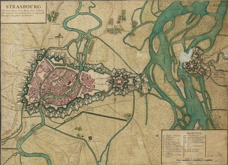
Map of the city of Strasbourg in 1720
Summary edit
| Description |
Français : Plan de la ville de Strasbourg en 1720 |
| Date | |
| Source | Own work |
| Author | Buchsweiler67330 |
| Other versions |

.png&action=edit§ion=1)
Licensing edit
.png&action=edit§ion=2)
I, the copyright holder of this work, hereby publish it under the following license:
This file is licensed under the Creative Commons Attribution-Share Alike 3.0 Unported license.
- You are free:
- to share – to copy, distribute and transmit the work
- to remix – to adapt the work
- Under the following conditions:
- attribution – You must give appropriate credit, provide a link to the license, and indicate if changes were made. You may do so in any reasonable manner, but not in any way that suggests the licensor endorses you or your use.
- share alike – If you remix, transform, or build upon the material, you must distribute your contributions under the same or compatible license as the original.
File history
Click on a date/time to view the file as it appeared at that time.
| Date/Time | Thumbnail | Dimensions | User | Comment | |
|---|---|---|---|---|---|
| current | 18:11, 4 July 2017 | | 5,653 × 4,105 (45.41 MB) | Frze (talk | contribs) | File:Plan Strasbourg 1720.png cropped 4 % horizontally and 4 % vertically using CropTool with precise mode. |
You cannot overwrite this file.
File usage on Commons
The following page uses this file:
File usage on other wikis
The following other wikis use this file:
- Usage on de.wikipedia.org
.png&oldid=718481666)