File:Polish and Lithuanian Conflict with Prussia. 1377-1435 - it.svg

Size of this PNG preview of this SVG file: 599 × 517 pixels. Other resolutions: 278 × 240 pixels | 556 × 480 pixels | 890 × 768 pixels | 1,186 × 1,024 pixels | 2,373 × 2,048 pixels.
Original file (SVG file, nominally 599 × 517 pixels, file size: 1.47 MB)
Captions
Captions
Add a one-line explanation of what this file represents
Summary edit
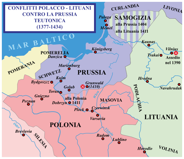
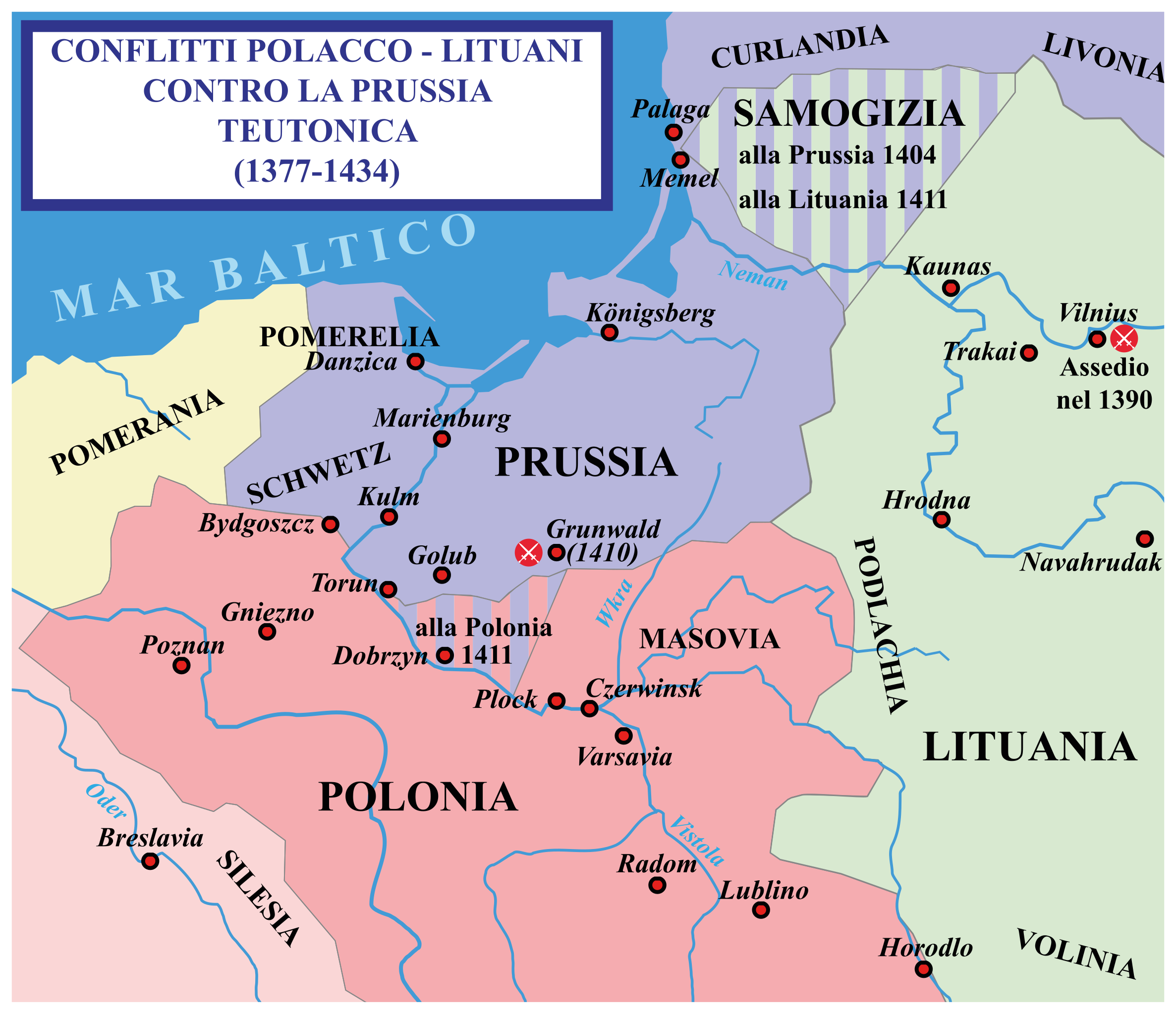
| Description | Mappa mostra i conflitti avvenuti tra i Cavalieri teutonici la Lituania e la Polonia (1389–1392). |
| Date | 29 January 2007 (original upload date) |
| Source | No machine-readable source provided. Own work assumed (based on copyright claims). |
| Author | No machine-readable author provided. Qp10qp assumed (based on copyright claims). |
Sources edit
- The map was outlined from this old German map: Image:Poland under Jagello.jpg.
Other references:
- The Times Concise Atlas of World History, Times Books, 1994, ISBN 0-7230-0674-1, p. 56.
- Lukowski, Jerzy and Hubert Zawadzki (2001). A Concise History of Poland. Cambridge: Cambridge University Press. ISBN 0-521-55917-0. Maps on p. 36-38.
- "Baltic Europe", in The New Cambridge Medieval History VI, ed. Michael Jones, Cambridge University Press, ISBN 0-521-36290-3. Map on p. 700.
Licensing edit
| I, the copyright holder of this work, release this work into the public domain. This applies worldwide. In some countries this may not be legally possible; if so: I grant anyone the right to use this work for any purpose, without any conditions, unless such conditions are required by law. |
File history
Click on a date/time to view the file as it appeared at that time.
| Date/Time | Thumbnail | Dimensions | User | Comment | |
|---|---|---|---|---|---|
| current | 20:59, 4 October 2020 | | 599 × 517 (1.47 MB) | MacMoreno (talk | contribs) | == {{int:filedesc}} == {{Information |description = Mappa mostra i conflitti avvenuti tra i Cavalieri teutonici la Lituania e la Polonia (1389–1392). |date = {{Original upload date|2007-01-29}} |source = {{own assumed}} |author = {{Author assumed|Qp10qp}} |permission = |other_versions = }} ==Sources== *The map was outlined from this old German map: Image:Poland under Jagello.jpg. Other references: *''The Times Concise Atlas of World History'', Times Books, 199... |
You cannot overwrite this file.
File usage on Commons
There are no pages that use this file.
File usage on other wikis
The following other wikis use this file: