File:Postal Map of Manitoba 1884.jpg

Size of this preview: 800 × 496 pixels. Other resolutions: 320 × 198 pixels | 640 × 396 pixels | 1,024 × 634 pixels | 1,280 × 793 pixels | 2,560 × 1,586 pixels | 11,175 × 6,922 pixels.
Original file (11,175 × 6,922 pixels, file size: 18.44 MB, MIME type: image/jpeg)
Captions
Captions
Add a one-line explanation of what this file represents
Summary
edit
| Description |
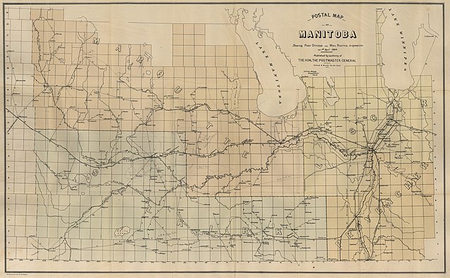
English: Maingy, Le F. Ans. Postal Map of Manitoba Shewing Post Offices and Mail Routes in Operation on 1st April 1884 [map]. 1:570,340. [Ottawa]: Canada Post Office Department, 1884. |
| Date | |
| Source | https://www.flickr.com/photos/manitobamaps/3875351518/sizes/o/ linked from https://www.flickr.com/photos/manitobamaps/3875351518/ from the University of Manitoba Archives & Special Collections |
| Author | The Burland Lithographic Co. Montreal. |
| Permission (Reusing this file) |
Published by authority of the Hon. the Postmaster General - Canadian Government works are crown copyright that only lasts for 50 years |
Licensing
edit
This Canadian work is in the public domain in Canada because its copyright has expired due to one of the following:
it was not subject to Crown copyright, and
|
 |
File history
Click on a date/time to view the file as it appeared at that time.
| Date/Time | Thumbnail | Dimensions | User | Comment | |
|---|---|---|---|---|---|
| current | 00:03, 10 November 2017 | | 11,175 × 6,922 (18.44 MB) | Ww2censor (talk | contribs) | == {{int:filedesc}} == {{Information |Description={{en|Maingy, Le F. Ans. Postal Map of Manitoba Shewing Post Offices and Mail Routes in Operation on 1st April 1884 [map]. 1:570,340. [Ottawa]: Canada Post Office Department, 1884. |Source=https://www.f... |
You cannot overwrite this file.
File usage on Commons
The following 5 pages use this file:
- User:Chumwa/OgreBot/Potential transport maps/2017 November 1-10
- User:Chumwa/OgreBot/Public transport information/2017 November 1-10
- User:Chumwa/OgreBot/Transport Maps/2017 November 1-10
- User:Chumwa/OgreBot/Travel and communication maps/2017 November 1-10
- User:Ww2censor/Recent philatelic uploads/2017 November