File:Red Vented Bulbul (6971327280).jpg

Original file (2,880 × 2,304 pixels, file size: 2.07 MB, MIME type: image/jpeg)
Captions
Captions
Summary
edit.jpg&action=edit§ion=1)
| Description |
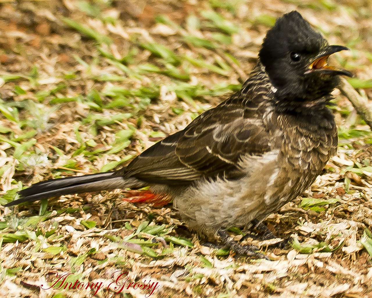
LOOKS LIKE HE IS SAYING "COME ANY CLOSER AND I WILL POKE THAT FANCY LENS YOU HAVE ON YOUR CAMERA" The Red-vented Bulbul (Pycnonotus cafer) is a member of the bulbul family of passerines. It is resident breeder across the Indian Subcontinent, including Sri Lanka extending east to Burma and parts of Tibet. The Red-vented Bulbul is easily identified by its short crest giving the head a squarish appearance. The body is dark brown with a scaly pattern while the head is darker or black. The rump is white while the vent is red. The black tail is tipped in white. The Himalayan races have a more prominent crest and are more streaked on the underside. The Race intermedius of the Western Himalayas has a black hood extending to the mid-breast. Population bengalensis of Central and Eastern Himalayas and the Gangetic plain has a dark hood, lacks the scale like pattern on the underside and instead has dark streaks on the paler lower belly. Race stanfordi of the South Assam hills is similar to intermedius. The desert race humayuni has a paler brown mantle. The nominate race cafer is found in Peninsular India. Northeast Indian race wetmorei is between cafer, humayuni and bengalensis. about 20 cm in length, with a long tail. This is a bird of dry scrub, open forest, plains and cultivated lands. In its native range it is rarely found in mature forests. A study based on 54 localities in India concluded that vegetation is the single most important factor that determines the distribution of the species. Red-vented bulbuls feed mainly on fruits, petals of flowers, nectar, insects and occasionally geckos They have also been seen feeding on the leaves of Medicago sativa. |
| Date | |
| Source | Red Vented Bulbul |
| Author | Antony Grossy from Conoor, Nilgiris District, Tamil Nadu State, India, India |
| Camera location | | View this and other nearby images on: OpenStreetMap |
|---|
.jpg¶ms=011.363163_N_0076.793755_E_globe:Earth_type:camera_source:Flickr_&language=en)
Licensing
edit.jpg&action=edit§ion=2)
- You are free:
- to share – to copy, distribute and transmit the work
- to remix – to adapt the work
- Under the following conditions:
- attribution – You must give appropriate credit, provide a link to the license, and indicate if changes were made. You may do so in any reasonable manner, but not in any way that suggests the licensor endorses you or your use.
| This image was originally posted to Flickr by AntoGros at https://flickr.com/photos/79476731@N00/6971327280 (archive). It was reviewed on 28 August 2019 by FlickreviewR 2 and was confirmed to be licensed under the terms of the cc-by-2.0. |
File history
Click on a date/time to view the file as it appeared at that time.
| Date/Time | Thumbnail | Dimensions | User | Comment | |
|---|---|---|---|---|---|
| current | 11:16, 28 August 2019 | | 2,880 × 2,304 (2.07 MB) | Rudolphous (talk | contribs) | Transferred from Flickr via #flickr2commons |
You cannot overwrite this file.
File usage on Commons
There are no pages that use this file.
.jpg&oldid=673630465)