File:Ringwall Otzenhausen 11.jpg

Size of this preview: 800 × 600 pixels. Other resolutions: 320 × 240 pixels | 640 × 480 pixels | 1,024 × 768 pixels | 1,280 × 960 pixels | 2,048 × 1,536 pixels.
Original file (2,048 × 1,536 pixels, file size: 2.2 MB, MIME type: image/jpeg)
Captions
Captions
Add a one-line explanation of what this file represents
Summary edit
| Description |
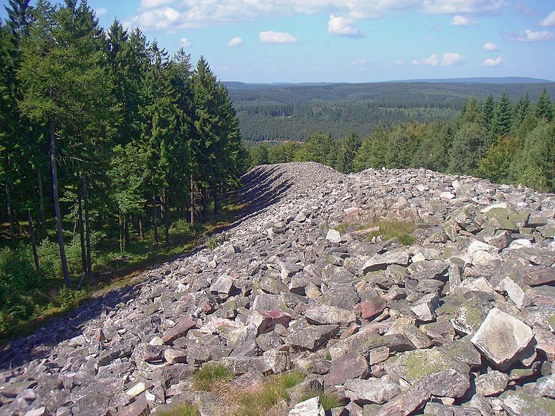
Deutsch: Ringwall Otzenhausen im Südabschnitt des Nationalparks Hunsrück-Hochwald; gesamter Waldbereich im Bild im Naturpark Saar-Hunsrück gelegen English: Remnants of celtic fortifications near Otzenhausen |
| Date | 21 August 2010, 12:20:43 |
| Source | Own work |
| Author | Dirtsc |
| Camera location | | View this and other nearby images on: OpenStreetMap |
|---|
Licensing edit
I, the copyright holder of this work, hereby publish it under the following license:
This file is licensed under the Creative Commons Attribution-Share Alike 4.0 International license.
- You are free:
- to share – to copy, distribute and transmit the work
- to remix – to adapt the work
- Under the following conditions:
- attribution – You must give appropriate credit, provide a link to the license, and indicate if changes were made. You may do so in any reasonable manner, but not in any way that suggests the licensor endorses you or your use.
- share alike – If you remix, transform, or build upon the material, you must distribute your contributions under the same or compatible license as the original.
This image was uploaded as part of Wiki Loves Earth 2016.
|
 |
This image has been assessed using the Quality image guidelines and is considered a Quality image.
|
File history
Click on a date/time to view the file as it appeared at that time.
| Date/Time | Thumbnail | Dimensions | User | Comment | |
|---|---|---|---|---|---|
| current | 19:56, 17 May 2016 | | 2,048 × 1,536 (2.2 MB) | Dirtsc (talk | contribs) | User created page with UploadWizard |
You cannot overwrite this file.
File usage on Commons
The following 5 pages use this file:
File usage on other wikis
The following other wikis use this file:
- Usage on de.wikipedia.org
- Liste von Sehenswürdigkeiten im Saarland
- Murus Gallicus
- Geschichte des Saarlandes
- Nationalpark Hunsrück-Hochwald
- Wikipedia Diskussion:Wiki Loves Earth 2016/Deutschland/Jury
- Benutzer:Commander-pirx/Entwurf Liste vor- und frühgeschichtlicher Wallanlagen in Rheinland-Pfalz
- Benutzer:Commander-pirx/Entwurf Liste vor- und frühgeschichtlicher Wallanlagen im Saarland
- Benutzer:Commander-pirx/Entwurf Liste vor- und frühgeschichtlicher Wallanlagen in Bayern
- Vorlage:Navigationsleiste vor- und frühgeschichtliche Wallanlagen in Deutschland
- Benutzer:Commander-pirx/Entwurf Liste vor- und frühgeschichtlicher Wallanlagen in Nordrhein-Westfalen
- Benutzer:Commander-pirx/Entwurf Liste vor- und frühgeschichtlicher Wallanlagen in BaWü
- Benutzer:Commander-pirx/Entwurf Liste vor- und frühgeschichtlicher Wallanlagen in Niedersachsen
- Benutzer:Commander-pirx/Entwurf Liste vor- und frühgeschichtlicher Wallanlagen in Sachsen-Anhalt
- Benutzer:Commander-pirx/Entwurf Liste vor- und frühgeschichtlicher Wallanlagen im Sachsen
- Usage on es.wikipedia.org
- Usage on pl.wikipedia.org