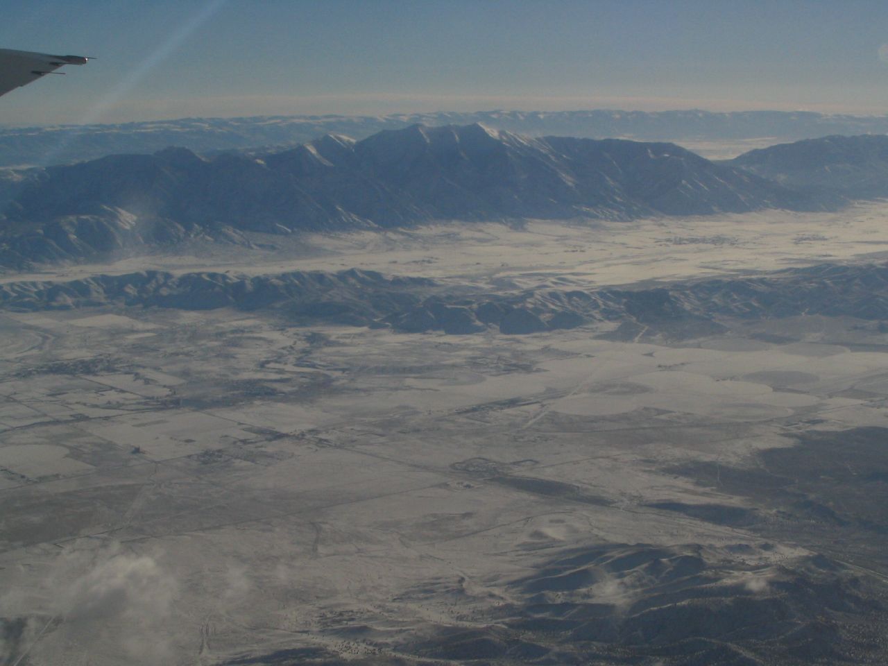
File:San Pitch Mountains, Manti Mountains, and Sanpete Valley from Flight to Salt Lake from Las Vegas (73262890).jpg
Original file (1,280 × 960 pixels, file size: 117 KB, MIME type: image/jpeg)
Captions
Captions
Summary
edit.jpg&action=edit§ion=1)
| Description |
Sanpete County is a county located in the U.S. state of Utah. As of the 2010 census, the population was 27,822. Its county seat is Manti, and its largest city is Ephraim. The county was named for the Ute chief Sanpitch, which was changed to Sanpete. On June 14, 1849, Ute chiefs Walkara and Sowiette went to the Salt Lake Valley to ask Mormon leader Brigham Young to settle a group of his people in the valley of Sanpitch, about 125 miles (201 km) to the south. Wanting to honor their request and needing to found new settlements where the quickly-growing population of Salt Lake could expand, Brigham Young sent a party to explore the area in August of that year. It was deemed favorable to settlement, and Brigham Young called Isaac Morley and George Washington Bradley to organize about fifty families to move south and settle "San Pete." The settlers arrived in the valley on November 19, 1849. They numbered 224 men, women, and children and were led by Isaac Morley, Charles Shumway, and Seth Taft and George Washington Bradley. After some debate, the first settlement in the valley was established on the present site of Manti, Utah. Over the course of the 19th Century, many of the settlers came from Scandinavian countries, as documented in the Saga of the Sanpitch. Sanpete County is bounded along its eastern side by the Wasatch Plateau (sometimes known as the Manti Mountains). The Wasatch Plateau rises to elevations of approximately 11,000 feet (3,300 m). Most of the Wasatch Plateau is encompassed by the Manti Division of the Manti-La Sal National Forest. Runoff from the western slopes of these mountains provides water to the county's cities and agricultural areas. Central Sanpete is dominated by the Sanpete Valley (sometimes known as the Sanpitch Valley), where most of the county's cities are located. The western side of the valley is bounded by the lower and drier San Pitch Mountains, which also form part of the western boundary of the county. The San Pitch River, runs from north to south through Sanpete and empties into the Sevier River in southwestern Sanpete. This portion of the Sevier River Valley is known as Gunnison Valley. Sanpete County is a largely agricultural region of the state, and it is dotted with small rural farming towns. Agriculture, livestock, small businesses, government employment and Snow College form the economic backbone of the county. A significant industry in the county is turkey ranching and the Moroni Feed Company, a Turkey producing and processing cooperative. Moroni Feed Company is a part owner of the marketing cooperative Norbest [1]. Moroni Feed Company operates several divisions throughout the county, including a turkey processing plant, hatchery, feed mill, propane store, and sales office located in and near the town of Moroni. The company employs over 600 people throughout the state, with the corporate headquarters located near Moroni. Numerous turkey barns and sheds dot the landscape; primarily around Moroni and the other northern Sanpete towns. Alfalfa fields and other animal feed crops make up the bulk of the agricultural activity and economy of the county. en.wikipedia.org/wiki/Sanpete_County,_Utah en.wikipedia.org/wiki/Wikipedia:Text_of_Creative_Commons_... |
| Date | |
| Source | San Pitch Mountains, Manti Mountains, and Sanpete Valley from Flight to Salt Lake from Las Vegas |
| Author | Ken Lund from Reno, Nevada, USA |
| Camera location | | View this and other nearby images on: OpenStreetMap |
|---|
.jpg¶ms=039.559250_N_-111.863994_E_globe:Earth_type:camera_source:Flickr_&language=en)
Licensing
edit.jpg&action=edit§ion=2)
- You are free:
- to share – to copy, distribute and transmit the work
- to remix – to adapt the work
- Under the following conditions:
- attribution – You must give appropriate credit, provide a link to the license, and indicate if changes were made. You may do so in any reasonable manner, but not in any way that suggests the licensor endorses you or your use.
- share alike – If you remix, transform, or build upon the material, you must distribute your contributions under the same or compatible license as the original.
| This image was originally posted to Flickr by Ken Lund at https://flickr.com/photos/75683070@N00/73262890. It was reviewed on 3 December 2015 by FlickreviewR and was confirmed to be licensed under the terms of the cc-by-sa-2.0. |
File history
Click on a date/time to view the file as it appeared at that time.
| Date/Time | Thumbnail | Dimensions | User | Comment | |
|---|---|---|---|---|---|
| current | 21:39, 3 December 2015 | | 1,280 × 960 (117 KB) | INeverCry (talk | contribs) | Transferred from Flickr via Flickr2Commons |
You cannot overwrite this file.
File usage on Commons
There are no pages that use this file.
.jpg&oldid=489459115)