File:Shubert MoscowRegion 1860 map 3-4.jpg

Size of this preview: 487 × 599 pixels. Other resolutions: 195 × 240 pixels | 390 × 480 pixels | 624 × 768 pixels | 832 × 1,024 pixels | 1,664 × 2,048 pixels | 6,492 × 7,990 pixels.
Original file (6,492 × 7,990 pixels, file size: 16.04 MB, MIME type: image/jpeg)
Captions
Captions
Add a one-line explanation of what this file represents
Summary
edit
| Description |
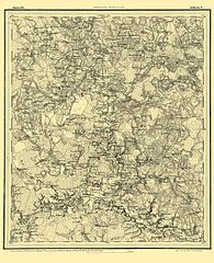
Русский: "Военно-топографическая карта Московской губернии", составленная Ф. Ф. Шубертом в 1860 году, ряд lIl, лист 4 |
| Date | |
| Source |
Русский: "Военно-топографическая карта Московской губернии" |
| Author |
Русский: Шуберт, Федор Федорович (1798-1865) |
Licensing
edit
|
This work is in the public domain in its country of origin and other countries and areas where the copyright term is the author's life plus 100 years or fewer. | |
| This file has been identified as being free of known restrictions under copyright law, including all related and neighboring rights. | |
Original upload log
edit
The original description page was here. All following user names refer to ru.wikipedia.
| Date/Time | Dimensions | User | Comment |
|---|---|---|---|
| 2014-01-08 03:39 | 6492×7990× (16817025 bytes) | Gerodian | {{Изображение | Описание = "Военно-топографическая карта Московской губернии", составленная Ф. Ф. Шубертом в 1860 году, ряд lIl, лист 4 | Источ… |
File history
Click on a date/time to view the file as it appeared at that time.
| Date/Time | Thumbnail | Dimensions | User | Comment | |
|---|---|---|---|---|---|
| current | 11:57, 19 July 2015 | | 6,492 × 7,990 (16.04 MB) | Gandvik (talk | contribs) | Transferred from ru.wikipedia |
You cannot overwrite this file.
File usage on Commons
There are no pages that use this file.
File usage on other wikis
The following other wikis use this file:
- Usage on ru.wikipedia.org