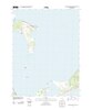
File:Southern tip of Gardiners Island, Cartwright Shoals, Cartwright Island USGS.jpg

Size of this preview: 436 × 599 pixels. Other resolutions: 175 × 240 pixels | 349 × 480 pixels | 559 × 768 pixels | 745 × 1,024 pixels | 2,111 × 2,900 pixels.
Original file (2,111 × 2,900 pixels, file size: 165 KB, MIME type: image/jpeg)
Captions
Captions
Add a one-line explanation of what this file represents
Summary edit
| Description | ||||
| Date | ||||
| Source | https://catalog.data.gov/dataset/usgs-us-topo-7-5-minute-map-for-gardiners-island-east-ny-201377893 | |||
| Author | USGS | |||
| Permission (Reusing this file) |
|
|||
| Other versions |
File history
Click on a date/time to view the file as it appeared at that time.
| Date/Time | Thumbnail | Dimensions | User | Comment | |
|---|---|---|---|---|---|
| current | 02:48, 17 September 2020 | | 2,111 × 2,900 (165 KB) | Geo Swan (talk | contribs) | File:Map of the southern part of Gardiners Island, also showing Cartwright Island.pdf cropped 71 % horizontally, 67 % vertically using CropTool with precise mode. |
You cannot overwrite this file.
File usage on Commons
The following page uses this file: