File:Spital am Pyhrn - Dr.-Vogelgesang-Klamm (a).JPG

Size of this preview: 400 × 600 pixels. Other resolutions: 160 × 240 pixels | 320 × 480 pixels | 512 × 768 pixels | 682 × 1,024 pixels | 1,365 × 2,048 pixels | 2,600 × 3,900 pixels.
Original file (2,600 × 3,900 pixels, file size: 9.71 MB, MIME type: image/jpeg)
Captions
Captions
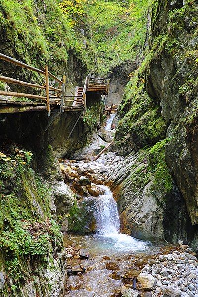
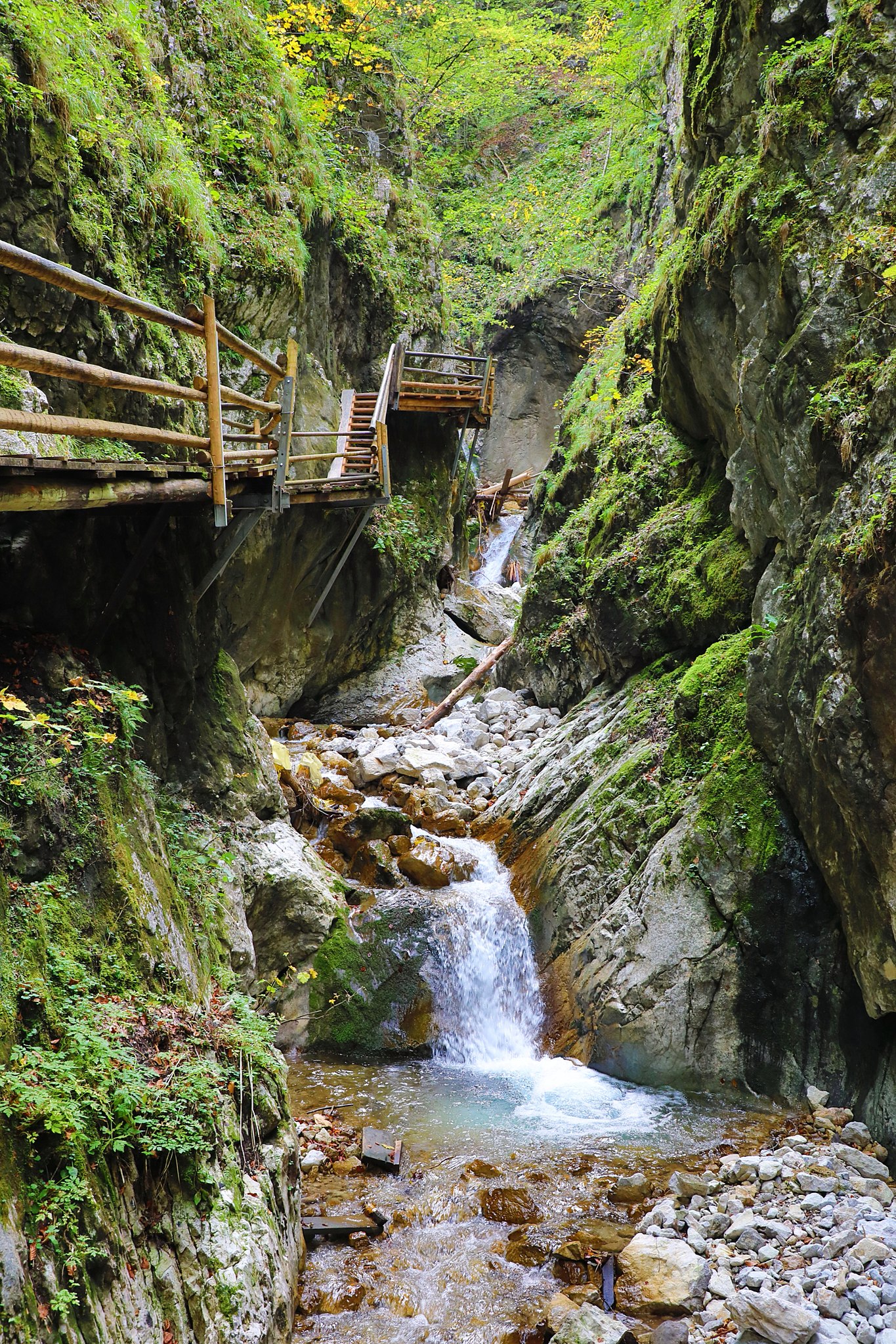
Dr. Vogelgesang Gorge in Spital am Pyhrn, Upper Austria.
Summary edit
| Description |
Deutsch: Die Dr.-Vogelgesang-Klamm in der oberösterreichischen Gemeinde Spital am Pyhrn im unteren Bereich der Felsenschlucht.
Die Klamm, die vom Klammbach (Fallbach) durchflossen wird, wurde ursprünglich „Fallbachklamm“ bezeichnet. Auf Initiative von Moritz Vogelgesang, Gemeindearzt und Obmann des Verschönerungsvereins sowie Vorstand der am 12. August 1905 gegründeten Sektion Spital am Pyhrn des Deutschen und Österreichischen Alpenvereins, wurde sie um 1906 durch die Gemeinde zum Teil erschlossen: [1]. Nach einem Hochwasser 1908, bei dem der Steg zerstört wurde, versah man 1926/27 die gesamte Felsschlucht mit Stiegen und Steigen: [2]. Die längste Klamm Oberösterreichs und die nach der Tiroler Leutaschklamm zweitlängste erschlossene Felsklamm Österreichs ([3]) hat eine Länge von rd. 2,7 km und einen Höhenunterschied von etwa 340 m, wobei die eigentliche Felsenschlucht eine Länge von rd. 1,5 km hat: [4]. English: Dr. Vogelgesang Gorge in Spital am Pyhrn, Upper Austria. |
| Date | |
| Source | Own work |
| Author | C.Stadler/Bwag |
| Permission (Reusing this file) |
Deutsch: Hallo, du darfst mein Foto kostenlos nutzen, aber nenne mich bitte als Fotograf, beispielsweise „Foto: C.Stadler/Bwag“ oder © C.Stadler/Bwag; CC-BY-SA-4.0. Auf mehr Angaben bestehe ich nicht - im Gegensatz zu manch anderen, die die Vorgaben der unten angeführten Lizenzierung auf Punkt und Beistrich einfordern. English: Feel free to use my photos, but please mention me as the author like © C.Stadler/Bwag or © C.Stadler/Bwag; CC-BY-SA-4.0 (that's good enough) and if you want send me a message: bwag@gmx.net. |
| Other versions |
|
.JPG)
.JPG)
.JPG&action=edit§ion=1)
| Object location | | View this and other nearby images on: OpenStreetMap |
|---|
.JPG¶ms=047.645140_N_0014.353890_E_globe:Earth_class:object_type:object__&language=en)
| Camera location | | View this and other nearby images on: OpenStreetMap |
|---|
.JPG¶ms=047.645140_N_0014.353890_E_globe:Earth_type:camera__&language=en)
Licensing edit
.JPG&action=edit§ion=2)
I, the copyright holder of this work, hereby publish it under the following license:
This file is licensed under the Creative Commons Attribution-Share Alike 4.0 International license.
- You are free:
- to share – to copy, distribute and transmit the work
- to remix – to adapt the work
- Under the following conditions:
- attribution – You must give appropriate credit, provide a link to the license, and indicate if changes were made. You may do so in any reasonable manner, but not in any way that suggests the licensor endorses you or your use.
- share alike – If you remix, transform, or build upon the material, you must distribute your contributions under the same or compatible license as the original.
File history
Click on a date/time to view the file as it appeared at that time.
| Date/Time | Thumbnail | Dimensions | User | Comment | |
|---|---|---|---|---|---|
| current | 20:31, 7 October 2021 | | 2,600 × 3,900 (9.71 MB) | Bwag (talk | contribs) | == {{int:filedesc}} == {{Information |Description= {{de|1= Die Dr.-Vogelgesang-Klamm in der oberösterreichischen Gemeinde Spital am Pyhrn im unteren Bereich der Felsenschlucht.<br/>Die Klamm, die vom Klammbach (Fallbach) durchflossen wird, wurde ursprünglich „Fallbachklamm“ bezeichnet. Auf Initiative von Moritz Vogelgesang, Gemeindearzt und Obmann des Verschönerungsvereins sowie Vorstand der am 12. August 1905 gegründeten Sektion Spital am Pyhrn des Deutschen und Österreichischen Alpenverein... |
You cannot overwrite this file.
File usage on Commons
The following 3 pages use this file:
File usage on other wikis
The following other wikis use this file:
- Usage on cs.wikipedia.org
- Usage on de.wikipedia.org
.JPG&oldid=706238589)