File:St. Florian - Stift (2).JPG
Size of this preview: 800 × 480 pixels. Other resolutions: 320 × 192 pixels | 1,024 × 615 pixels | 1,280 × 769 pixels | 2,560 × 1,537 pixels | 4,547 × 2,730 pixels.
Original file (4,547 × 2,730 pixels, file size: 10.34 MB, MIME type: image/jpeg)
Captions
Captions
Add a one-line explanation of what this file represents
Summary
edit| Description |
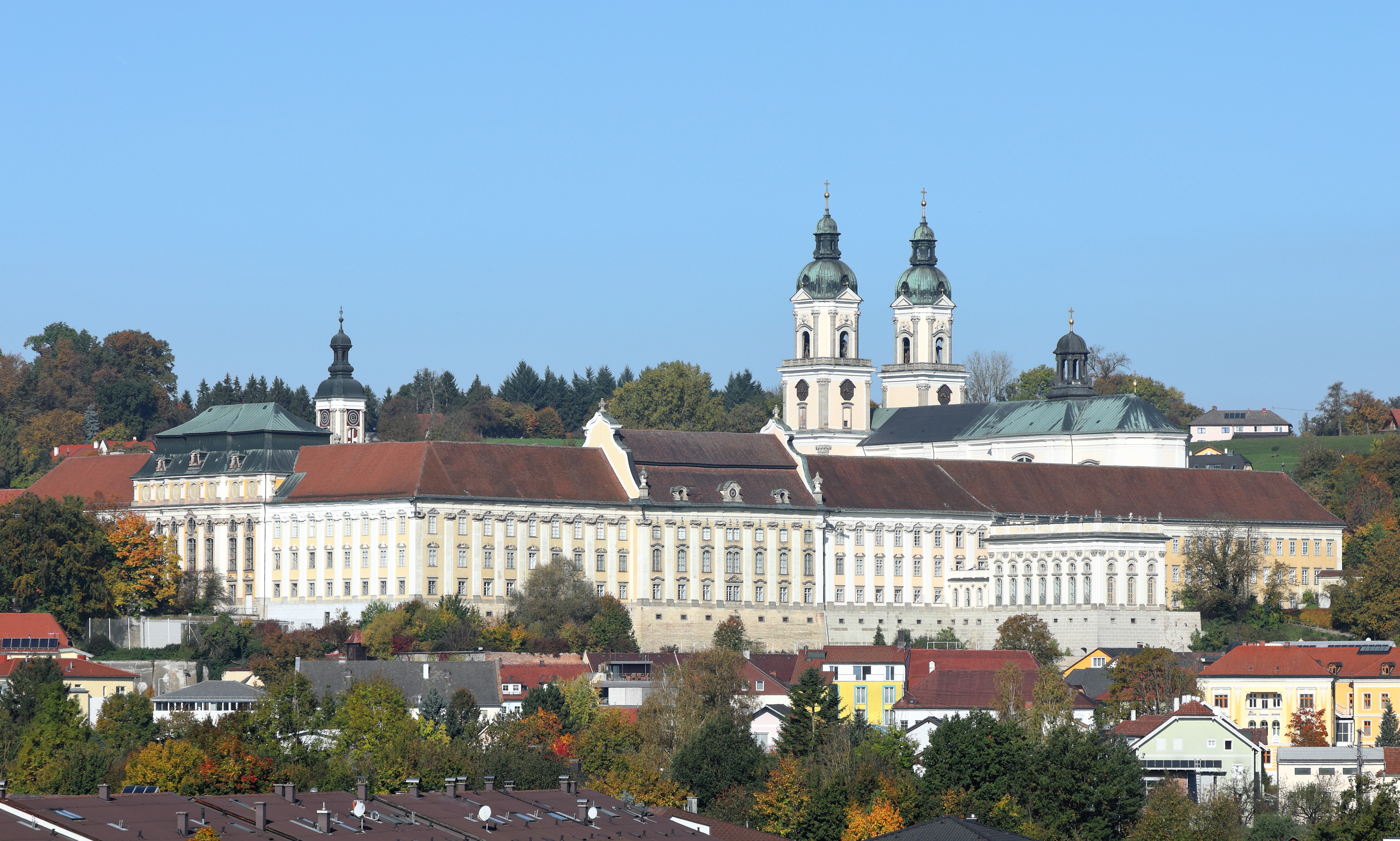
Deutsch: Südostansicht des Stiftes Sankt Florian in der oberösterreichischen Marktgemeinde St. Florian bei Linz. Wann das Kloster gegründet wurde ist unbekannt, jedoch erste schriftliche Zeugnisse einer Klosteranlage gehen auf karolingische Zeit zurück (um 800 n. Chr.). Von 1668 bis in die Mitte des 18. Jahrhunderts erfolgte eine weitgehende Neuerrichtung des Stiftes unter Einbeziehung älterer Bausubstanz. Der Neubau zählt zu den glänzendsten Leistungen des österr. Barockbaues, der vorwiegend von dem Baumeister Carlo Antonio Carlone realisiert wurde. |
| Date | |
| Source | Own work |
| Author | C.Stadler/Bwag |
| Permission (Reusing this file) |
Deutsch: Hallo, du darfst meine Fotos kostenlos nutzen, aber nenne mich bitte als Fotograf, beispielsweise „Foto: C.Stadler/Bwag“ oder © C.Stadler/Bwag; CC-BY-SA-4.0. Auf mehr Angaben bestehe ich nicht - im Gegensatz zu manch anderen, die die Vorgaben der unten angeführten Lizenzierung auf Punkt und Beistrich einfordern. English: Feel free to use my photos, but please mention me as the author like © C.Stadler/Bwag or © C.Stadler/Bwag; CC-BY-SA-4.0 (that's good enough) and if you want send me a message: bwag@gmx.net. |
| Other versions |
|
.JPG)

.JPG&action=edit§ion=1)
| Object location | | View this and other nearby images on: OpenStreetMap |
|---|
.JPG¶ms=048.207150_N_0014.378850_E_globe:Earth_class:object_type:object__&language=en)
| Camera location | | View this and other nearby images on: OpenStreetMap |
|---|
.JPG¶ms=048.200611_N_0014.387194_E_globe:Earth_type:camera_heading:315.00&language=en)
Licensing
edit.JPG&action=edit§ion=2)
I, the copyright holder of this work, hereby publish it under the following license:
This file is licensed under the Creative Commons Attribution-Share Alike 4.0 International license.
- You are free:
- to share – to copy, distribute and transmit the work
- to remix – to adapt the work
- Under the following conditions:
- attribution – You must give appropriate credit, provide a link to the license, and indicate if changes were made. You may do so in any reasonable manner, but not in any way that suggests the licensor endorses you or your use.
- share alike – If you remix, transform, or build upon the material, you must distribute your contributions under the same or compatible license as the original.
File history
Click on a date/time to view the file as it appeared at that time.
| Date/Time | Thumbnail | Dimensions | User | Comment | |
|---|---|---|---|---|---|
| current | 10:42, 16 October 2017 | | 4,547 × 2,730 (10.34 MB) | Bwag (talk | contribs) | {{Information |Description= {{de|1=Südostansicht des Stift Sankt Florian in der oberösterreichischen Marktgemeinde St. Florian bei Linz.<br/>Wann das Kloster gegründet wurde ist unbekannt,... |
You cannot overwrite this file.
File usage on Commons
The following 4 pages use this file:
File usage on other wikis
The following other wikis use this file:
- Usage on ca.wikipedia.org
- Usage on de.wikipedia.org
- Anton Bruckner
- Stift Sankt Florian
- St. Florianer Sängerknaben
- Liste von Internaten in Österreich
- Portal:Österreich/RegiowikiAT Redundanzen
- Wikipedia:WikiProjekt Österreich/WD/Linz-Land
- Neujahrskonzert der Wiener Philharmoniker 2024
- Wikipedia:WikiProjekt Österreich/checks/Denkmalschutz/WP - WD diffs 06
- Usage on de.wikivoyage.org
- Usage on en.wikipedia.org
- Usage on es.wikipedia.org
- Usage on fr.wikipedia.org
- Usage on id.wikipedia.org
- Usage on it.wikipedia.org
- Usage on nl.wikipedia.org
- Usage on no.wikipedia.org
- Usage on pl.wikipedia.org
- Usage on ro.wikipedia.org
- Usage on ru.wikivoyage.org
- Usage on sv.wikipedia.org
- Usage on uk.wikipedia.org
- Usage on www.wikidata.org
.JPG&oldid=865958742)