File:Swisstopo-000-450-346-Digitale Kartenbearbeitung.tif

Original file (4,984 × 5,452 pixels, file size: 77.74 MB, MIME type: image/tiff)
Captions
Captions
Summary
editSummary
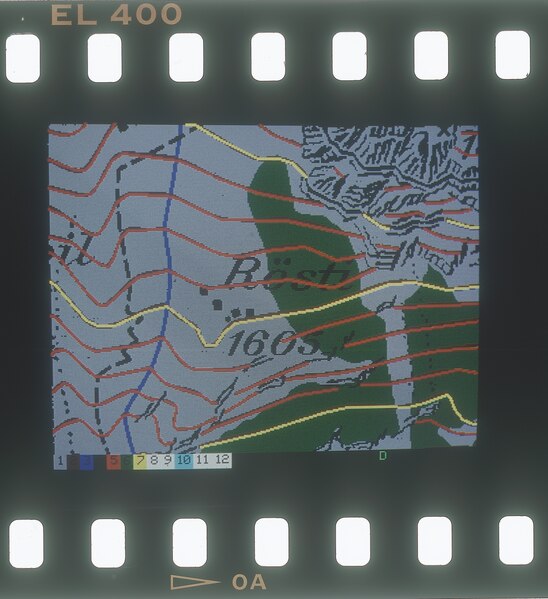
edit| Digitale Kartenbearbeitung, Höhenkurven mit Kartenhintergrund | |||
|---|---|---|---|
| Photographer |
Mitarbeitende Bundesamt für Landestopografie swisstopo |
||
| Title |
Digitale Kartenbearbeitung, Höhenkurven mit Kartenhintergrund |
||
| Description |
Bildschirmfoto aus der digitalen Kartenbearbeitung |
||
| Depicted place | Bundesamt für Landestopografie, Wabenr | ||
| Date | 1994 | ||
| Medium | Celluloseacetat | ||
| Collection | Bundesamt für Landestopografie - Bildsammlung | ||
| Current location |
Bildsammlung swisstopo
|
||
| Accession number |
000-450-346 |
||
| References | https://www.swisstopohistoric.ch/karten-im-computer-digitalisierung-bei-swisstopo-1980-2000-142.html | ||
| Source | Swisstopo | ||
| Permission (Reusing this file) |
|
||
.svg)
Licensing
edithttps://commons.wikimedia.org/wiki/Template:Attribution-Swisstopo
}
File history
Click on a date/time to view the file as it appeared at that time.
| Date/Time | Thumbnail | Dimensions | User | Comment | |
|---|---|---|---|---|---|
| current | 10:40, 12 September 2023 |  | 4,984 × 5,452 (77.74 MB) | Swisstopo historic (talk | contribs) | =={{int:filedesc}}== {{Photograph |photographer=Mitarbeitende Bundesamt für Landestopografie swisstopo |title=Digitale Kartenbearbeitung, Höhenkurven mit Kartenhintergrund |description=Bildschirmfoto aus der digitalen Kartenbearbeitung |depicted people= |depicted place=Bundesamt für Landestopografie, Wabenr |date=1994 |medium=Celluloseacetat |dimensions= |institution=Bundesamt für Landestopografie - Bildsammlung |department=Bildsammlung swisstopo {{Cultural property of regional significance... |
You cannot overwrite this file.
File usage on Commons
The following page uses this file: