File:Tønder municipality numbered.svg

Size of this PNG preview of this SVG file: 691 × 599 pixels. Other resolutions: 277 × 240 pixels | 554 × 480 pixels | 886 × 768 pixels | 1,181 × 1,024 pixels | 2,362 × 2,048 pixels | 858 × 744 pixels.
Original file (SVG file, nominally 858 × 744 pixels, file size: 212 KB)
Captions
Captions
Add a one-line explanation of what this file represents
| Description |
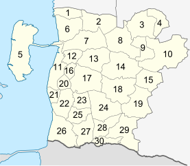
English: Map of the perishes in the Tønder municipality with numbers. Deutsch: Nummerierte Karte der Kirchspiele in der Tønder Kommune.
|
| Date | (UTC) |
| Source | |
| Author |
|
| This is a retouched picture, which means that it has been digitally altered from its original version. Modifications: Numbers added. The original can be viewed here: Tønder municipality.svg:
|
I, the copyright holder of this work, hereby publish it under the following licenses:
This file is licensed under the Creative Commons Attribution-Share Alike 3.0 Unported license.
- You are free:
- to share – to copy, distribute and transmit the work
- to remix – to adapt the work
- Under the following conditions:
- attribution – You must give appropriate credit, provide a link to the license, and indicate if changes were made. You may do so in any reasonable manner, but not in any way that suggests the licensor endorses you or your use.
- share alike – If you remix, transform, or build upon the material, you must distribute your contributions under the same or compatible license as the original.

|
Permission is granted to copy, distribute and/or modify this document under the terms of the GNU Free Documentation License, Version 1.2 or any later version published by the Free Software Foundation; with no Invariant Sections, no Front-Cover Texts, and no Back-Cover Texts. A copy of the license is included in the section entitled GNU Free Documentation License. |
You may select the license of your choice.
Original upload log edit
This image is a derivative work of the following images:
- File:Tønder_municipality.svg licensed with Cc-by-sa-3.0, GFDL
- 2011-01-24T12:44:26Z Erik Frohne 858x744 (149876 Bytes) == Summary == {{Information |Description={{en|1=Map of the perishes in the Tønder municipality.}} {{de|1=Karte der Kirchspiele in der Tønder Kommune.}} |Source={{own}} |Author=[[User:Erik Frohne|Erik Frohne]] |Date=2011-01-
Uploaded with derivativeFX
File history
Click on a date/time to view the file as it appeared at that time.
| Date/Time | Thumbnail | Dimensions | User | Comment | |
|---|---|---|---|---|---|
| current | 10:13, 25 January 2011 | | 858 × 744 (212 KB) | Erik Frohne (talk | contribs) | Renumbered for better readability |
| 07:33, 25 January 2011 |  | 858 × 744 (211 KB) | Erik Frohne (talk | contribs) | {{Information |Description={{en|1=Map of the perishes in the Tønder municipality with numbers.}} {{de|1=Nummerierte Karte der Kirchspiele in der Tønder Kommune.}} * {{0}}1: Abild * {{0}}2: Aggerskov * {{0}}3: Arrild * {{0}}4: Bedsted * {{0}}5: Ballum * |
You cannot overwrite this file.
File usage on Commons
The following page uses this file:
File usage on other wikis
The following other wikis use this file:
- Usage on de.wikipedia.org
- Usage on en.wikipedia.org
- Usage on fi.wikipedia.org
- Usage on frr.wikipedia.org
- Usage on sv.wikipedia.org