File:The Plough - Museum Street, Holborn.jpg
Size of this preview: 450 × 600 pixels. Other resolutions: 180 × 240 pixels | 360 × 480 pixels | 576 × 768 pixels | 768 × 1,024 pixels | 1,536 × 2,048 pixels | 3,216 × 4,288 pixels.
Original file (3,216 × 4,288 pixels, file size: 3.64 MB, MIME type: image/jpeg)
Captions
Captions
Add a one-line explanation of what this file represents
Summary
edit
| Description |
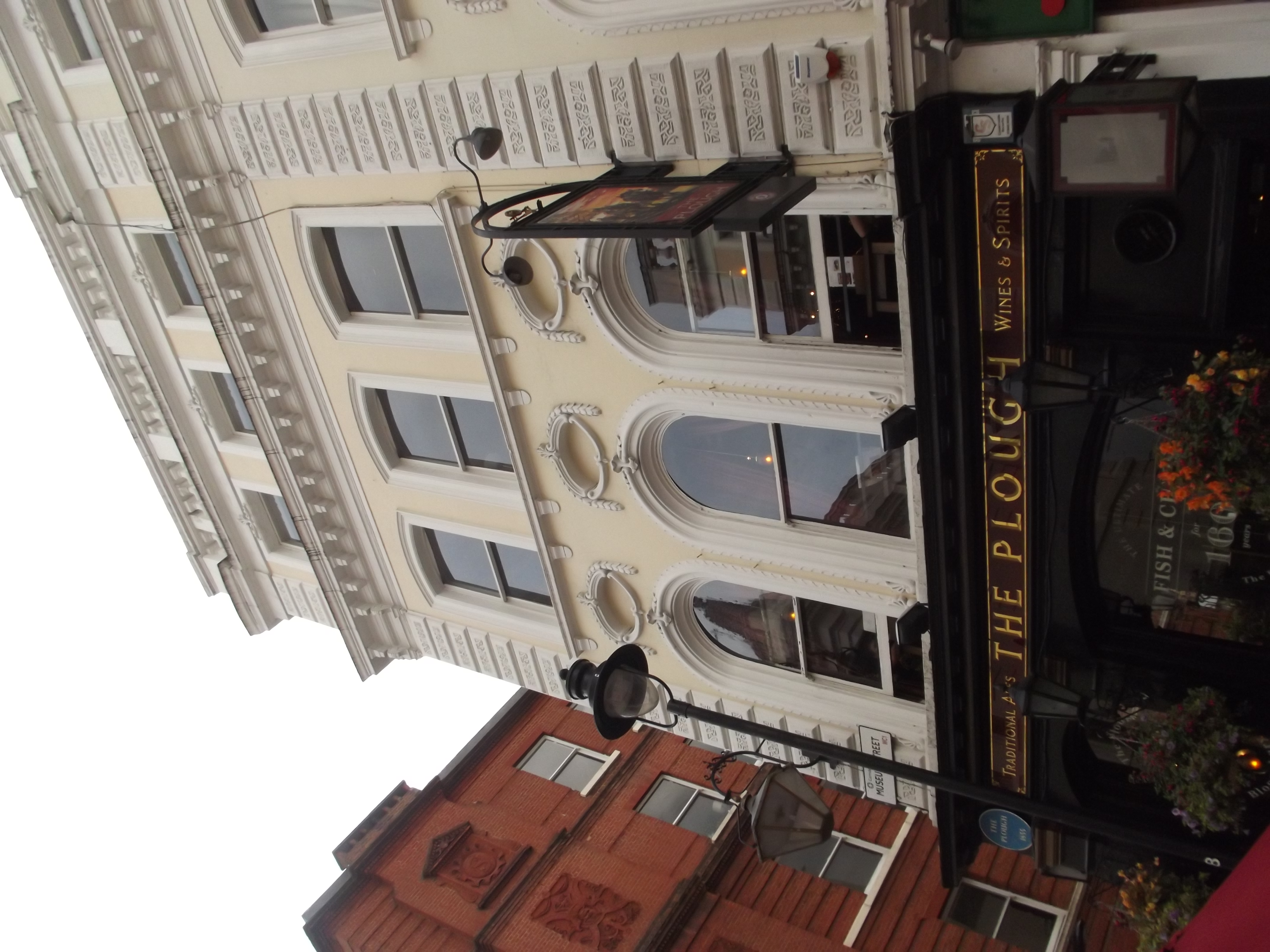
English: On Museum Street in Holborn (within what is now part of the London Borough of Camden).
We went this way after leaving the British Museum. At least it was no longer raining when we left the museum! Finding a route to a tube station (we eventually made it to Holborn Underground Station). Pub on Museum Street called The Plough. The pub is dated to 1855. |
| Date | |
| Source | https://www.flickr.com/photos/39415781@N06/20880387519/ |
| Author | ell brown |
| Camera location | | View this and other nearby images on: OpenStreetMap |
|---|
Licensing
edit
This file is licensed under the Creative Commons Attribution-Share Alike 2.0 Generic license.
- You are free:
- to share – to copy, distribute and transmit the work
- to remix – to adapt the work
- Under the following conditions:
- attribution – You must give appropriate credit, provide a link to the license, and indicate if changes were made. You may do so in any reasonable manner, but not in any way that suggests the licensor endorses you or your use.
- share alike – If you remix, transform, or build upon the material, you must distribute your contributions under the same or compatible license as the original.
| This image was originally posted to Flickr by ell brown at https://flickr.com/photos/39415781@N06/20880387519. It was reviewed on 1 January 2022 by FlickreviewR 2 and was confirmed to be licensed under the terms of the cc-by-sa-2.0. |
Summary
edit
| Description |
Numbers 46 And 47 And Attached Railings
|
|
| Date |
|
|
| Source | Own work | |
| Author | Magnus Manske |
| Object location | | View this and other nearby images on: OpenStreetMap |
|---|
Licensing
edit
I, the copyright holder of this work, hereby publish it under the following license:
This file is licensed under the Creative Commons Attribution-Share Alike 3.0 Unported license.
- You are free:
- to share – to copy, distribute and transmit the work
- to remix – to adapt the work
- Under the following conditions:
- attribution – You must give appropriate credit, provide a link to the license, and indicate if changes were made. You may do so in any reasonable manner, but not in any way that suggests the licensor endorses you or your use.
- share alike – If you remix, transform, or build upon the material, you must distribute your contributions under the same or compatible license as the original.
File history
Click on a date/time to view the file as it appeared at that time.
| Date/Time | Thumbnail | Dimensions | User | Comment | |
|---|---|---|---|---|---|
| current | 17:24, 1 January 2022 | | 3,216 × 4,288 (3.64 MB) | Oxyman (talk | contribs) | Uploaded a work by ell brown from https://www.flickr.com/photos/39415781@N06/20880387519/ with UploadWizard |
You cannot overwrite this file.
File usage on Commons
There are no pages that use this file.