File:Transformator, Windischgarsten.jpg

Size of this preview: 389 × 599 pixels. Other resolutions: 156 × 240 pixels | 311 × 480 pixels | 498 × 768 pixels | 664 × 1,024 pixels | 1,920 × 2,958 pixels.
Original file (1,920 × 2,958 pixels, file size: 4.02 MB, MIME type: image/jpeg)
Captions
Captions
Add a one-line explanation of what this file represents
Summary
edit
| Camera location | | View this and other nearby images on: OpenStreetMap |
|---|
| Description |
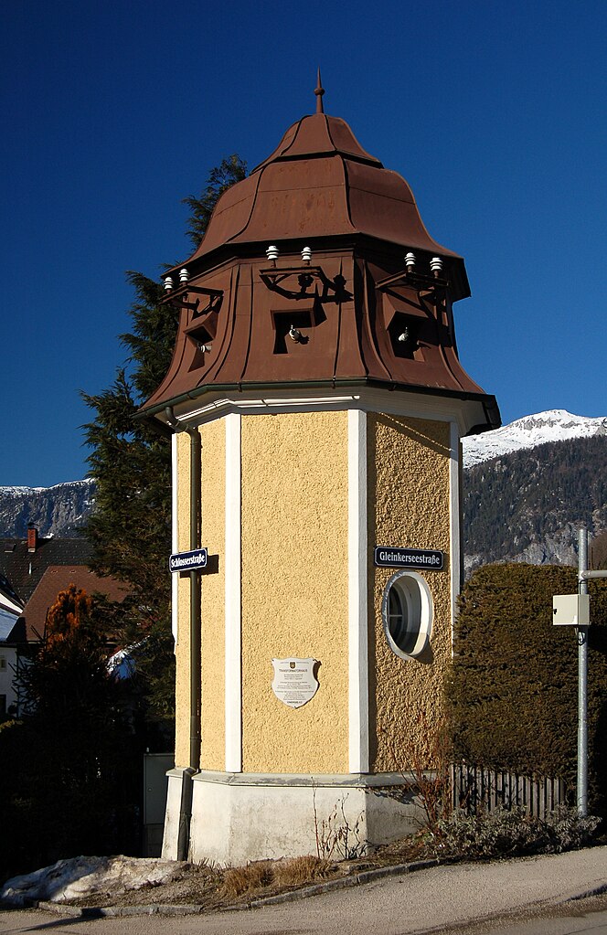
English: The Transformator house in Windischgarsten, Upper Austria, was built in 1904 by the local electricity company. Deutsch: Transformatorhaus der Elektrizitäts-Gesellschaft Windischgarsten-Spital a.P. erbaut 1904 in "Jugendstil"
Erstmalige Stromversorgung des Marktes am 15. Februar 1905 durch 9,1 km lange Versorgungsleitung (4120 Volt) vom Kraftwerk Grünau (170 kW). Netzspannung 150 V. Im September 1905 wurden im Ort 692 Glühlampen versorgt. ab 1937 Hofmann & Co., 1955 Netzspannung 220/380 V ab 1977 Versorgung durch OKA (heute Energie-AG Oberösterreich) |
| Date | |
| Source | Own work |
| Author | Herzi Pinki |
Licensing
edit
I, the copyright holder of this work, hereby publish it under the following license:
This file is licensed under the Creative Commons Attribution-Share Alike 3.0 Unported license.
- You are free:
- to share – to copy, distribute and transmit the work
- to remix – to adapt the work
- Under the following conditions:
- attribution – You must give appropriate credit, provide a link to the license, and indicate if changes were made. You may do so in any reasonable manner, but not in any way that suggests the licensor endorses you or your use.
- share alike – If you remix, transform, or build upon the material, you must distribute your contributions under the same or compatible license as the original.
File history
Click on a date/time to view the file as it appeared at that time.
| Date/Time | Thumbnail | Dimensions | User | Comment | |
|---|---|---|---|---|---|
| current | 23:47, 21 November 2011 | | 1,920 × 2,958 (4.02 MB) | Herzi Pinki (talk | contribs) |
You cannot overwrite this file.
File usage on Commons
There are no pages that use this file.