File:Uttar Pradesh administrative divisions ml.svg

Size of this PNG preview of this SVG file: 600 × 600 pixels. Other resolutions: 240 × 240 pixels | 480 × 480 pixels | 768 × 768 pixels | 1,024 × 1,024 pixels | 2,048 × 2,048 pixels | 1,600 × 1,600 pixels.
Original file (SVG file, nominally 1,600 × 1,600 pixels, file size: 109 KB)
Captions
Captions
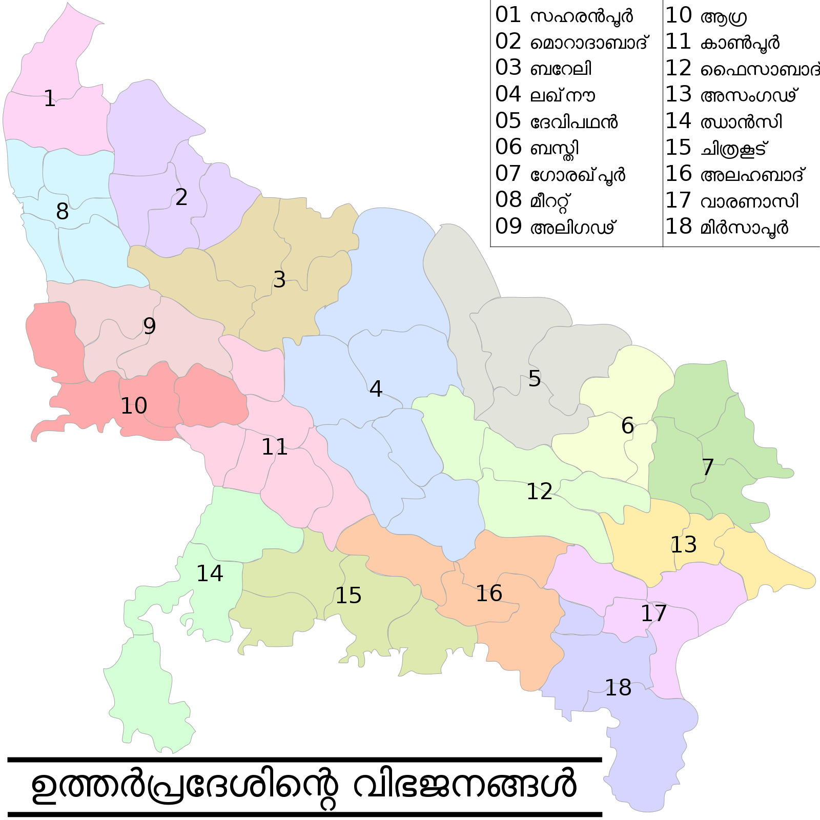
This map has been created by Faiz Haider, it is based on Map of Uttar Pradesh on National Portal of India.
Summary edit
| Description |
English: This map has been created by Faiz Haider, it is based on Map of Uttar Pradesh on National Portal of India. |
| Date | |
| Source | File:Uttar Pradesh administrative divisions.svg by User:Faizhaider |
| Author | Translated to Malayalam by User:Abhijith Sheheer |
Licensing edit
This file is licensed under the Creative Commons Attribution-Share Alike 4.0 International license.
- You are free:
- to share – to copy, distribute and transmit the work
- to remix – to adapt the work
- Under the following conditions:
- attribution – You must give appropriate credit, provide a link to the license, and indicate if changes were made. You may do so in any reasonable manner, but not in any way that suggests the licensor endorses you or your use.
- share alike – If you remix, transform, or build upon the material, you must distribute your contributions under the same or compatible license as the original.
File history
Click on a date/time to view the file as it appeared at that time.
| Date/Time | Thumbnail | Dimensions | User | Comment | |
|---|---|---|---|---|---|
| current | 18:10, 27 April 2019 | | 1,600 × 1,600 (109 KB) | Gnoeee (talk | contribs) | Spelling correction as per Malayalam SVG Corrections |
| 17:47, 1 March 2019 |  | 1,600 × 1,600 (109 KB) | Abhijith Sheheer (talk | contribs) | User created page with UploadWizard |
You cannot overwrite this file.
File usage on Commons
The following 11 pages use this file:
- File:Uttar Pradesh administrative divisions-bn.svg
- File:Uttar Pradesh administrative divisions-gu.svg
- File:Uttar Pradesh administrative divisions-hi.svg
- File:Uttar Pradesh administrative divisions-kn.svg
- File:Uttar Pradesh administrative divisions-or.svg
- File:Uttar Pradesh administrative divisions-pa.svg
- File:Uttar Pradesh administrative divisions-sat.svg
- File:Uttar Pradesh administrative divisions-te.svg
- File:Uttar Pradesh administrative divisions.svg
- File:Uttar Pradesh administrative divisions as.svg
- Template:Other versions/Uttar Pradesh administrative divisions