File:Valleyfire oli 2015263-truecolor.jpg

Size of this preview: 600 × 600 pixels. Other resolutions: 240 × 240 pixels | 480 × 480 pixels | 768 × 768 pixels | 1,024 × 1,024 pixels | 2,048 × 2,048 pixels | 3,500 × 3,500 pixels.
Original file (3,500 × 3,500 pixels, file size: 10.77 MB, MIME type: image/jpeg)
Captions
Captions
Add a one-line explanation of what this file represents
Summary
edit| Description |
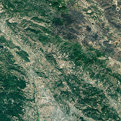
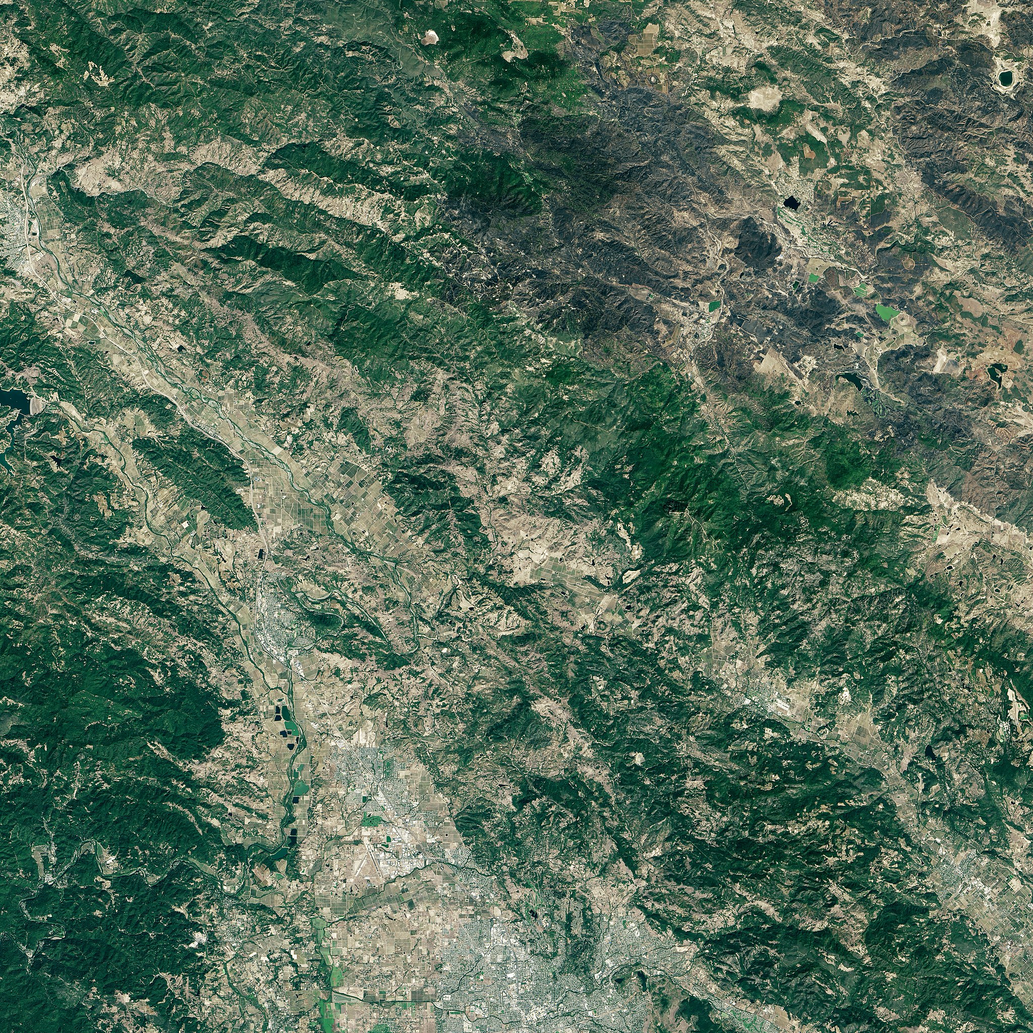
English: Valley Fire, 2015 in northern California from NASA's Earth Observatory: "images from space ... NASA’s Landsat 8 satellite as it passed over Lake County on Monday and capture the magnitude of the 76,067-acre fire. In the pictures, pronounced burn scars appear around Harbin Hot Springs, Cobb and Middletown after the fire moved through on Sept. 12. At least 1,910 structures, including 1,325 homes, were destroyed, making the Valley Fire the third most destructive in California history." |
|||||
| Date | ||||||
| Source | NASA's Earth Observatory real color http://eoimages.gsfc.nasa.gov/images/imagerecords/86000/86663/valleyfire_oli_2015263_lrg.jpg, also see http://landsat.visibleearth.nasa.gov/view.php?id=86663 for version with locator map. | |||||
| Author | NASA | |||||
| Permission (Reusing this file) |
|

File history
Click on a date/time to view the file as it appeared at that time.
| Date/Time | Thumbnail | Dimensions | User | Comment | |
|---|---|---|---|---|---|
| current | 02:05, 29 September 2015 | | 3,500 × 3,500 (10.77 MB) | Ellin Beltz (talk | contribs) | {{Information |Description ={{en|1=Valley Fire, 2015 in northern California from NASA's Earth Observatory: "images from space ... NASA’s Landsat 8 satellite as it passed over Lake County on Monday and capture the magnitude of the 76,067-acre fire.... |
You cannot overwrite this file.
File usage on Commons
There are no pages that use this file.