File:Vallon orrenaye.jpg
Size of this preview: 800 × 361 pixels. Other resolutions: 320 × 145 pixels | 640 × 289 pixels | 1,024 × 463 pixels | 1,280 × 578 pixels | 2,560 × 1,156 pixels | 5,092 × 2,300 pixels.
Original file (5,092 × 2,300 pixels, file size: 16.4 MB, MIME type: image/jpeg)
Captions
Captions
Add a one-line explanation of what this file represents
Summary
edit| Description |
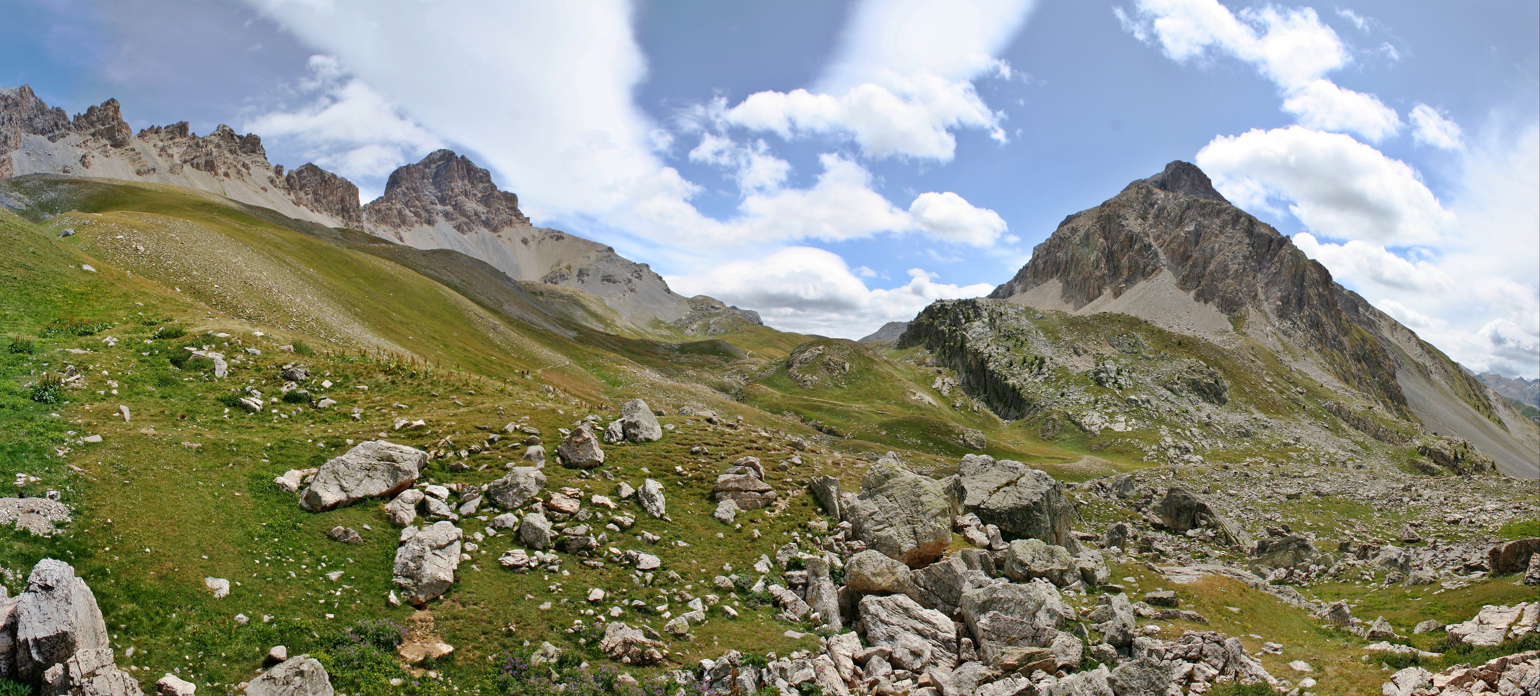
English: The Orrenaye valley, above the Ubayette Valley, on the French side of the Ubaye Range, in the Alps. Visible features include, from the left to the right: Aiguilles de l'Orrenaye (Litt. Orrenaye's needles), Tête de Moïse (Litt. Mosses Head), Orrenaye Pass, and Tête des Blaves (Litt. Head of the Blaves).
Français : Le vallon de l'Orrenaye, au dessus de la vallée de l'Ubayette, sur le versant français du massif de l'Ubayette. De gauche à droite, on distingue: les aiguilles de l'Orrenaye, la tête de Moïse, le col de l'Orrenaye, et la tête des blaves. Massif de l'Ubaye, Alpes du sud. |
||
| Date | |||
| Source | Own work | ||
| Author | Berrucomons | ||
| Permission (Reusing this file) |
I, the copyright holder of this work, hereby publish it under the following licenses:
This file is licensed under the Creative Commons Attribution-Share Alike 3.0 Unported, 2.5 Generic, 2.0 Generic and 1.0 Generic license.
You may select the license of your choice. |
||
| Other versions |
|


| Camera location | | View this and other nearby images on: OpenStreetMap |
|---|
This image has been assessed using the Quality image guidelines and is considered a Quality image.
|
File history
Click on a date/time to view the file as it appeared at that time.
| Date/Time | Thumbnail | Dimensions | User | Comment | |
|---|---|---|---|---|---|
| current | 20:39, 4 November 2009 | | 5,092 × 2,300 (16.4 MB) | Berrucomons (talk | contribs) | {{Information |Description={{en|1=The Orrenaye valley, above the Ubayette Valley, on the French side of the Ubaye Range, in the Alps. Visible features include, from the left to the right: ''Aiguilles de l'Orrenaye'' (Litt. Orrenaye's needles), Tête de Mo |
You cannot overwrite this file.
File usage on Commons
The following 5 pages use this file:
File usage on other wikis
The following other wikis use this file:
- Usage on da.wikipedia.org
- Usage on fr.wikipedia.org
- Usage on www.wikidata.org