File:Vapeurbrug, Moerbeke (27346099966).jpg
Original file (2,800 × 3,733 pixels, file size: 7.61 MB, MIME type: image/jpeg)
Captions
Captions
Summary
edit.jpg&action=edit§ion=1)
| Description |
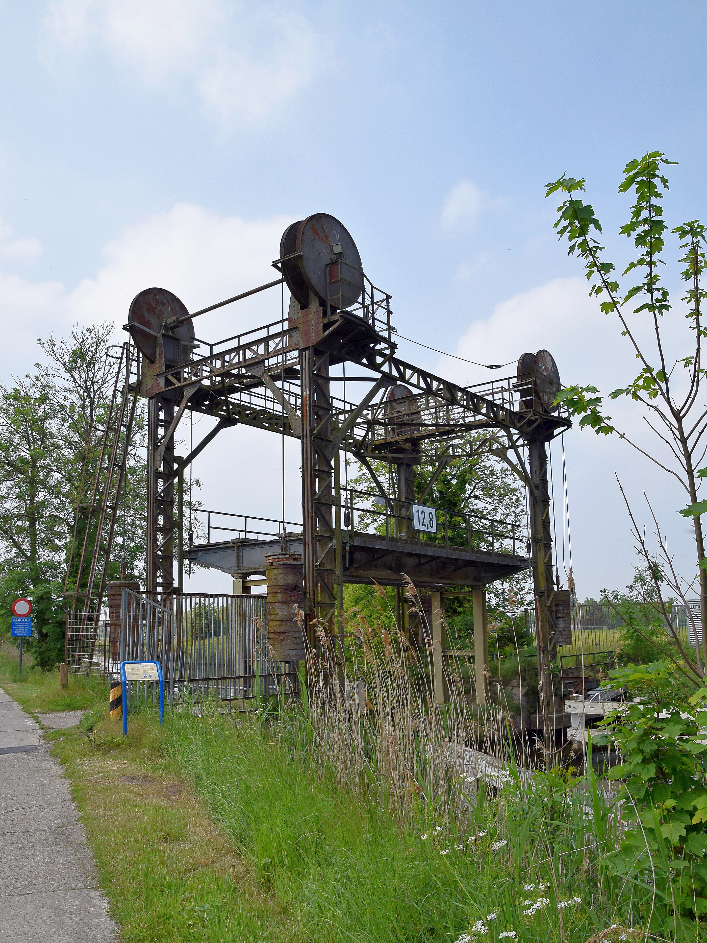
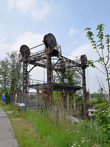
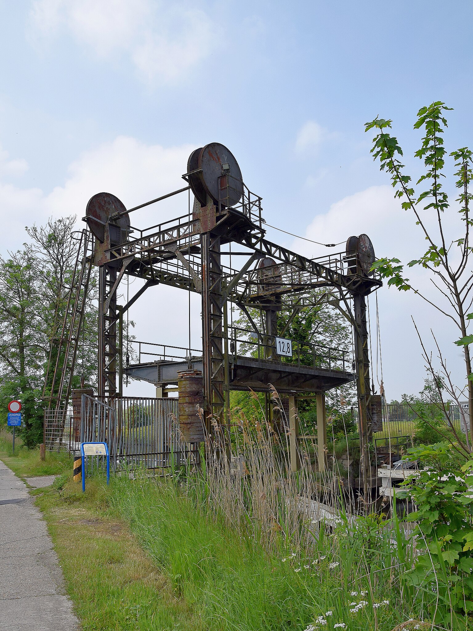
Rond 1920 werd deze hefbrug op de Moervaart gebouwd voor de spoorlijn 77A tussen Lokeren en Moerbeke. De spoorlijn werd in 1971 buiten dienst gesteld. Vlakbij de brug stonden reservoirs ter bevoorrading van de stoomlocomotieven, waardoor de brug 'Vapeurbrug' werd genoemd. Het rijdek werd als een platform tussen vier ijzeren heftorens opgehaald. Dit gebeurde handmatig met een lier en door het gebruik van tegengewichten. Around 1920, this lifting bridge was built on the Moervaart for railroad 77A between Lokeren and Moerbeke. The railway was used until 1971. Near the bridge were reservoirs to supply the steam locomotives with water, that's why people called it "Vapeurbrug" (vapeur = steam). The deck was raised as a platform between the four iron lifting portals. This was done by hand with a winch and by the use of counterweights. |
| Date | |
| Source | Vapeurbrug, Moerbeke |
| Author | Luc.T from Buggenhout, België |
| Camera location | | View this and other nearby images on: OpenStreetMap |
|---|
.jpg¶ms=051.171702_N_0003.936266_E_globe:Earth_type:camera_source:Flickr_&language=en)
Licensing
edit.jpg&action=edit§ion=2)
- You are free:
- to share – to copy, distribute and transmit the work
- to remix – to adapt the work
- Under the following conditions:
- attribution – You must give appropriate credit, provide a link to the license, and indicate if changes were made. You may do so in any reasonable manner, but not in any way that suggests the licensor endorses you or your use.
| This image was originally posted to Flickr by Luc.T at https://flickr.com/photos/65015316@N07/27346099966. It was reviewed on 5 August 2021 by FlickreviewR 2 and was confirmed to be licensed under the terms of the cc-by-2.0. |
File history
Click on a date/time to view the file as it appeared at that time.
| Date/Time | Thumbnail | Dimensions | User | Comment | |
|---|---|---|---|---|---|
| current | 08:25, 5 August 2021 | | 2,800 × 3,733 (7.61 MB) | 1Veertje (talk | contribs) | Transferred from Flickr via #flickr2commons |
You cannot overwrite this file.
File usage on Commons
There are no pages that use this file.
.jpg&oldid=888745038)